

Rusquec Manor at Saint-Herbot
No reviews yet
Have you flown here? Share your experience with other pilots.
+ Write the first reviewHistory
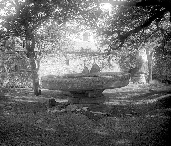
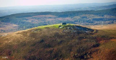
16e siècle ; 17e siècle Situé au bord de la rivière Ellez au nord (devenue lac à cet endroit à la création d'une centrale hydraulique qui canalisa malheureusement la plus belle cascade de Bretagne, d'une dénivellation de 70 mètres) , cet édifice consiste en un manoir à trois enclos : du nord au sud, le potager, puis le logis et ses dépendances, des remises, crèches, puits, aire à battre, fuie, et, en contrebas, le verger. L'ensemble est situé au sommet d'une colline proche de la chapelle Saint-Herbot (classée) où d'importantes foires et un pardon se déroulaient au début du 16e siècle. Le premier seigneur du Rusquec apparut en 1427 à la réformation, et les plus anciennes archives du manoir conservées aux Archives départementales du Finistère sont postérieures au début du 16e siècle. Il semblerait qu'une partie de la construction qui nous est parvenue soit l'oeuvre d'Anceau du Rusquec, mort en 1522, qui épousa en 1480 Françoise de Rosnyvinen, et de son fils, Anne Jehan, mort en 1536. Un corps de logis fut ajouté au nord au milieu du 17e siècle ; celui-ci est remisé en partie (oeuvre d'Alan de Kerlech du Chastel, marié à Renée de Lannion en 1637 ; voir aveu de 1653 conservé aux Archives départementales).
Map and restricted areas
Open in the main mapRestricted zones
Nearby aerodromes
Open aerodromes within 25 km of the spot, heliports included, with their distance and direction from the spot. Near an aerodrome, drone flying is prohibited or height-limited: check the UAS zones map.
| Aerodrome | Type | Distance | Elevation |
|---|---|---|---|
| Mairie Heliport | Heliport | 15 km S | 151 m |
Aviation weather (METAR and TAF)
LFRU – Morlaix-Ploujean Airport IFR
METAR
METAR LFRU 171400Z AUTO 24025G39KT 3500 RA BR SCT017/// BKN025/// BKN035/// ///CB 13/11 Q0987
- Wind
- 240°, 46 km/h, gusts 72 km/h
- Visibility
- 3.5 km
- Weather
- Rain ; mist
- Clouds
- Scattered (3-4/8) at 1,700 ft (520 m) ; Broken (5-7/8) at 2,500 ft (760 m) ; Broken (5-7/8) at 3,500 ft (1070 m)
- Temperature
- 13 °C, dew point 11 °C
- QNH
- 987 hPa
- Flight category
- IFR: ceiling 500–1,000 ft or visibility 1–3 mi
TAF
Weather and Kp index
Sunrise and sunset
| Day | Dawn | Sunrise | Golden hour | Sunset | Dusk | Day length |
|---|---|---|---|---|---|---|
| Tue 17 Nov | 07:51 | 08:26 | 08:26–09:15 · 16:46–17:35 | 17:35 | 18:09 | 9 h 09 |
| Wed 18 Nov | 07:53 | 08:27 | 08:27–09:17 · 16:44–17:34 | 17:34 | 18:08 | 9 h 06 |
| Thu 19 Nov | 07:54 | 08:29 | 08:29–09:18 · 16:43–17:33 | 17:33 | 18:07 | 9 h 03 |
| Fri 20 Nov | 07:56 | 08:30 | 08:30–09:20 · 16:42–17:32 | 17:32 | 18:06 | 9 h 01 |
| Sat 21 Nov | 07:57 | 08:32 | 08:32–09:22 · 16:40–17:31 | 17:31 | 18:05 | 8 h 59 |
| Sun 22 Nov | 07:58 | 08:33 | 08:33–09:23 · 16:39–17:30 | 17:30 | 18:04 | 8 h 56 |
| Mon 23 Nov | 08:00 | 08:34 | 08:34–09:25 · 16:38–17:29 | 17:29 | 18:04 | 8 h 54 |


Reviews (0)
Log in to review this spot. Log in · Create a free account
No reviews yet. Share yours!