

La Bussière Castle
No reviews yet
Have you flown here? Share your experience with other pilots.
+ Write the first reviewHistory
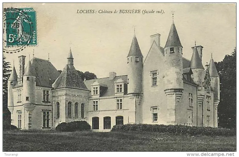
15e siècle ; 16e siècle Un corps de logis est prolongé de deux ailes en retour d'équerre. A l'angle intérieur de l'aile sud se trouve une tour polygonale d'escalier. A l'angle qui lui fait pendant, une chapelle rectangulaire a été édifiée à la Renaissance. Elle est éclairée par six fenêtres en plein cintre, encadrées de pilastres et surmontées d'une frise ornée de médaillons. Sur le corps principal, les ouvertures du premier et les lucarnes sont Renaissance. L'aile méridionale est gothique, avec une porte d'entrée en tiers point et une échauguette à l'angle sud-ouest. Trois autres échauguettes ont été rajoutées à la fin de l'époque romantique. A l'angle sud-est se trouve une grosse tour cylindrique avec chemin de ronde aux mâchicoulis ornés de trèfles. Celle qui lui fait pendant au nord-est date du 19e siècle. L'extrémité de la façade nord a dû être surélevée en pavillon au 19e siècle, lui-même chargé de deux échauguettes pour obtenir un effet de symétrie contraire au 15e siècle.
Map and restricted areas
Open in the main mapRestricted zones
Nearby aerodromes
Open aerodromes within 25 km of the spot, heliports included, with their distance and direction from the spot. Near an aerodrome, drone flying is prohibited or height-limited: check the UAS zones map.
| Aerodrome | Type | Distance | Elevation |
|---|---|---|---|
| Tours Le Louroux Airport | Aerodrome | 18 km W | 126 m |
| Tours Sorigny Airport | Aerodrome | 25 km NW | 91 m |
| Amboise Dierre Airport | Aerodrome | 25 km N | 55 m |
Aviation weather (METAR and TAF)
No METAR station within 50 km.
Weather and Kp index
Sunrise and sunset
| Day | Dawn | Sunrise | Golden hour | Sunset | Dusk | Day length |
|---|---|---|---|---|---|---|
| Tue 17 Nov | 07:30 | 08:03 | 08:03–08:50 · 16:32–17:20 | 17:20 | 17:53 | 9 h 16 |
| Wed 18 Nov | 07:31 | 08:04 | 08:04–08:52 · 16:31–17:19 | 17:19 | 17:52 | 9 h 14 |
| Thu 19 Nov | 07:32 | 08:06 | 08:06–08:54 · 16:30–17:18 | 17:18 | 17:51 | 9 h 11 |
| Fri 20 Nov | 07:33 | 08:07 | 08:07–08:55 · 16:28–17:17 | 17:17 | 17:50 | 9 h 09 |
| Sat 21 Nov | 07:35 | 08:08 | 08:08–08:57 · 16:27–17:16 | 17:16 | 17:49 | 9 h 07 |
| Sun 22 Nov | 07:36 | 08:10 | 08:10–08:58 · 16:26–17:15 | 17:15 | 17:49 | 9 h 04 |
| Mon 23 Nov | 07:37 | 08:11 | 08:11–09:00 · 16:25–17:14 | 17:14 | 17:48 | 9 h 02 |

Reviews (0)
Log in to review this spot. Log in · Create a free account
No reviews yet. Share yours!