

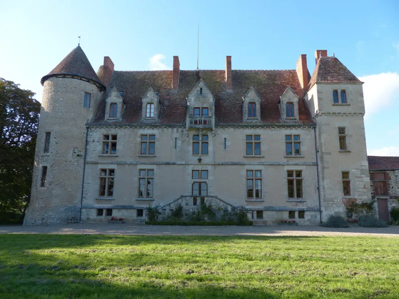
Chatelard Castle
No reviews yet
Have you flown here? Share your experience with other pilots.
+ Write the first reviewHistory
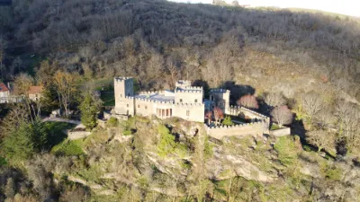
14e siècle ; 15e siècle ; 16e siècle Château très remanié au 19e siècle, conservant plusieurs éléments anciens. La chapelle portant la date de 1582 est un rare exemple d'architecture religieuse dans la région pour cette époque. Il s'agit d'une construction à chevet plat et à charpente apparente, qui s'appuie contre une tour ronde, certainement très antérieure, dérasée à la Révolution, vestige de l'ancien système défensif qui entourait le château. Un élément de chemin de ronde perpendiculaire à la façade nord-ouest du château et se terminant par une tour carrée, remonte au Moyen-Age. La façade sud-est du château a été entièrement refaite au 19e, mais elle conserve à l'angle sud une tour tonde d'époque médiévale et au nord-est d'une tour carrée dont la maçonnerie paraît également ancienne. La façade nord-ouest semble dater du 16e siècle et comprend le chemin de ronde ainsi qu'une tour carrée en son centre.
Map and restricted areas
Open in the main mapRestricted zones
Nearby aerodromes
Open aerodromes within 25 km of the spot, heliports included, with their distance and direction from the spot. Near an aerodrome, drone flying is prohibited or height-limited: check the UAS zones map.
No known open aerodrome within 25 km.
Aviation weather (METAR and TAF)
LFLV – Vichy-Charmeil Airport VFR
METAR
METAR LFLV 171330Z AUTO VRB06KT 9999 BKN046 BKN056 BKN210 18/10 Q1000
- Wind
- Variable, 11 km/h
- Visibility
- 10 km or more
- Clouds
- Broken (5-7/8) at 4,600 ft (1400 m) ; Broken (5-7/8) at 5,600 ft (1710 m) ; Broken (5-7/8) at 21,000 ft (6400 m)
- Temperature
- 18 °C, dew point 10 °C
- QNH
- 1000 hPa
- Flight category
- VFR: ceiling > 3,000 ft and visibility > 5 mi
TAF
Weather and Kp index
| Day | Weather | Temp. min. / max. | Wind | Rain | Max Kp |
|---|---|---|---|---|---|
| Tue 17 Nov | Fair | 11° / 15° | 33 km/h SW | 3.3 mm | 5 |
| Wed 18 Nov | Partly cloudy | 9° / 13° | 32 km/h W | 5.4 mm | 5 |
| Thu 19 Nov | Showers | 7° / 11° | 36 km/h W | 7.8 mm | 3 |
| Fri 20 Nov | Showers | 7° / 10° | 31 km/h SW | 1.0 mm | 3 |
| Sat 21 Nov | Fair | 7° / 12° | 25 km/h W | 0.3 mm | – |
| Sun 22 Nov | Partly cloudy | 8° / 11° | 30 km/h W | 7.5 mm | – |
| Mon 23 Nov | Partly cloudy | 6° / 10° | 28 km/h W | 0.6 mm | – |
Hour by hour: Tuesday 17 November
| Time | Weather | Temp. | Wind | Rain | Clouds | Kp |
|---|---|---|---|---|---|---|
| 15:00 | Fair | 15° | 29 km/h SW | – | 25 % | 4 |
| 16:00 | Clear sky | 14° | 30 km/h SW | – | 4 % | 4 |
| 17:00 | Fair | 13° | 30 km/h SW | – | 16 % | 4 |
| 18:00 | Fair | 12° | 30 km/h SW | – | 25 % | 4 |
| 19:00 | Partly cloudy | 12° | 32 km/h SW | – | 62 % | 5 |
| 20:00 | Rain | 12° | 33 km/h SW | 0.4 mm | 100 % | 5 |
| 21:00 | Heavy rain | 11° | 33 km/h SW | 1.1 mm | 100 % | 5 |
| 22:00 | Rain | 11° | 32 km/h SW | 0.7 mm | 100 % | 5 |
Hour by hour: Wednesday 18 November
| Time | Weather | Temp. | Wind | Rain | Clouds | Kp |
|---|---|---|---|---|---|---|
| 06:00 | Fair | 10° | 30 km/h W | – | 30 % | 4 |
| 07:00 | Clear sky | 9° | 27 km/h SW | – | 5 % | 4 |
| 08:00 | Showers | 9° | 26 km/h SW | 0.2 mm | 48 % | 4 |
| 09:00 | Light rain | 10° | 28 km/h W | 0.3 mm | 100 % | 4 |
| 10:00 | Partly cloudy | 10° | 30 km/h W | – | 69 % | 4 |
| 11:00 | Fair | 11° | 30 km/h W | – | 20 % | 4 |
| 12:00 | Fair | 12° | 32 km/h W | – | 30 % | 4 |
| 13:00 | Partly cloudy | 12° | 32 km/h W | – | 47 % | 3 |
| 14:00 | Partly cloudy | 13° | 31 km/h W | – | 81 % | 3 |
| 15:00 | Partly cloudy | 12° | 30 km/h SW | – | 66 % | 3 |
| 16:00 | Cloudy | 12° | 28 km/h SW | – | 97 % | 3 |
| 17:00 | Cloudy | 11° | 25 km/h SW | – | 88 % | 3 |
| 18:00 | Partly cloudy | 10° | 24 km/h SW | – | 68 % | 3 |
| 19:00 | Partly cloudy | 10° | 26 km/h SW | – | 62 % | 2 |
| 20:00 | Cloudy | 10° | 27 km/h SW | – | 87 % | 2 |
| 21:00 | Cloudy | 10° | 25 km/h SW | – | 98 % | 2 |
| 22:00 | Cloudy | 10° | 25 km/h SW | – | 100 % | 2 |
Sunrise and sunset
| Day | Dawn | Sunrise | Golden hour | Sunset | Dusk | Day length |
|---|---|---|---|---|---|---|
| Tue 17 Nov | 07:19 | 07:51 | 07:51–08:38 · 16:28–17:14 | 17:14 | 17:47 | 9 h 22 |
| Wed 18 Nov | 07:20 | 07:53 | 07:53–08:39 · 16:27–17:13 | 17:13 | 17:46 | 9 h 20 |
| Thu 19 Nov | 07:21 | 07:54 | 07:54–08:41 · 16:26–17:12 | 17:12 | 17:45 | 9 h 18 |
| Fri 20 Nov | 07:23 | 07:56 | 07:56–08:42 · 16:24–17:11 | 17:11 | 17:44 | 9 h 15 |
| Sat 21 Nov | 07:24 | 07:57 | 07:57–08:44 · 16:23–17:10 | 17:10 | 17:43 | 9 h 13 |
| Sun 22 Nov | 07:25 | 07:58 | 07:58–08:46 · 16:22–17:10 | 17:10 | 17:43 | 9 h 11 |
| Mon 23 Nov | 07:26 | 08:00 | 08:00–08:47 · 16:21–17:09 | 17:09 | 17:42 | 9 h 09 |
Reviews (0)
Log in to review this spot. Log in · Create a free account
No reviews yet. Share yours!