

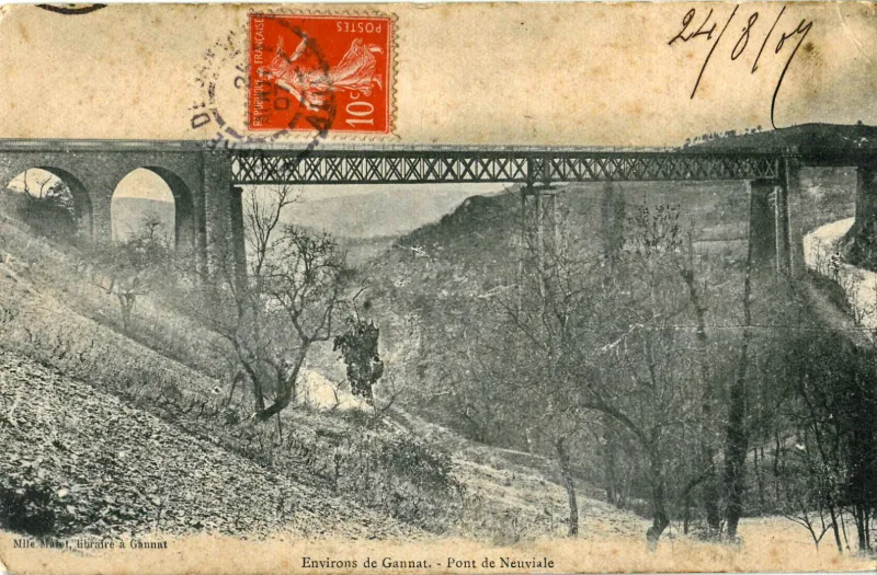
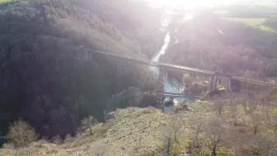
Neuvial Viaduct
No reviews yet
Have you flown here? Share your experience with other pilots.
+ Write the first reviewHistory
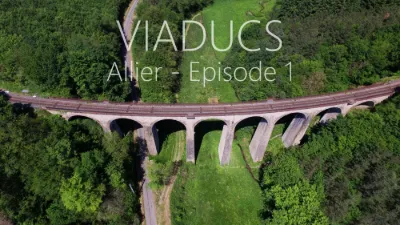
3e quart 19e siècle Viaduc métallique servant à la voie ferrée reliant Gannat à Bordeaux, oeuvre de jeunesse de Gustave Eiffel. L'ouvrage s'appuie sur une culée à deux arches, de dix mètres de hauteur. Une première travée métallique, indépendante du tablier, joint cette culée à une pile de maçonnerie élevée de l'autre côté de la route. S'appuyant sur cette pile, et jeté à la suite, le tablier métallique posé sur des poutres étrésillonnées, est soutenu en son milieu par un pilier métallique d'une trentaine de mètres de hauteur. A l'ouest, après être passé une nouvelle fois au-dessus de la route, il repose sur une culée de maçonnerie à arche élevée. Ce viaduc marque une étape importante dans le progrès de la construction métallique, constituant le premier exemple, avec celui de Rouzat, de la substitution du métal à la maçonnerie.
Map and restricted areas
Open in the main mapRestricted zones
Nearby aerodromes
Open aerodromes within 25 km of the spot, heliports included, with their distance and direction from the spot. Near an aerodrome, drone flying is prohibited or height-limited: check the UAS zones map.
| Aerodrome | Type | Distance | Elevation |
|---|---|---|---|
| Vichy-Charmeil Airport | Airport | 19 km E | 249 m |
Aviation weather (METAR and TAF)
LFLV – Vichy-Charmeil Airport VFR
METAR
METAR LFLV 171400Z AUTO 21007KT 140V280 9999 SCT048 SCT056 OVC210 18/10 Q0999
- Wind
- 210°, 13 km/h
- Visibility
- 10 km or more
- Clouds
- Scattered (3-4/8) at 4,800 ft (1460 m) ; Scattered (3-4/8) at 5,600 ft (1710 m) ; Overcast (8/8) at 21,000 ft (6400 m)
- Temperature
- 18 °C, dew point 10 °C
- QNH
- 999 hPa
- Flight category
- VFR: ceiling > 3,000 ft and visibility > 5 mi
TAF
Weather and Kp index
Sunrise and sunset
| Day | Dawn | Sunrise | Golden hour | Sunset | Dusk | Day length |
|---|---|---|---|---|---|---|
| Tue 17 Nov | 07:18 | 07:51 | 07:51–08:37 · 16:27–17:14 | 17:14 | 17:46 | 9 h 22 |
| Wed 18 Nov | 07:20 | 07:52 | 07:52–08:39 · 16:26–17:13 | 17:13 | 17:45 | 9 h 20 |
| Thu 19 Nov | 07:21 | 07:54 | 07:54–08:40 · 16:25–17:12 | 17:12 | 17:45 | 9 h 18 |
| Fri 20 Nov | 07:22 | 07:55 | 07:55–08:42 · 16:24–17:11 | 17:11 | 17:44 | 9 h 15 |
| Sat 21 Nov | 07:23 | 07:56 | 07:56–08:44 · 16:23–17:10 | 17:10 | 17:43 | 9 h 13 |
| Sun 22 Nov | 07:25 | 07:58 | 07:58–08:45 · 16:22–17:09 | 17:09 | 17:42 | 9 h 11 |
| Mon 23 Nov | 07:26 | 07:59 | 07:59–08:47 · 16:21–17:08 | 17:08 | 17:42 | 9 h 09 |
Reviews (0)
Log in to review this spot. Log in · Create a free account
No reviews yet. Share yours!