

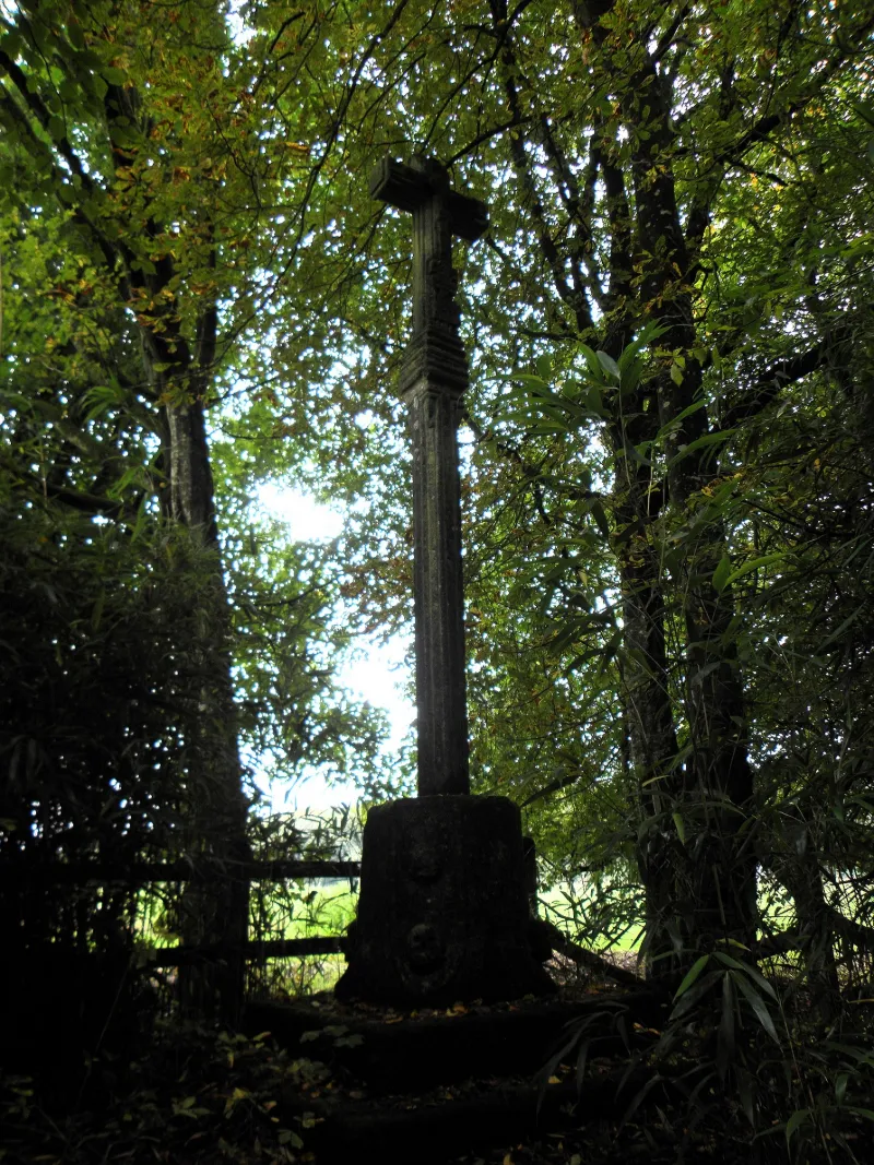
Calvary known as Ville Gontier
No reviews yet
Have you flown here? Share your experience with other pilots.
+ Write the first reviewHistory
16e siècle Croix en granit dressée sur un socle à pans cannelés. Quatre écussons portent un monogramme, ainsi que l'année 1581. Les bras de la croix sont terminés, à leurs extrémités, par les noms de Jéus et Marie. Le montant est renflé vers les deux tiers de sa hauteur, et se termine par des amincissements gradués. Sur quatre des faces du socle sont représentées des têtes de mort. Ce calvaire avait certainement été dressé, à l'origine, au bord d'un chemin.
Map and restricted areas
Open in the main mapRestricted zones
| Zone | Category | Limits | Conditions |
|---|---|---|---|
| SETBA Secteur SELUNE | Entrainement Militaire | 0 m above ground level → 15241 m above ground level | Pilotage de drones en vue directe : les aéronefs dont la masse est supérieure à 900 grammes sont soumis à notification préalable selon des modalités publiées sur le site www.ecologie.gouv.fr |
| Tours Cinq Mars la Pile | Zone réglementée | 3053 m above sea level → 6259 m above sea level | Vols interdits sauf lorsque the official document of the zone l'autorise explicitement ou avec l'accord du gestionnaire de la zone lorsqu'il est désigné par the official document of the zone |
| Zrt Fougeres | ZRT | From about 3,800 m to about 4,100 m above sea level | SUP AIP 053/26 · Du jeudi 16 avril 2026 au mercredi 12 avril 2028 |
| Zrt Fougeres High | ZRT | From about 6,250 m to about 6,550 m above sea level | SUP AIP 053/26 · Du jeudi 16 avril 2026 au mercredi 12 avril 2028 |
Nearby aerodromes
Open aerodromes within 25 km of the spot, heliports included, with their distance and direction from the spot. Near an aerodrome, drone flying is prohibited or height-limited: check the UAS zones map.
No known open aerodrome within 25 km.
Aviation weather (METAR and TAF)
LFOV – Laval-Entrammes Airport MVFR
METAR
METAR LFOV 171400Z AUTO 21018G31KT 190V250 9999 BKN027 OVC032 15/11 Q0991
- Wind
- 210°, 33 km/h, gusts 57 km/h
- Visibility
- 10 km or more
- Clouds
- Broken (5-7/8) at 2,700 ft (820 m) ; Overcast (8/8) at 3,200 ft (980 m)
- Temperature
- 15 °C, dew point 11 °C
- QNH
- 991 hPa
- Flight category
- MVFR: ceiling 1,000–3,000 ft or visibility 3–5 mi
TAF
Weather and Kp index
Sunrise and sunset
| Day | Dawn | Sunrise | Golden hour | Sunset | Dusk | Day length |
|---|---|---|---|---|---|---|
| Tue 17 Nov | 07:41 | 08:15 | 08:15–09:04 · 16:35–17:24 | 17:24 | 17:58 | 9 h 08 |
| Wed 18 Nov | 07:42 | 08:17 | 08:17–09:06 · 16:33–17:23 | 17:23 | 17:57 | 9 h 06 |
| Thu 19 Nov | 07:44 | 08:18 | 08:18–09:08 · 16:32–17:22 | 17:22 | 17:56 | 9 h 03 |
| Fri 20 Nov | 07:45 | 08:20 | 08:20–09:10 · 16:31–17:21 | 17:21 | 17:55 | 9 h 01 |
| Sat 21 Nov | 07:46 | 08:21 | 08:21–09:11 · 16:30–17:20 | 17:20 | 17:54 | 8 h 58 |
| Sun 22 Nov | 07:48 | 08:23 | 08:23–09:13 · 16:28–17:19 | 17:19 | 17:54 | 8 h 56 |
| Mon 23 Nov | 07:49 | 08:24 | 08:24–09:15 · 16:27–17:18 | 17:18 | 17:53 | 8 h 53 |
Reviews (0)
Log in to review this spot. Log in · Create a free account
No reviews yet. Share yours!