

Chanteloup Estate
No reviews yet
Have you flown here? Share your experience with other pilots.
+ Write the first reviewHistory
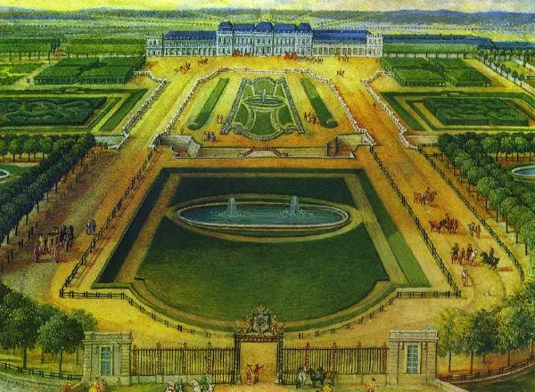
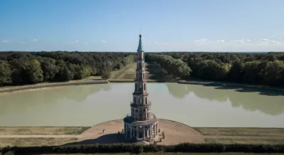
18e siècle ; 19e siècle Ce domaine fut acheté en 1711 pour la princesse des Ursins, qui fit réaménager château et jardins. D'importants travaux d'embellissement furent conduits à partir de 1775 par l'architecte Le Camus pour Choiseul : jardin anglo-chinois (entièrement disparu) , pagode (haute de 44 mètres) inaugurée en 1778, aménagement de parterres, bosquets et bassins, parc boisé au nord avec sept larges avenues, pièce d'eau en demi-lune prolongée par un canal de 500 mètres de long. Après les désordres de la Révolution et les vicissitudes du domaine au 19e siècle, notamment les déboires financiers de Chaptal (dont la sucrerie expérimentale existe toujours) , il ne reste que peu de choses d'un ensemble historique prestigieux du 18e siècle, mais qui demeure une oeuvre majeure pour l'art des jardins.
Map and restricted areas
Open in the main mapRestricted zones
Nearby aerodromes
Open aerodromes within 25 km of the spot, heliports included, with their distance and direction from the spot. Near an aerodrome, drone flying is prohibited or height-limited: check the UAS zones map.
| Aerodrome | Type | Distance | Elevation |
|---|---|---|---|
| Amboise Dierre Airport | Aerodrome | 5.9 km S | 55 m |
| Tours-Val-de-Loire Airport | Airport | 19 km W | 109 m |
| Trousseau Chu Heliport | Heliport | 20 km W | 84 m |
| Tours Sorigny Airport | Aerodrome | 24 km SW | 91 m |
Aviation weather (METAR and TAF)
No METAR station within 50 km.
Weather and Kp index
Sunrise and sunset
| Day | Dawn | Sunrise | Golden hour | Sunset | Dusk | Day length |
|---|---|---|---|---|---|---|
| Tue 17 Nov | 07:30 | 08:04 | 08:04–08:51 · 16:31–17:19 | 17:19 | 17:52 | 9 h 15 |
| Wed 18 Nov | 07:31 | 08:05 | 08:05–08:53 · 16:29–17:18 | 17:18 | 17:51 | 9 h 12 |
| Thu 19 Nov | 07:33 | 08:06 | 08:06–08:55 · 16:28–17:17 | 17:17 | 17:50 | 9 h 10 |
| Fri 20 Nov | 07:34 | 08:08 | 08:08–08:56 · 16:27–17:16 | 17:16 | 17:49 | 9 h 07 |
| Sat 21 Nov | 07:35 | 08:09 | 08:09–08:58 · 16:26–17:15 | 17:15 | 17:49 | 9 h 05 |
| Sun 22 Nov | 07:37 | 08:11 | 08:11–09:00 · 16:25–17:14 | 17:14 | 17:48 | 9 h 03 |
| Mon 23 Nov | 07:38 | 08:12 | 08:12–09:01 · 16:24–17:13 | 17:13 | 17:47 | 9 h 00 |

Reviews (0)
Log in to review this spot. Log in · Create a free account
No reviews yet. Share yours!