

Roquefavour Aqueduct
No reviews yet
Have you flown here? Share your experience with other pilots.
+ Write the first reviewHistory
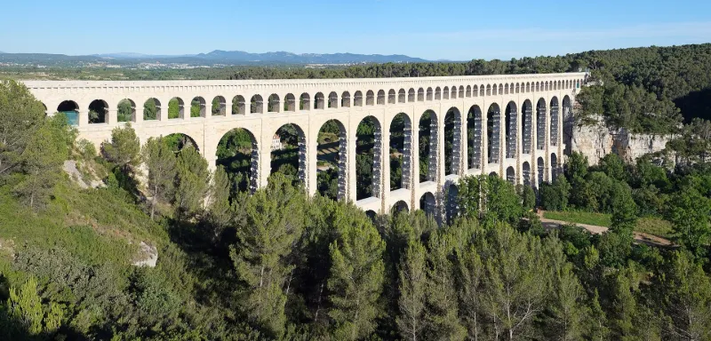
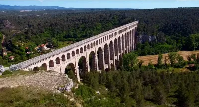
2e quart 19e siècle Pièce maîtresse du canal de Marseille, l'aqueduc s'élève à 82, 65 mètres de haut sur 375 mètres de long. Il est formé de trois étages. A la base, douze arches de 15 mètres d'ouverture et 27, 50 mètres de haut. Au-dessus, une série de quinze arcades de seize mètres d'ouverture et 34, 10 mètres de haut. L'étage supérieur comprend 35 petites ouvertures en plein cintre de cinq mètres de large. Les travaux commencent en 1838, sur le projet de l'ingénieur Mayor de Montricher. En 1847, l'eau de la Durance franchit l'arc.
Map and restricted areas
Open in the main mapRestricted zones
| Zone | Category | Limits | Conditions |
|---|---|---|---|
| Ctr Aix |
Zone de contrôle civile | 50 m above ground level → 762 m above sea level | Flights above 50 metres are forbidden without the prior agreement of air traffic control |
Nearby aerodromes
Open aerodromes within 25 km of the spot, heliports included, with their distance and direction from the spot. Near an aerodrome, drone flying is prohibited or height-limited: check the UAS zones map.
| Aerodrome | Type | Distance | Elevation |
|---|---|---|---|
| Aix - Les Milles Airport | Aerodrome | 4.6 km E | 112 m |
| Pays d'Aix Medical Center Heliport | Heliport | 11 km E | 222 m |
| Berre/Marignane Seaplane Base | Seaplane base | 11 km SW | 2 m |
| Berre-la-Fare Airfield | Aerodrome | 11 km W | 33 m |
| Marseille Provence Airport | Major airport | 11 km SW | 23 m |
Aviation weather (METAR and TAF)
LFML – Marseille Provence Airport VFR
METAR
METAR LFML 171400Z AUTO 07007KT 040V100 9999 FEW048/// OVC100/// ///TCU 17/13 Q1003 TEMPO 4000 SHRA
- Wind
- 070°, 13 km/h
- Visibility
- 10 km or more
- Clouds
- Few (1-2/8) at 4,800 ft (1460 m) ; Overcast (8/8) at 10,000 ft (3050 m)
- Temperature
- 17 °C, dew point 13 °C
- QNH
- 1003 hPa
- Flight category
- VFR: ceiling > 3,000 ft and visibility > 5 mi
TAF
TAF LFML 171400Z 1715/1821 VRB06KT 9999 SCT045 TX17/1813Z TN13/1806Z PROB40 TEMPO 1715/1719 4000 SHRA SCT070TCU PROB40 TEMPO 1719/1724 BKN008 PROB30 TEMPO 1800/1807 4000 BR PROB40 TEMPO 1808/1813 SHRA SCT070TCU
| Period (local time) | Change | Wind | Visibility | Weather | Clouds |
|---|---|---|---|---|---|
| 17/11 16:00 → 18/11 22:00 | Initial conditions | Variable, 11 km/h | 10 km or more | Scattered (3-4/8) at 4,500 ft (1370 m) | |
| 17/11 16:00 → 17/11 20:00 | Temporarily, probability 40% | 4.0 km | Showers of rain | Scattered (3-4/8) at 7,000 ft (2130 m) (towering cumulus) | |
| 17/11 20:00 → 18/11 01:00 | Temporarily, probability 40% | Broken (5-7/8) at 800 ft (240 m) | |||
| 18/11 01:00 → 18/11 08:00 | Temporarily, probability 30% | 4.0 km | Mist | ||
| 18/11 09:00 → 18/11 14:00 | Temporarily, probability 40% | Showers of rain | Scattered (3-4/8) at 7,000 ft (2130 m) (towering cumulus) |
Weather and Kp index
Sunrise and sunset
| Day | Dawn | Sunrise | Golden hour | Sunset | Dusk | Day length |
|---|---|---|---|---|---|---|
| Tue 17 Nov | 07:04 | 07:35 | 07:35–08:19 · 16:29–17:12 | 17:12 | 17:43 | 9 h 37 |
| Wed 18 Nov | 07:05 | 07:36 | 07:36–08:20 · 16:28–17:12 | 17:12 | 17:43 | 9 h 35 |
| Thu 19 Nov | 07:06 | 07:38 | 07:38–08:21 · 16:27–17:11 | 17:11 | 17:42 | 9 h 33 |
| Fri 20 Nov | 07:08 | 07:39 | 07:39–08:23 · 16:26–17:10 | 17:10 | 17:41 | 9 h 31 |
| Sat 21 Nov | 07:09 | 07:40 | 07:40–08:24 · 16:25–17:09 | 17:09 | 17:40 | 9 h 29 |
| Sun 22 Nov | 07:10 | 07:41 | 07:41–08:26 · 16:24–17:08 | 17:08 | 17:40 | 9 h 27 |
| Mon 23 Nov | 07:11 | 07:42 | 07:42–08:27 · 16:23–17:08 | 17:08 | 17:39 | 9 h 25 |



Reviews (0)
Log in to review this spot. Log in · Create a free account
No reviews yet. Share yours!