

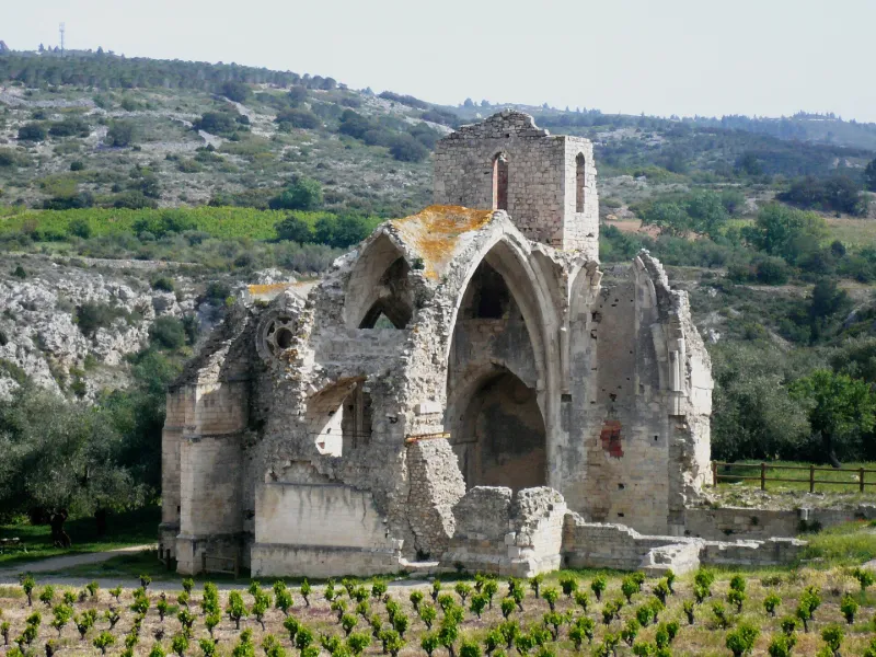
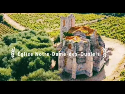
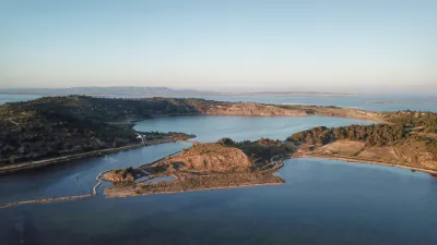
Ruins of the Former Notre-Dame-des-Oubiels Church
No reviews yet
Have you flown here? Share your experience with other pilots.
+ Write the first reviewHistory
14e siècle Cette église marque l'emplacement d'une localité disparue, les Ouviels, mentionnée en 990. Il y fut édifiée une église mentionnée en 1080, à la collation de l'archevêque de Narbonne. Vers 1644, une nouvelle église paroissiale, sous la même invocation, fut construite, pour plus de commodité, dans le village même de Portel. Du premier édifice ne subsistent que le chevet, le clocher, une partie du transept et de la nef. Il était entièrement voûté. Sa construction peut être rapportée à la seconde moitié du 13e siècle. La partie supérieure du clocher paraît toutefois plus récente : c'est la seule partie qui ne soit pas en pierre d'appareil. Le chevet est pentagonal. La voûte est supportée par des nervures profilées en boudin à bec méplat, renforcées par des dosserets. Les voûtins appareillés supportent la maçonnerie en blocage de la couverture par l'intermédiaire de grands carreaux peu épais. Chapiteaux sculptés. Ce sanctuaire était muni de deux niches dont la plus grande était une piscine double dont se distingue encore l'arcature géminée. Dans la face nord-est, à environ six mètres du sol, une des pierres, sans doute un remploi de l'édifice primitif, porte, sculpté en réserve, un entrelac roman archaïque, noué en huit, les extrémités libres ramifiées symétriquement. La première travée de nef, prolongée latéralement par deux chapelles, peut être considérée comme un transept. Ce transept est voûté, comme le sanctuaire, sur ogives. De la nef ne subsiste que la première travée. Le clocher s'élève au-dessus du bras sud du transept. La tour est ajourée, à l'étage supérieur, par des baies en plein cintre.
Map and restricted areas
Open in the main mapRestricted zones
| Zone | Category | Limits | Conditions |
|---|---|---|---|
| R 46 E2 | Zone réglementée | 244 m above ground level → 853 m above sea level | Vols interdits sauf lorsque the official document of the zone l'autorise explicitement ou avec l'accord du gestionnaire de la zone lorsqu'il est désigné par the official document of the zone |
| Istres | Zone réglementée | 5491 m above sea level → 30766 m above sea level | Vols interdits sauf lorsque the official document of the zone l'autorise explicitement ou avec l'accord du gestionnaire de la zone lorsqu'il est désigné par the official document of the zone |
| Istres | Zone réglementée | 5491 m above sea level → 30766 m above sea level | Vols interdits sauf lorsque the official document of the zone l'autorise explicitement ou avec l'accord du gestionnaire de la zone lorsqu'il est désigné par the official document of the zone |
| Zrt/zdt Lima 2 | ZRT/ZDT | FL 195 / FL 285 | SUP AIP 219/26 · Du mardi 20 octobre au jeudi 22 octobre 2026 |
Nearby aerodromes
Open aerodromes within 25 km of the spot, heliports included, with their distance and direction from the spot. Near an aerodrome, drone flying is prohibited or height-limited: check the UAS zones map.
| Aerodrome | Type | Distance | Elevation |
|---|---|---|---|
| St Crescent Heliport | Heliport | 15 km NE | 9 m |
| Narbonne | Aerodrome | 19 km NE | 3 m |
| Lézignan-Corbières Airfield | Aerodrome | 20 km NW | 63 m |
Aviation weather (METAR and TAF)
LFMP – Perpignan-Rivesaltes (Llabanère) Airport VFR
METAR
METAR LFMP 171330Z AUTO VRB02KT CAVOK 17/13 Q1006 NOSIG
- Wind
- Variable, 4 km/h
- Visibility
- 10 km or more
- Clouds
- –
- Temperature
- 17 °C, dew point 13 °C
- QNH
- 1006 hPa
- Flight category
- VFR: ceiling > 3,000 ft and visibility > 5 mi
TAF
TAF LFMP 170800Z 1709/1809 VRB02KT 9999 BKN008 BECMG 1710/1712 CAVOK BECMG 1806/1808 28012KT
| Period (local time) | Change | Wind | Visibility | Weather | Clouds |
|---|---|---|---|---|---|
| 17/11 10:00 → 17/11 11:00 | Initial conditions | Variable, 4 km/h | 10 km or more | Broken (5-7/8) at 800 ft (240 m) | |
| 17/11 11:00 → 18/11 07:00 | Becoming | Variable, 4 km/h | 10 km or more | No significant weather | No significant cloud |
| 18/11 07:00 → 18/11 10:00 | Becoming | 280°, 22 km/h | 10 km or more | No significant weather | No significant cloud |
Weather and Kp index
| Day | Weather | Temp. min. / max. | Wind | Rain | Max Kp |
|---|---|---|---|---|---|
| Tue 17 Nov | Light rain | 12° / 16° | 13 km/h SW | 0.3 mm | 5 |
| Wed 18 Nov | Clear sky | 11° / 18° | 39 km/h W | 0.5 mm | 5 |
| Thu 19 Nov | Clear sky | 12° / 17° | 42 km/h W | 1.3 mm | 3 |
| Fri 20 Nov | Partly cloudy | 10° / 17° | 27 km/h W | – | 3 |
| Sat 21 Nov | Cloudy | 10° / 16° | 12 km/h W | 0.1 mm | – |
| Sun 22 Nov | Fair | 12° / 15° | 33 km/h W | 0.2 mm | – |
| Mon 23 Nov | Cloudy | 10° / 15° | 19 km/h W | – | – |
Hour by hour: Tuesday 17 November
| Time | Weather | Temp. | Wind | Rain | Clouds | Kp |
|---|---|---|---|---|---|---|
| 15:00 | Light rain | 16° | 13 km/h SW | 0.3 mm | 100 % | 4 |
| 16:00 | Cloudy | 16° | 12 km/h S | – | 100 % | 4 |
| 17:00 | Cloudy | 16° | 4 km/h E | – | 99 % | 4 |
| 18:00 | Cloudy | 14° | 6 km/h NE | – | 99 % | 4 |
| 19:00 | Cloudy | 14° | 8 km/h N | – | 94 % | 5 |
| 20:00 | Cloudy | 14° | 8 km/h N | – | 91 % | 5 |
| 21:00 | Cloudy | 13° | 10 km/h NW | – | 91 % | 5 |
| 22:00 | Cloudy | 12° | 9 km/h W | – | 87 % | 5 |
Hour by hour: Wednesday 18 November
| Time | Weather | Temp. | Wind | Rain | Clouds | Kp |
|---|---|---|---|---|---|---|
| 06:00 | Cloudy | 12° | 9 km/h SW | – | 100 % | 4 |
| 07:00 | Light rain | 12° | 11 km/h W | 0.3 mm | 100 % | 4 |
| 08:00 | Light rain | 13° | 23 km/h W | 0.2 mm | 98 % | 4 |
| 09:00 | Cloudy | 14° | 35 km/h W | – | 91 % | 4 |
| 10:00 | Partly cloudy | 15° | 35 km/h W | – | 64 % | 4 |
| 11:00 | Partly cloudy | 16° | 39 km/h W | – | 59 % | 4 |
| 12:00 | Fair | 17° | 33 km/h W | – | 24 % | 4 |
| 13:00 | Clear sky | 18° | 30 km/h W | – | 9 % | 3 |
| 14:00 | Clear sky | 18° | 28 km/h W | – | 2 % | 3 |
| 15:00 | Fair | 18° | 22 km/h NW | – | 16 % | 3 |
| 16:00 | Partly cloudy | 18° | 18 km/h W | – | 73 % | 3 |
| 17:00 | Partly cloudy | 16° | 14 km/h W | – | 73 % | 3 |
| 18:00 | Partly cloudy | 14° | 9 km/h SW | – | 82 % | 3 |
| 19:00 | Partly cloudy | 14° | 10 km/h S | – | 74 % | 2 |
| 20:00 | Partly cloudy | 14° | 13 km/h S | – | 84 % | 2 |
| 21:00 | Partly cloudy | 14° | 16 km/h S | – | 85 % | 2 |
| 22:00 | Partly cloudy | 15° | 18 km/h S | – | 94 % | 2 |
Sunrise and sunset
| Day | Dawn | Sunrise | Golden hour | Sunset | Dusk | Day length |
|---|---|---|---|---|---|---|
| Tue 17 Nov | 07:13 | 07:43 | 07:43–08:26 · 16:40–17:23 | 17:23 | 17:54 | 9 h 39 |
| Wed 18 Nov | 07:14 | 07:45 | 07:45–08:28 · 16:39–17:22 | 17:22 | 17:53 | 9 h 37 |
| Thu 19 Nov | 07:15 | 07:46 | 07:46–08:29 · 16:38–17:22 | 17:22 | 17:52 | 9 h 35 |
| Fri 20 Nov | 07:16 | 07:47 | 07:47–08:31 · 16:37–17:21 | 17:21 | 17:52 | 9 h 33 |
| Sat 21 Nov | 07:17 | 07:48 | 07:48–08:32 · 16:36–17:20 | 17:20 | 17:51 | 9 h 31 |
| Sun 22 Nov | 07:19 | 07:50 | 07:50–08:33 · 16:36–17:19 | 17:19 | 17:50 | 9 h 29 |
| Mon 23 Nov | 07:20 | 07:51 | 07:51–08:35 · 16:35–17:19 | 17:19 | 17:50 | 9 h 27 |
Reviews (0)
Log in to review this spot. Log in · Create a free account
No reviews yet. Share yours!