

Saint Stephen of Issensac Chapel
No reviews yet
Have you flown here? Share your experience with other pilots.
+ Write the first reviewHistory
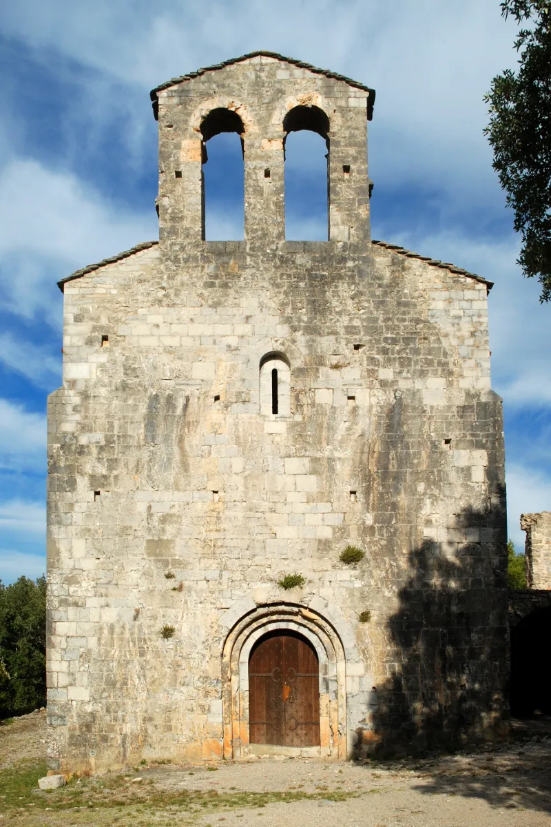
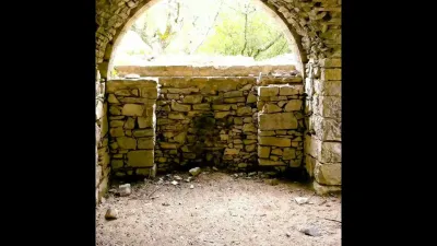
12e siècle La chapelle, avec son prieuré, devait former un ensemble assez important. De toutes ces constructions ne subsistent qu'une ou deux salles voûtées au milieu des ruines. La chapelle peut être un édifice du 12e siècle ayant subi l'influence de l'école romane provençale, avec ses pilastres et ses arcs de décharge entre les contreforts intérieurs. La nef comprend deux travées formant en plan un angle du côté nord. La voûte en berceau actuelle est plus récente, sans doute rebâtie à la suite des mouvements ayant entraîné la construction des contreforts. Le choeur est sur plan trapézoïdal et se raccorde à l'abside semi-circulaire voûtée en cul de four. L'arc triomphal est porté par deux colonnes avec chapiteaux à décor géométrique. Autour de l'abside et du choeur, arcatures sur colonnettes avec chapiteaux. Le mur sud est percé d'une porte dont le seuil est plus haut que celui de la chapelle. Elle devait donner accès aux bâtiments conventuels. L'édifice est en pierre de taille. La façade porte un clocher-arcade à deux baies.
Map and restricted areas
Open in the main mapRestricted zones
| Zone | Category | Limits | Conditions |
|---|---|---|---|
| Istres | Zone réglementée | 5491 m above sea level → 30766 m above sea level | Vols interdits sauf lorsque the official document of the zone l'autorise explicitement ou avec l'accord du gestionnaire de la zone lorsqu'il est désigné par the official document of the zone |
| Istres | Zone réglementée | 5491 m above sea level → 30766 m above sea level | Vols interdits sauf lorsque the official document of the zone l'autorise explicitement ou avec l'accord du gestionnaire de la zone lorsqu'il est désigné par the official document of the zone |
| Istres | Zone réglementée | 5491 m above sea level → 30766 m above sea level | Vols interdits sauf lorsque the official document of the zone l'autorise explicitement ou avec l'accord du gestionnaire de la zone lorsqu'il est désigné par the official document of the zone |
| Istres | Zone réglementée | 5491 m above sea level → 30766 m above sea level | Vols interdits sauf lorsque the official document of the zone l'autorise explicitement ou avec l'accord du gestionnaire de la zone lorsqu'il est désigné par the official document of the zone |
Nearby aerodromes
Open aerodromes within 25 km of the spot, heliports included, with their distance and direction from the spot. Near an aerodrome, drone flying is prohibited or height-limited: check the UAS zones map.
| Aerodrome | Type | Distance | Elevation |
|---|---|---|---|
| Aérodrome de Saint-Martin-de-Londres | Aerodrome | 8.1 km SE | 182 m |
Aviation weather (METAR and TAF)
LFMT – Montpellier-Méditerranée Airport VFR
METAR
METAR LFMT 171400Z AUTO 25009KT 9999 FEW071/// SCT150/// ///TCU 15/13 Q1004 TEMPO
- Wind
- 250°, 17 km/h
- Visibility
- 10 km or more
- Clouds
- Few (1-2/8) at 7,100 ft (2160 m) ; Scattered (3-4/8) at 15,000 ft (4570 m)
- Temperature
- 15 °C, dew point 13 °C
- QNH
- 1004 hPa
- Flight category
- VFR: ceiling > 3,000 ft and visibility > 5 mi
TAF
TAF LFMT 170800Z 1709/1809 01008KT 9999 BKN016 BECMG 1710/1712 CAVOK TEMPO 1712/1718 -SHRA FEW050TCU BECMG 1713/1715 21010KT
| Period (local time) | Change | Wind | Visibility | Weather | Clouds |
|---|---|---|---|---|---|
| 17/11 10:00 → 17/11 11:00 | Initial conditions | 010°, 15 km/h | 10 km or more | Broken (5-7/8) at 1,600 ft (490 m) | |
| 17/11 11:00 → 17/11 14:00 | Becoming | 010°, 15 km/h | 10 km or more | No significant weather | No significant cloud |
| 17/11 13:00 → 17/11 19:00 | Temporarily | Showers of rain light | Few (1-2/8) at 5,000 ft (1520 m) (towering cumulus) | ||
| 17/11 14:00 → 18/11 10:00 | Becoming | 210°, 19 km/h | 10 km or more | No significant weather | No significant cloud |
Weather and Kp index
Sunrise and sunset
| Day | Dawn | Sunrise | Golden hour | Sunset | Dusk | Day length |
|---|---|---|---|---|---|---|
| Tue 17 Nov | 07:11 | 07:42 | 07:42–08:26 · 16:34–17:18 | 17:18 | 17:49 | 9 h 35 |
| Wed 18 Nov | 07:12 | 07:44 | 07:44–08:28 · 16:33–17:17 | 17:17 | 17:48 | 9 h 33 |
| Thu 19 Nov | 07:14 | 07:45 | 07:45–08:29 · 16:32–17:16 | 17:16 | 17:48 | 9 h 31 |
| Fri 20 Nov | 07:15 | 07:46 | 07:46–08:30 · 16:31–17:15 | 17:15 | 17:47 | 9 h 29 |
| Sat 21 Nov | 07:16 | 07:47 | 07:47–08:32 · 16:30–17:15 | 17:15 | 17:46 | 9 h 27 |
| Sun 22 Nov | 07:17 | 07:49 | 07:49–08:33 · 16:29–17:14 | 17:14 | 17:45 | 9 h 25 |
| Mon 23 Nov | 07:18 | 07:50 | 07:50–08:35 · 16:28–17:13 | 17:13 | 17:45 | 9 h 23 |

Reviews (0)
Log in to review this spot. Log in · Create a free account
No reviews yet. Share yours!