

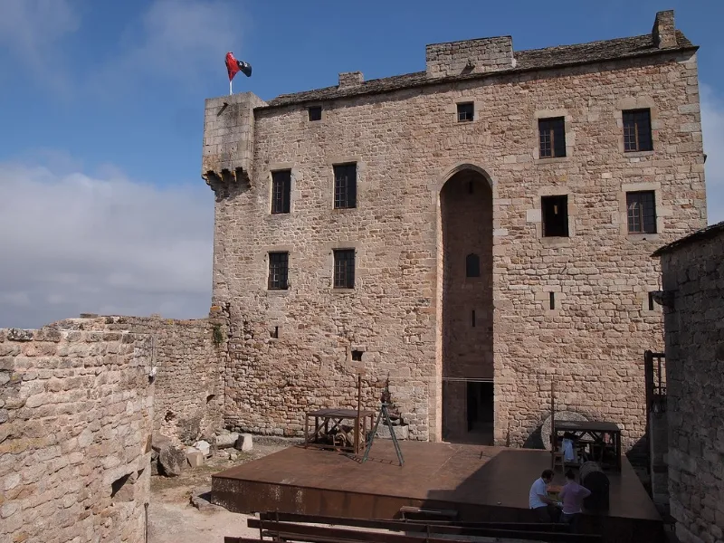
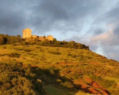
Montaigut Castle
No reviews yet
Have you flown here? Share your experience with other pilots.
+ Write the first reviewHistory
12e siècle ; 15e siècle Les premières traces du château remontent au 10e siècle. Au 12e siècle, les seigneurs font des dons pour la construction de l'abbaye de Silvanès. Construit sur un promontoire, sur une nécropole mérovingienne, ce château défendait la ville contre les attaques venant du midi. Le grand donjon est protégé par un mur d'enceinte renfermant une basse-cour et des communs, et par un fossé taillé dans le roc. Au 15e siècle, l'édifice est embelli et agrandi (construction de voûtes, portes en accolade, cheminées gothiques, mâchicoulis et échauguettes...). Au 17e siècle, le système de défense est démantelé et le château recouvert d'un toit en lauzes. Montaigut était également un lieu où la justice était rendue ; le château a conservé sa prison intacte.
Map and restricted areas
Open in the main mapRestricted zones
| Zone | Category | Limits | Conditions |
|---|---|---|---|
| Zrt Victor | ZRT | From the ground up to about 2,000 m above sea level | SUP AIP 219/26 · Du mardi 20 octobre au jeudi 22 octobre 2026 |
| Tarn | Zone réglementée | 244 m above ground level → 1280 m above sea level | Vols interdits sauf lorsque the official document of the zone l'autorise explicitement ou avec l'accord du gestionnaire de la zone lorsqu'il est désigné par the official document of the zone |
| Istres | Zone réglementée | 5491 m above sea level → 30766 m above sea level | Vols interdits sauf lorsque the official document of the zone l'autorise explicitement ou avec l'accord du gestionnaire de la zone lorsqu'il est désigné par the official document of the zone |
| Istres | Zone réglementée | 5491 m above sea level → 30766 m above sea level | Vols interdits sauf lorsque the official document of the zone l'autorise explicitement ou avec l'accord du gestionnaire de la zone lorsqu'il est désigné par the official document of the zone |
| Istres | Zone réglementée | 5491 m above sea level → 30766 m above sea level | Vols interdits sauf lorsque the official document of the zone l'autorise explicitement ou avec l'accord du gestionnaire de la zone lorsqu'il est désigné par the official document of the zone |
| Istres | Zone réglementée | 5491 m above sea level → 30766 m above sea level | Vols interdits sauf lorsque the official document of the zone l'autorise explicitement ou avec l'accord du gestionnaire de la zone lorsqu'il est désigné par the official document of the zone |
| Zrt Belmont - Tarn | ZRT | 800 ft ASFC / 4200 ft AMSL | SUP AIP 216/26 · Du mercredi 14 octobre au jeudi 22 octobre 2026 |
Nearby aerodromes
Open aerodromes within 25 km of the spot, heliports included, with their distance and direction from the spot. Near an aerodrome, drone flying is prohibited or height-limited: check the UAS zones map.
| Aerodrome | Type | Distance | Elevation |
|---|---|---|---|
| Saint-Affrique-Belmont Airport | Aerodrome | 13 km SW | 514 m |
Aviation weather (METAR and TAF)
No METAR station within 50 km.
Weather and Kp index
Sunrise and sunset
| Day | Dawn | Sunrise | Golden hour | Sunset | Dusk | Day length |
|---|---|---|---|---|---|---|
| Tue 17 Nov | 07:15 | 07:46 | 07:46–08:30 · 16:37–17:21 | 17:21 | 17:52 | 9 h 35 |
| Wed 18 Nov | 07:16 | 07:47 | 07:47–08:31 · 16:36–17:20 | 17:20 | 17:51 | 9 h 33 |
| Thu 19 Nov | 07:17 | 07:48 | 07:48–08:33 · 16:35–17:19 | 17:19 | 17:51 | 9 h 31 |
| Fri 20 Nov | 07:18 | 07:50 | 07:50–08:34 · 16:34–17:19 | 17:19 | 17:50 | 9 h 29 |
| Sat 21 Nov | 07:19 | 07:51 | 07:51–08:35 · 16:33–17:18 | 17:18 | 17:49 | 9 h 27 |
| Sun 22 Nov | 07:21 | 07:52 | 07:52–08:37 · 16:32–17:17 | 17:17 | 17:49 | 9 h 25 |
| Mon 23 Nov | 07:22 | 07:53 | 07:53–08:38 · 16:32–17:16 | 17:16 | 17:48 | 9 h 23 |

Reviews (0)
Log in to review this spot. Log in · Create a free account
No reviews yet. Share yours!