

Bellon Viaduct
No reviews yet
Have you flown here? Share your experience with other pilots.
+ Write the first reviewHistory
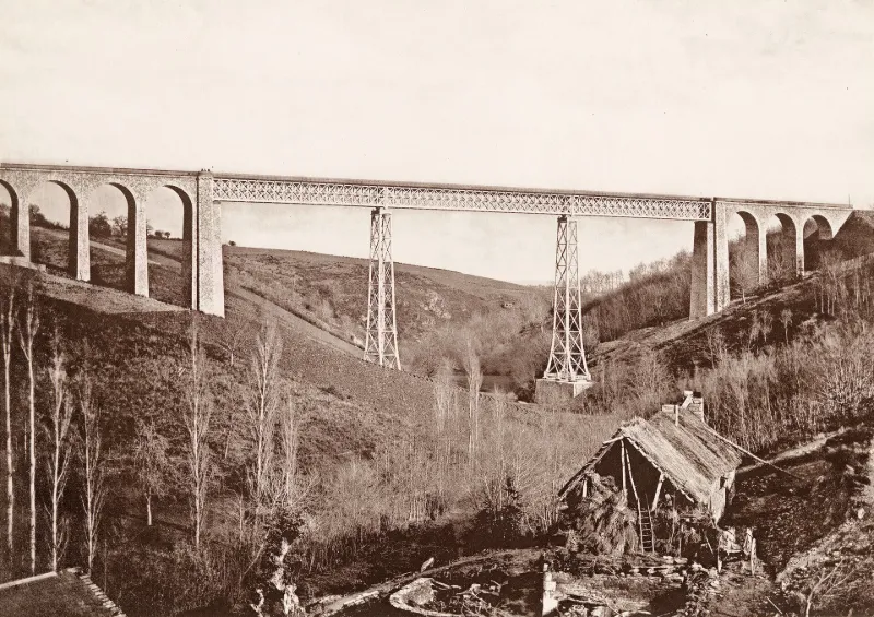
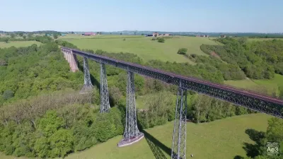
3e quart 19e siècle La ligne Gannat-Commentry fut créée en 1861 suite au développement industriel de ces deux villes sous le Second empire. L'ingénieur Wilhelm Nördling conçut des ouvrages en métal pour le franchissement des quatre vallées les plus encaissées de la ligne. Le viaduc du Belon comporte des piles renforcées sur chaque angle par un arbalétrier cylindrique cintré vers l'extérieur, reposant sur un massif maçonné par l'intermédiaire d'un bloc-étrier. Les colonnes ainsi formées sont renforcées par des goussets d'attache permettant la fixation sur des entretoises en fer. Le viaduc de la Bouble comporte de simples arbalétriers droits renforcés par des jambes de force incurvées. Ses quatre piles et cinq travées en font l'un des ouvrages monumental par la taille. La construction commença en 1868, mais les difficultés techniques à résoudre furent telles que les ouvrages furent achevés en 1871.
Map and restricted areas
Open in the main mapRestricted zones
Nearby aerodromes
Open aerodromes within 25 km of the spot, heliports included, with their distance and direction from the spot. Near an aerodrome, drone flying is prohibited or height-limited: check the UAS zones map.
No known open aerodrome within 25 km.
Aviation weather (METAR and TAF)
LFLV – Vichy-Charmeil Airport VFR
METAR
METAR LFLV 171400Z AUTO 21007KT 140V280 9999 SCT048 SCT056 OVC210 18/10 Q0999
- Wind
- 210°, 13 km/h
- Visibility
- 10 km or more
- Clouds
- Scattered (3-4/8) at 4,800 ft (1460 m) ; Scattered (3-4/8) at 5,600 ft (1710 m) ; Overcast (8/8) at 21,000 ft (6400 m)
- Temperature
- 18 °C, dew point 10 °C
- QNH
- 999 hPa
- Flight category
- VFR: ceiling > 3,000 ft and visibility > 5 mi
TAF
Weather and Kp index
Sunrise and sunset
| Day | Dawn | Sunrise | Golden hour | Sunset | Dusk | Day length |
|---|---|---|---|---|---|---|
| Tue 17 Nov | 07:19 | 07:52 | 07:52–08:38 · 16:28–17:14 | 17:14 | 17:47 | 9 h 22 |
| Wed 18 Nov | 07:21 | 07:53 | 07:53–08:40 · 16:26–17:13 | 17:13 | 17:46 | 9 h 19 |
| Thu 19 Nov | 07:22 | 07:55 | 07:55–08:41 · 16:25–17:12 | 17:12 | 17:45 | 9 h 17 |
| Fri 20 Nov | 07:23 | 07:56 | 07:56–08:43 · 16:24–17:11 | 17:11 | 17:44 | 9 h 15 |
| Sat 21 Nov | 07:24 | 07:57 | 07:57–08:45 · 16:23–17:10 | 17:10 | 17:43 | 9 h 12 |
| Sun 22 Nov | 07:26 | 07:59 | 07:59–08:46 · 16:22–17:10 | 17:10 | 17:43 | 9 h 10 |
| Mon 23 Nov | 07:27 | 08:00 | 08:00–08:48 · 16:21–17:09 | 17:09 | 17:42 | 9 h 08 |
Reviews (0)
Log in to review this spot. Log in · Create a free account
No reviews yet. Share yours!