

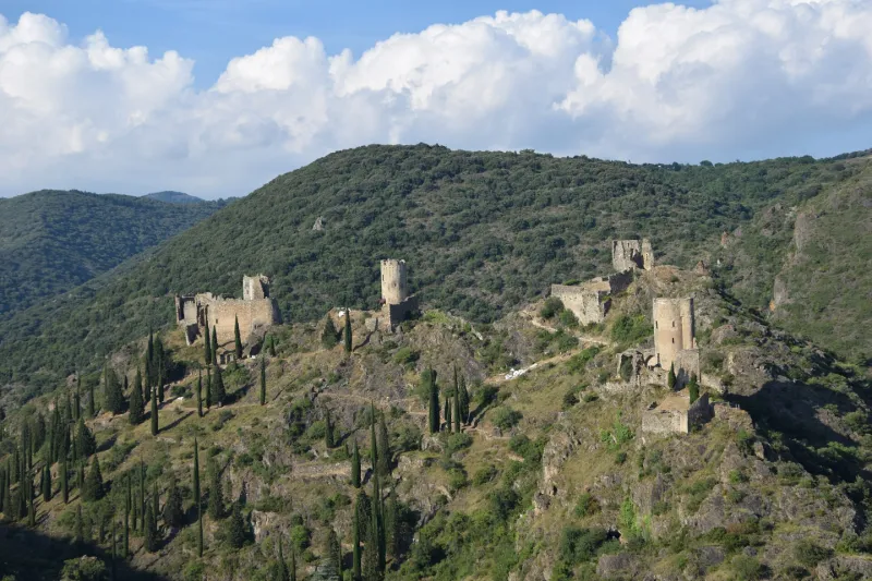
Ruins of the Four Castles
No reviews yet
Have you flown here? Share your experience with other pilots.
+ Write the first reviewHistory
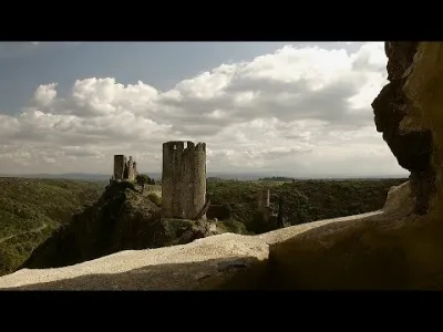
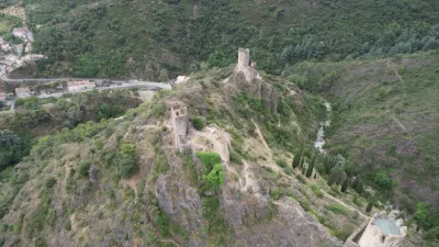
12e siècle ; 13e siècle ; 16e siècle Les châteaux comprennent une tour, une cour étroite et quelques bâtiments adossés pouvant contenir une ou deux salles avec une citerne. Ce peu d'importance des constructions fait penser qu'ils étaient plutôt destinés à être le signe d'une suzeraineté que de véritables forteresses. Suzeraineté peut-être partagée par quatre co-seigneurs. Leur force résidait dans leur situation inaccessible, la construction étant ordinaire. Les chaines, arcs et piedroits de baies sont seuls en pierre de taille, le reste étant en moellons. Le plus au sud est planté sur un piton rocheux. La tour ronde servant de donjon s'élevait de quatre étages percés d'archères. Trois étaient séparés par des planchers et le quatrième couvert par une voûte qui portait le dallage supérieur. Il ne reste que les naissances des nervures. La salle contigüe est entourée d'arcades en ogives sur lesquelles passe le chemin de ronde. Des trois châteaux suivants, le second et le plus en ruine. Le donjon était carré et la cour à l'ouest assez vaste. Le troisème édifice présente une tour ronde semblable à celle du premier. Le quatrième, le plus au nord, avec une tour carrée, s'élève sur la pointe extrème de la ligne de faîte. Les bâtiments présentent des traces de chemin de ronde et des divisions intérieures. Ces constructions semblent remonter au 13e siècle. La base des tours est peut-être plus ancienne.
Map and restricted areas
Open in the main mapRestricted zones
| Zone | Category | Limits | Conditions |
|---|---|---|---|
| Tma Toulouse |
Région de contrôle terminal | 457 m above ground level → 2297 m above sea level · 610 m above sea level → 914 m above sea level · 610 m above sea level → 2297 m above sea level · 732 m above sea level → 914 m above sea level · 762 m above sea level → 2297 m above sea level · 914 m above sea level → 1219 m above sea level · 914 m above sea level → 1219 m above sea level · 914 m above sea level → 2297 m above sea level · 914 m above sea level → 2297 m above sea level · 914 m above sea level → 2297 m above sea level · 1067 m above sea level → 2297 m above sea level · 1067 m above sea level → 3821 m above sea level · 1219 m above sea level → 2297 m above sea level · 1219 m above sea level → 2297 m above sea level · 1219 m above sea level → 2297 m above sea level · 1529 m above sea level → 3821 m above sea level · 1529 m above sea level → 3821 m above sea level · 1529 m above sea level → 3821 m above sea level | Drone flights inside this zone are forbidden without the prior agreement of air traffic control |
| Istres | Zone réglementée | 5491 m above sea level → 30766 m above sea level | Vols interdits sauf lorsque the official document of the zone l'autorise explicitement ou avec l'accord du gestionnaire de la zone lorsqu'il est désigné par the official document of the zone |
Nearby aerodromes
Open aerodromes within 25 km of the spot, heliports included, with their distance and direction from the spot. Near an aerodrome, drone flying is prohibited or height-limited: check the UAS zones map.
| Aerodrome | Type | Distance | Elevation |
|---|---|---|---|
| Carcassonne Airport | Airport | 15 km SW | 132 m |
| Gayraud Centre Hospitalier Heliport | Heliport | 16 km S | 145 m |
Aviation weather (METAR and TAF)
LFMK – Carcassonne Airport VFR
METAR
METAR LFMK 171400Z AUTO VRB03KT 9999 FEW092/// BKN120/// ///TCU 15/14 Q1004 NOSIG
- Wind
- Variable, 6 km/h
- Visibility
- 10 km or more
- Clouds
- Few (1-2/8) at 9,200 ft (2800 m) ; Broken (5-7/8) at 12,000 ft (3660 m)
- Temperature
- 15 °C, dew point 14 °C
- QNH
- 1004 hPa
- Flight category
- VFR: ceiling > 3,000 ft and visibility > 5 mi
TAF
TAF LFMK 170800Z 1709/1809 08008KT 9999 BKN070 TEMPO 1709/1712 -RA SCT004 BKN010 BECMG 1710/1712 VRB03KT TEMPO 1712/1720 SCT025TCU BECMG 1720/1722 CAVOK PROB30 TEMPO 1801/1807 3000 BR BECMG 1806/1808 27010KT 4000 RA BKN020 BKN030
| Period (local time) | Change | Wind | Visibility | Weather | Clouds |
|---|---|---|---|---|---|
| 17/11 10:00 → 17/11 11:00 | Initial conditions | 080°, 15 km/h | 10 km or more | Broken (5-7/8) at 7,000 ft (2130 m) | |
| 17/11 10:00 → 17/11 13:00 | Temporarily | Rain light | Scattered (3-4/8) at 400 ft (120 m) ; Broken (5-7/8) at 1,000 ft (300 m) | ||
| 17/11 11:00 → 17/11 21:00 | Becoming | Variable, 6 km/h | 10 km or more | Broken (5-7/8) at 7,000 ft (2130 m) | |
| 17/11 13:00 → 17/11 21:00 | Temporarily | Scattered (3-4/8) at 2,500 ft (760 m) (towering cumulus) | |||
| 17/11 21:00 → 18/11 07:00 | Becoming | Variable, 6 km/h | 10 km or more | No significant weather | No significant cloud |
| 18/11 02:00 → 18/11 08:00 | Temporarily, probability 30% | 3.0 km | Mist | ||
| 18/11 07:00 → 18/11 10:00 | Becoming | 270°, 19 km/h | 4.0 km | Rain | Broken (5-7/8) at 2,000 ft (610 m) ; Broken (5-7/8) at 3,000 ft (910 m) |
Weather and Kp index
| Day | Weather | Temp. min. / max. | Wind | Rain | Max Kp |
|---|---|---|---|---|---|
| Tue 17 Nov | Cloudy | 11° / 14° | 11 km/h SW | 0.8 mm | 5 |
| Wed 18 Nov | Fair | 10° / 16° | 23 km/h NW | 3.9 mm | 5 |
| Thu 19 Nov | Clear sky | 10° / 14° | 34 km/h W | 5.3 mm | 3 |
| Fri 20 Nov | Partly cloudy | 8° / 14° | 25 km/h W | – | 3 |
| Sat 21 Nov | Cloudy | 8° / 14° | 18 km/h E | – | – |
| Sun 22 Nov | Partly cloudy | 10° / 12° | 28 km/h W | 1.9 mm | – |
| Mon 23 Nov | Cloudy | 7° / 13° | 20 km/h W | – | – |
Hour by hour: Tuesday 17 November
| Time | Weather | Temp. | Wind | Rain | Clouds | Kp |
|---|---|---|---|---|---|---|
| 15:00 | Cloudy | 14° | 11 km/h SW | – | 100 % | 4 |
| 16:00 | Cloudy | 14° | 6 km/h W | – | 100 % | 4 |
| 17:00 | Cloudy | 13° | 7 km/h NE | – | 100 % | 4 |
| 18:00 | Light rain | 12° | 5 km/h N | 0.1 mm | 100 % | 4 |
| 19:00 | Cloudy | 12° | 5 km/h N | – | 96 % | 5 |
| 20:00 | Cloudy | 11° | 5 km/h N | – | 94 % | 5 |
| 21:00 | Rain | 11° | 6 km/h N | 0.5 mm | 99 % | 5 |
| 22:00 | Light rain | 11° | 6 km/h N | 0.2 mm | 100 % | 5 |
Hour by hour: Wednesday 18 November
| Time | Weather | Temp. | Wind | Rain | Clouds | Kp |
|---|---|---|---|---|---|---|
| 06:00 | Rain | 12° | 23 km/h NW | 0.4 mm | 100 % | 4 |
| 07:00 | Heavy rain | 12° | 19 km/h W | 1.1 mm | 100 % | 4 |
| 08:00 | Heavy rain | 12° | 20 km/h W | 1.2 mm | 100 % | 4 |
| 09:00 | Rain | 12° | 23 km/h W | 0.8 mm | 100 % | 4 |
| 10:00 | Cloudy | 11° | 23 km/h W | – | 100 % | 4 |
| 11:00 | Cloudy | 12° | 21 km/h W | – | 100 % | 4 |
| 12:00 | Fair | 13° | 21 km/h W | – | 28 % | 4 |
| 13:00 | Fair | 15° | 22 km/h W | – | 17 % | 3 |
| 14:00 | Clear sky | 15° | 21 km/h W | – | 10 % | 3 |
| 15:00 | Partly cloudy | 16° | 20 km/h W | – | 42 % | 3 |
| 16:00 | Partly cloudy | 15° | 17 km/h W | – | 56 % | 3 |
| 17:00 | Partly cloudy | 14° | 11 km/h W | – | 79 % | 3 |
| 18:00 | Partly cloudy | 11° | 7 km/h NW | – | 75 % | 3 |
| 19:00 | Partly cloudy | 10° | 4 km/h N | – | 98 % | 2 |
| 20:00 | Partly cloudy | 10° | 5 km/h NE | – | 93 % | 2 |
| 21:00 | Partly cloudy | 11° | 13 km/h NE | – | 94 % | 2 |
| 22:00 | Cloudy | 11° | 18 km/h NE | – | 93 % | 2 |
Sunrise and sunset
| Day | Dawn | Sunrise | Golden hour | Sunset | Dusk | Day length |
|---|---|---|---|---|---|---|
| Tue 17 Nov | 07:15 | 07:46 | 07:46–08:30 · 16:41–17:25 | 17:25 | 17:55 | 9 h 38 |
| Wed 18 Nov | 07:17 | 07:48 | 07:48–08:31 · 16:40–17:24 | 17:24 | 17:55 | 9 h 36 |
| Thu 19 Nov | 07:18 | 07:49 | 07:49–08:32 · 16:39–17:23 | 17:23 | 17:54 | 9 h 34 |
| Fri 20 Nov | 07:19 | 07:50 | 07:50–08:34 · 16:38–17:22 | 17:22 | 17:53 | 9 h 32 |
| Sat 21 Nov | 07:20 | 07:51 | 07:51–08:35 · 16:37–17:21 | 17:21 | 17:53 | 9 h 30 |
| Sun 22 Nov | 07:21 | 07:52 | 07:52–08:37 · 16:37–17:21 | 17:21 | 17:52 | 9 h 28 |
| Mon 23 Nov | 07:22 | 07:54 | 07:54–08:38 · 16:36–17:20 | 17:20 | 17:51 | 9 h 26 |

Reviews (0)
Log in to review this spot. Log in · Create a free account
No reviews yet. Share yours!