

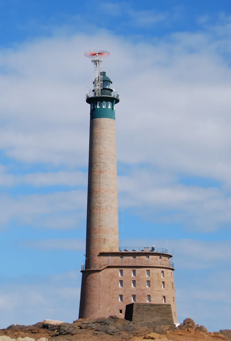
Roches-Douvres Lighthouse
No reviews yet
Have you flown here? Share your experience with other pilots.
+ Write the first reviewHistory
Ce phare, le dernier en mer construit en France et le plus éloigné des côtes européennes, est un ouvrage complexe de pierre et de béton, imprégné de références architecturales et maritimes. Entièrement détruit en août 1944 par les Allemands qui l’occupaient, il est reconstruit dès 1947 et le feu est allumé en juin 1954. L’édifice est d’une ampleur et d’un confort inégalés pour un ouvrage de ce type et constitue une pièce majeure du programme de reconstruction des phares après la Seconde Guerre mondiale.
Map and restricted areas
Open in the main mapRestricted zones
| Zone | Category | Limits | Conditions |
|---|---|---|---|
| (Partie sud) |
Zone de contrôle civile | 50 m above ground level → 2754 m above sea level | Flights above 50 metres are forbidden without the prior agreement of air traffic control |
| (Partie sud) |
Région de contrôle terminal | 1986 m above sea level → 6259 m above sea level | Drone flights inside this zone are forbidden without the prior agreement of air traffic control |
Nearby aerodromes
Open aerodromes within 25 km of the spot, heliports included, with their distance and direction from the spot. Near an aerodrome, drone flying is prohibited or height-limited: check the UAS zones map.
No known open aerodrome within 25 km.
Aviation weather (METAR and TAF)
EGJB – Guernsey Airport VFR
METAR
METAR EGJB 171420Z 24022KT 9999 -RA FEW008CB SCT010 11/10 Q0985 RERA
- Wind
- 240°, 41 km/h
- Visibility
- 10 km or more
- Weather
- Rain light
- Clouds
- Few (1-2/8) at 800 ft (240 m) ; Scattered (3-4/8) at 1,000 ft (300 m)
- Temperature
- 11 °C, dew point 10 °C
- QNH
- 985 hPa
- Flight category
- VFR: ceiling > 3,000 ft and visibility > 5 mi
TAF
TAF EGJB 171359Z 1715/1724 25028G39KT 9999 FEW015 BKN020 TEMPO 1715/1724 7000 SHRA FEW008 BKN014TCU PROB30 TEMPO 1715/1718 26032G50KT 3000 +TSRAGS FEW004 BKN008CB
| Period (local time) | Change | Wind | Visibility | Weather | Clouds |
|---|---|---|---|---|---|
| 17/11 16:00 → 18/11 01:00 | Initial conditions | 250°, 52 km/h, gusts 72 km/h | 10 km or more | Few (1-2/8) at 1,500 ft (460 m) ; Broken (5-7/8) at 2,000 ft (610 m) | |
| 17/11 16:00 → 18/11 01:00 | Temporarily | 7 km | Showers of rain | Few (1-2/8) at 800 ft (240 m) ; Broken (5-7/8) at 1,400 ft (430 m) (towering cumulus) | |
| 17/11 16:00 → 17/11 19:00 | Temporarily, probability 30% | 260°, 59 km/h, gusts 93 km/h | 3.0 km | Thunderstorm rain heavy ; thunderstorm small hail heavy | Few (1-2/8) at 400 ft (120 m) ; Broken (5-7/8) at 800 ft (240 m) (cumulonimbus) |
Weather and Kp index
Sunrise and sunset
| Day | Dawn | Sunrise | Golden hour | Sunset | Dusk | Day length |
|---|---|---|---|---|---|---|
| Tue 17 Nov | 07:49 | 08:24 | 08:24–09:15 · 16:38–17:28 | 17:28 | 18:03 | 9 h 03 |
| Wed 18 Nov | 07:51 | 08:26 | 08:26–09:16 · 16:36–17:27 | 17:27 | 18:02 | 9 h 01 |
| Thu 19 Nov | 07:52 | 08:27 | 08:27–09:18 · 16:35–17:26 | 17:26 | 18:01 | 8 h 58 |
| Fri 20 Nov | 07:54 | 08:29 | 08:29–09:20 · 16:34–17:25 | 17:25 | 18:00 | 8 h 56 |
| Sat 21 Nov | 07:55 | 08:30 | 08:30–09:22 · 16:33–17:24 | 17:24 | 17:59 | 8 h 53 |
| Sun 22 Nov | 07:56 | 08:32 | 08:32–09:23 · 16:31–17:23 | 17:23 | 17:58 | 8 h 51 |
| Mon 23 Nov | 07:58 | 08:33 | 08:33–09:25 · 16:30–17:22 | 17:22 | 17:58 | 8 h 48 |


Reviews (0)
Log in to review this spot. Log in · Create a free account
No reviews yet. Share yours!