

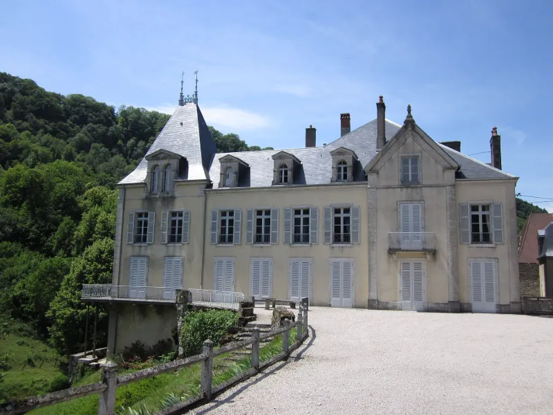
Vaux-sur-Poligny Castle
No reviews yet
Have you flown here? Share your experience with other pilots.
+ Write the first reviewHistory
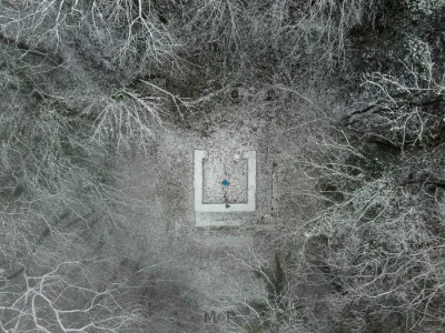
L'abbaye bénédictine de Vaux-sur-Poligny était devenue un petit séminaire au 19e siècle. En 1870, son supérieur, l'abbé Petit, acheta le moulin à l'Est de l'ancienne abbaye, conjointement avec sa nièce qui épousa peu après Louis Milcent, auditeur au Conseil d'Etat. Cet adepte des idées sociales du marquis de la Tour du Pin et du comte Albert de Mun trouva là une implantation rurale qui en fit le créateur du syndicat agricole de l'arrondissement de Poligny en 1884 puis le cofondateur en 1885 de l'association de crédit mutuel de l'arrondissement de Poligny - Première caisse locale de crédit agricole, avec Alfred Bouvet et le marquis de Froissard. Entre temps, il avait développé le domaine de Vaux. L'architecte bisontin Ducat fut chargé de la construction d'une demeure spacieuse sur les soubassements du moulin, perpendiculairement à la vallée. L'architecte-paysagiste Brice Michel aménagea le parc, mettant en scène le cours de la Glantine. Des communs et une ferme sont disposés le long de la route nationale depuis laquelle un portail et une rue donnent accès à la propriété. Elle comporte aussi une chapelle funéraire sur le versant Sud. Le corps de logis conserve la distribution et les décors d'origine. Ensemble complet, bien conservé, relativement documenté, ce château se distingue des demeures semblables de cette époque par l'aménagement exceptionnel d'un site de reculée caractéristique du Jura.
Map and restricted areas
Open in the main mapRestricted zones
| Zone | Category | Limits | Conditions |
|---|---|---|---|
| Zrt/zdt Riviera | ZRT/ZDT | From about 14,950 m to about 16,750 m above sea level | SUP AIP 233/24 · Du 16 janvier 2025 au 13 janvier 2027 |
Nearby aerodromes
Open aerodromes within 25 km of the spot, heliports included, with their distance and direction from the spot. Near an aerodrome, drone flying is prohibited or height-limited: check the UAS zones map.
| Aerodrome | Type | Distance | Elevation |
|---|---|---|---|
| Aérodrome de Champagnole - Crotenay | Aerodrome | 9.9 km SE | 532 m |
| Doucier ULM | Aerodrome | 18 km S | 529 m |
| Centre Hospitalier de Lons le Saunier Heliport | Heliport | 21 km SW | 273 m |
Aviation weather (METAR and TAF)
LFGJ – Dole-Tavaux Airport VFR
METAR
METAR LFGJ 171400Z AUTO 20018KT CAVOK 17/13 Q0998 TEMPO 21020G35KT SCT020TCU
- Wind
- 200°, 33 km/h
- Visibility
- 10 km or more
- Clouds
- –
- Temperature
- 17 °C, dew point 13 °C
- QNH
- 998 hPa
- Flight category
- VFR: ceiling > 3,000 ft and visibility > 5 mi
TAF
TAF LFGJ 171400Z 1715/1724 21015G25KT CAVOK TEMPO 1715/1718 -SHRA FEW025TCU TEMPO 1721/1724 21020G37KT SHRA SCT040TCU PROB30 TEMPO 1721/1724 FEW035CB
| Period (local time) | Change | Wind | Visibility | Weather | Clouds |
|---|---|---|---|---|---|
| 17/11 16:00 → 18/11 01:00 | Initial conditions | 210°, 28 km/h, gusts 46 km/h | 10 km or more | No significant weather | No significant cloud |
| 17/11 16:00 → 17/11 19:00 | Temporarily | Showers of rain light | Few (1-2/8) at 2,500 ft (760 m) (towering cumulus) | ||
| 17/11 22:00 → 18/11 01:00 | Temporarily | 210°, 37 km/h, gusts 69 km/h | Showers of rain | Scattered (3-4/8) at 4,000 ft (1220 m) (towering cumulus) | |
| 17/11 22:00 → 18/11 01:00 | Temporarily, probability 30% | Few (1-2/8) at 3,500 ft (1070 m) (cumulonimbus) |
Weather and Kp index
Sunrise and sunset
| Day | Dawn | Sunrise | Golden hour | Sunset | Dusk | Day length |
|---|---|---|---|---|---|---|
| Tue 17 Nov | 07:10 | 07:43 | 07:43–08:30 · 16:14–17:01 | 17:01 | 17:34 | 9 h 18 |
| Wed 18 Nov | 07:11 | 07:44 | 07:44–08:32 · 16:13–17:00 | 17:00 | 17:34 | 9 h 16 |
| Thu 19 Nov | 07:12 | 07:46 | 07:46–08:33 · 16:12–16:59 | 16:59 | 17:33 | 9 h 13 |
| Fri 20 Nov | 07:14 | 07:47 | 07:47–08:35 · 16:11–16:58 | 16:58 | 17:32 | 9 h 11 |
| Sat 21 Nov | 07:15 | 07:48 | 07:48–08:36 · 16:10–16:58 | 16:58 | 17:31 | 9 h 09 |
| Sun 22 Nov | 07:16 | 07:50 | 07:50–08:38 · 16:08–16:57 | 16:57 | 17:30 | 9 h 06 |
| Mon 23 Nov | 07:17 | 07:51 | 07:51–08:40 · 16:07–16:56 | 16:56 | 17:30 | 9 h 04 |
Reviews (0)
Log in to review this spot. Log in · Create a free account
No reviews yet. Share yours!