

La Mothe Castle
No reviews yet
Have you flown here? Share your experience with other pilots.
+ Write the first reviewHistory
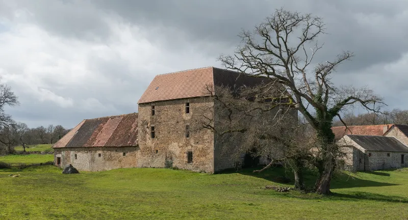
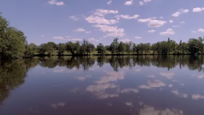
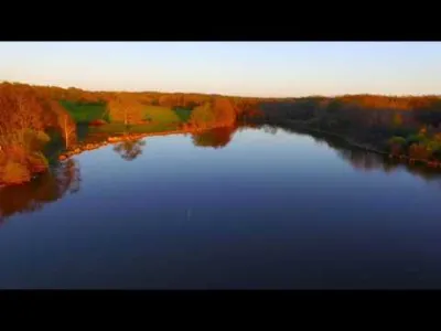
La première mention d'un seigneur de la Mothe remonte à 1490, avec construction d'un édifice en 1491. A partir du 17e siècle, le logis ne servit que de résidence occasionnelle. Dans les années 1730, le domaine fut vendu aux soeurs hospitalières de Magnac, puis devint hôpital public à la Révolution. Les bâtiments conservés sont disposés selon un plan masse en U autour d'une aire centrale. Ils comprennent un logis en équerre et des dépendances à simple rez-de-chaussée dont une aile forme aussi retour. Un étang bordait autrefois le domaine ; il n'en reste aujourd'hui qu'une mare. Le logis est un bâtiment à deux étages dont l'angle rentrant est occupé par une tour circulaire, à la base de laquelle se trouve la porte d'entrée. Celle-ci présente le principal ornement de la façade, à savoir un imposant linteau creusé en accolade dans lequel a été réservé un écu aux armoiries effacées. Le volume intérieur est desservi par un escalier en vis situé dans la tour placée à l'articulation des deux ailes. Le premier étage conserve des cheminées de la fin de l'époque gothique. Si le logis remonte à 1491, les dépendances sont plus tardives. Deux tours devaient flanquer l'aile sud, à usage de grange à foin. Le château comprenait également une borderie dans l'avant-cour, des jardins enclos de murs ou de haies et peut-être une chapelle.
Map and restricted areas
Open in the main mapRestricted zones
Nearby aerodromes
Open aerodromes within 25 km of the spot, heliports included, with their distance and direction from the spot. Near an aerodrome, drone flying is prohibited or height-limited: check the UAS zones map.
No known open aerodrome within 25 km.
Aviation weather (METAR and TAF)
LFBL – Limoges Airport VFR
METAR
METAR LFBL 171330Z AUTO 21012KT 9999 SCT032 SCT041 OVC180 15/10 Q1001 TEMPO 24015G25KT 4000 SHRA BKN010 BKN015TCU
- Wind
- 210°, 22 km/h
- Visibility
- 10 km or more
- Clouds
- Scattered (3-4/8) at 3,200 ft (980 m) ; Scattered (3-4/8) at 4,100 ft (1250 m) ; Overcast (8/8) at 18,000 ft (5490 m)
- Temperature
- 15 °C, dew point 10 °C
- QNH
- 1001 hPa
- Flight category
- VFR: ceiling > 3,000 ft and visibility > 5 mi
TAF
TAF LFBL 171100Z 1712/1812 24010KT 9999 BKN020 TEMPO 1712/1812 24015G25KT 4000 SHRA BKN010 BKN015TCU PROB30 TEMPO 1720/1724 24020G35KT 2000 TSRA BKN005 BKN015CB PROB30 TEMPO 1808/1812 26015G40KT 1500 TSRA BKN005 BKN010CB
| Period (local time) | Change | Wind | Visibility | Weather | Clouds |
|---|---|---|---|---|---|
| 17/11 13:00 → 18/11 13:00 | Initial conditions | 240°, 19 km/h | 10 km or more | Broken (5-7/8) at 2,000 ft (610 m) | |
| 17/11 13:00 → 18/11 13:00 | Temporarily | 240°, 28 km/h, gusts 46 km/h | 4.0 km | Showers of rain | Broken (5-7/8) at 1,000 ft (300 m) ; Broken (5-7/8) at 1,500 ft (460 m) (towering cumulus) |
| 17/11 21:00 → 18/11 01:00 | Temporarily, probability 30% | 240°, 37 km/h, gusts 65 km/h | 2.0 km | Thunderstorm rain | Broken (5-7/8) at 500 ft (150 m) ; Broken (5-7/8) at 1,500 ft (460 m) (cumulonimbus) |
| 18/11 09:00 → 18/11 13:00 | Temporarily, probability 30% | 260°, 28 km/h, gusts 74 km/h | 1.5 km | Thunderstorm rain | Broken (5-7/8) at 500 ft (150 m) ; Broken (5-7/8) at 1,000 ft (300 m) (cumulonimbus) |
Weather and Kp index
| Day | Weather | Temp. min. / max. | Wind | Rain | Max Kp |
|---|---|---|---|---|---|
| Tue 17 Nov | Fair | 12° / 16° | 36 km/h SW | 5.9 mm | 5 |
| Wed 18 Nov | Showers | 10° / 13° | 32 km/h SW | 11 mm | 5 |
| Thu 19 Nov | Showers | 8° / 11° | 40 km/h S | 13 mm | 3 |
| Fri 20 Nov | Rain | 8° / 12° | 29 km/h SW | 5.7 mm | 3 |
| Sat 21 Nov | Cloudy | 9° / 13° | 18 km/h SW | 0.9 mm | – |
| Sun 22 Nov | Showers | 10° / 11° | 30 km/h SW | 8.5 mm | – |
| Mon 23 Nov | Cloudy | 7° / 12° | 17 km/h SW | 4.2 mm | – |
Hour by hour: Tuesday 17 November
| Time | Weather | Temp. | Wind | Rain | Clouds | Kp |
|---|---|---|---|---|---|---|
| 15:00 | Fair | 16° | 33 km/h SW | – | 16 % | 4 |
| 16:00 | Fair | 15° | 34 km/h SW | – | 34 % | 4 |
| 17:00 | Fair | 14° | 33 km/h SW | – | 34 % | 4 |
| 18:00 | Showers | 13° | 35 km/h SW | 0.2 mm | 66 % | 4 |
| 19:00 | Rain | 13° | 36 km/h SW | 0.8 mm | 99 % | 5 |
| 20:00 | Rain | 12° | 36 km/h SW | 0.8 mm | 98 % | 5 |
| 21:00 | Heavy rain | 12° | 33 km/h SW | 3.4 mm | 98 % | 5 |
| 22:00 | Rain | 12° | 33 km/h SW | 0.7 mm | 100 % | 5 |
Hour by hour: Wednesday 18 November
| Time | Weather | Temp. | Wind | Rain | Clouds | Kp |
|---|---|---|---|---|---|---|
| 06:00 | Showers | 11° | 25 km/h SW | 0.3 mm | 53 % | 4 |
| 07:00 | Heavy rain | 10° | 28 km/h SW | 2.8 mm | 99 % | 4 |
| 08:00 | Light rain | 10° | 27 km/h SW | 0.3 mm | 100 % | 4 |
| 09:00 | Cloudy | 10° | 30 km/h SW | – | 94 % | 4 |
| 10:00 | Fair | 11° | 29 km/h SW | – | 18 % | 4 |
| 11:00 | Showers | 12° | 31 km/h SW | 0.1 mm | 30 % | 4 |
| 12:00 | Showers | 13° | 32 km/h SW | 0.3 mm | 67 % | 4 |
| 13:00 | Showers | 12° | 30 km/h SW | 0.3 mm | 76 % | 3 |
| 14:00 | Partly cloudy | 13° | 31 km/h SW | – | 62 % | 3 |
| 15:00 | Showers | 13° | 28 km/h SW | 0.2 mm | 84 % | 3 |
| 16:00 | Partly cloudy | 12° | 28 km/h SW | – | 74 % | 3 |
| 17:00 | Partly cloudy | 12° | 24 km/h SW | – | 81 % | 3 |
| 18:00 | Cloudy | 11° | 24 km/h SW | – | 90 % | 3 |
| 19:00 | Light rain | 11° | 25 km/h S | 0.1 mm | 98 % | 2 |
| 20:00 | Light rain | 11° | 26 km/h S | 0.1 mm | 100 % | 2 |
| 21:00 | Heavy rain | 12° | 27 km/h S | 1.4 mm | 100 % | 2 |
| 22:00 | Heavy rain | 11° | 27 km/h S | 1.5 mm | 100 % | 2 |
Sunrise and sunset
| Day | Dawn | Sunrise | Golden hour | Sunset | Dusk | Day length |
|---|---|---|---|---|---|---|
| Tue 17 Nov | 07:27 | 08:00 | 08:00–08:46 · 16:35–17:21 | 17:21 | 17:54 | 9 h 21 |
| Wed 18 Nov | 07:28 | 08:01 | 08:01–08:48 · 16:34–17:20 | 17:20 | 17:53 | 9 h 19 |
| Thu 19 Nov | 07:29 | 08:02 | 08:02–08:49 · 16:32–17:19 | 17:19 | 17:52 | 9 h 17 |
| Fri 20 Nov | 07:31 | 08:04 | 08:04–08:51 · 16:31–17:18 | 17:18 | 17:51 | 9 h 14 |
| Sat 21 Nov | 07:32 | 08:05 | 08:05–08:52 · 16:30–17:18 | 17:18 | 17:51 | 9 h 12 |
| Sun 22 Nov | 07:33 | 08:06 | 08:06–08:54 · 16:29–17:17 | 17:17 | 17:50 | 9 h 10 |
| Mon 23 Nov | 07:35 | 08:08 | 08:08–08:55 · 16:28–17:16 | 17:16 | 17:49 | 9 h 08 |
Reviews (0)
Log in to review this spot. Log in · Create a free account
No reviews yet. Share yours!