

Unusual
The old stones
No reviews yet
Have you flown here? Share your experience with other pilots.
+ Write the first reviewDescription
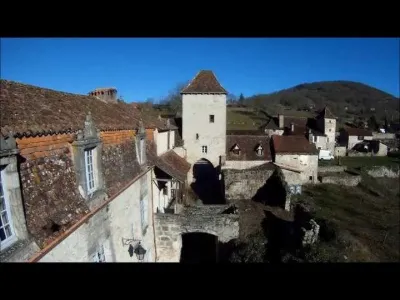
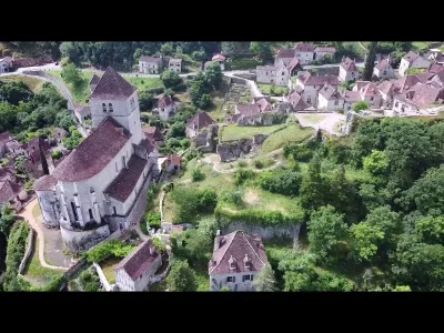
Stroll in the LOT with a XAIRCRAFT in X 650 full carbon XAIRCRAFT, mounted in slow fly, 5010 360kv engine, 16" carbon propeller, ESC 40a rct, naza v1 gps, GOPRO hd in 1080, with quite a lot of wind and a yello effect, problem coming surely from the low efficiency of the engines with unbalanced propellers!!!!!! next test in R3 hd in 720
Map and restricted areas
Open in the main mapNearby aerodromes
Open aerodromes within 25 km of the spot, heliports included, with their distance and direction from the spot. Near an aerodrome, drone flying is prohibited or height-limited: check the UAS zones map.
| Aerodrome | Type | Distance | Elevation | Difference |
|---|---|---|---|---|
| Aérodrome de Figeac - Livernon | Aerodrome | 19 km N | 331 m | spot 23 m higher |
| Cabrerets ULM | Aerodrome | 19 km W | 359 m | spot 5 m lower |
| Aérodrome de Villefranche de Rouergue | Aerodrome | 22 km SE | 334 m | spot 20 m higher |
Aviation weather (METAR and TAF)
No METAR station within 50 km.
Weather and Kp index
Sunrise and sunset
| Day | Dawn | Sunrise | Golden hour | Sunset | Dusk | Day length |
|---|---|---|---|---|---|---|
| Sat 21 Nov | 07:25 | 07:57 | 07:57–08:42 · 16:35–17:20 | 17:20 | 17:52 | 9 h 23 |
| Sun 22 Nov | 07:26 | 07:58 | 07:58–08:43 · 16:34–17:19 | 17:19 | 17:51 | 9 h 21 |
| Mon 23 Nov | 07:27 | 07:59 | 07:59–08:45 · 16:33–17:19 | 17:19 | 17:51 | 9 h 19 |
| Tue 24 Nov | 07:29 | 08:01 | 08:01–08:46 · 16:32–17:18 | 17:18 | 17:50 | 9 h 17 |
| Wed 25 Nov | 07:30 | 08:02 | 08:02–08:48 · 16:32–17:17 | 17:17 | 17:50 | 9 h 15 |
| Thu 26 Nov | 07:31 | 08:03 | 08:03–08:49 · 16:31–17:17 | 17:17 | 17:49 | 9 h 13 |
| Fri 27 Nov | 07:32 | 08:04 | 08:04–08:50 · 16:30–17:16 | 17:16 | 17:49 | 9 h 12 |


Reviews
Log in to review this spot. Log in · Create a free account
No reviews yet. Share yours!