

The Sardinian Way

No reviews yet
Have you flown here? Share your experience with other pilots.
+ Write the first reviewDescription
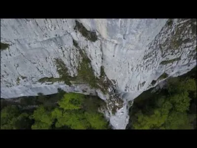
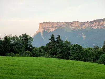
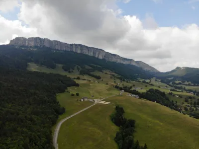
The Sardinian Way was a strategic and delicate passage between Lyon and Turin, before Napoleon I broke through the Echelles tunnel in 1804. Situated in the Chartreuse, the Sardinian route follows a natural passageway developed since antiquity and made passable by the Dukes of Savoy, it is halfway between Voiron, in Isère, and Chambéry, in Savoy.
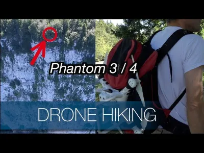
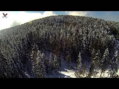
Aerial shots taken by a civilian drone pilot. Drones: DJI Inspire Pro and DJI phantom 3 Pro Ground camera: steadicam Ronin Mx Sony FDR AX100 4K
Soundtrack: Act Three by Audionautix is distributed under the license Creative Commons Attribution (https://creativecommons.org/licenses/by/4.0/) http://audionautix.com/
Video and editing: Paladrone https://www.facebook.com/paladrones
Map and restricted areas
Open in the main mapNearby aerodromes
Open aerodromes within 25 km of the spot, heliports included, with their distance and direction from the spot. Near an aerodrome, drone flying is prohibited or height-limited: check the UAS zones map.
| Aerodrome | Type | Distance | Elevation | Difference |
|---|---|---|---|---|
| St Jean D'avelanne Airfield | Aerodrome | 11 km NW | 294 m | spot 315 m higher |
| Centre Hospitalier Heliport | Heliport | 16 km NE | 319 m | spot 289 m higher |
| Aérodrome de Chambéry Challes-les-Eaux | Aerodrome | 19 km NE | 297 m | spot 312 m higher |
| Chambéry-Savoie Airport | Airport | 22 km N | 237 m | spot 371 m higher |
| Hôtel Le Château Heliport | Heliport | 25 km NW | 387 m | spot 221 m higher |
Aviation weather (METAR and TAF)
LFLB – Chambéry-Savoie Airport VFR
METAR
METAR LFLB 211130Z AUTO VRB03KT 9999 FEW017 13/09 Q1020 NOSIG
- Wind
- Variable, 6 km/h
- Visibility
- 10 km or more
- Clouds
- Few (1-2/8) at 1,700 ft (520 m)
- Temperature
- 13 °C, dew point 9 °C
- QNH
- 1020 hPa
- Flight category
- VFR: ceiling > 3,000 ft and visibility > 5 mi
TAF
TAF LFLB 210800Z 2109/2209 VRB03KT 9999 SCT050 BECMG 2122/2124 RA BKN050 TEMPO 2203/2209 3000 RA SCT012 BKN020 SCT040TCU BECMG 2205/2207 20010KT
| Period (local time) | Change | Wind | Visibility | Weather | Clouds |
|---|---|---|---|---|---|
| 21/11 10:00 → 21/11 23:00 | Initial conditions | Variable, 6 km/h | 10 km or more | Scattered (3-4/8) at 5,000 ft (1520 m) | |
| 21/11 23:00 → 22/11 06:00 | Becoming | Variable, 6 km/h | 10 km or more | Rain | Broken (5-7/8) at 5,000 ft (1520 m) |
| 22/11 04:00 → 22/11 10:00 | Temporarily | 3.0 km | Rain | Scattered (3-4/8) at 1,200 ft (370 m) ; Broken (5-7/8) at 2,000 ft (610 m) ; Scattered (3-4/8) at 4,000 ft (1220 m) (towering cumulus) | |
| 22/11 06:00 → 22/11 10:00 | Becoming | 200°, 19 km/h | 10 km or more | Rain | Broken (5-7/8) at 5,000 ft (1520 m) |
Weather and Kp index
Sunrise and sunset
| Day | Dawn | Sunrise | Golden hour | Sunset | Dusk | Day length |
|---|---|---|---|---|---|---|
| Sat 21 Nov | 07:11 | 07:44 | 07:44–08:30 · 16:15–17:02 | 17:02 | 17:34 | 9 h 17 |
| Sun 22 Nov | 07:13 | 07:45 | 07:45–08:32 · 16:14–17:01 | 17:01 | 17:33 | 9 h 15 |
| Mon 23 Nov | 07:14 | 07:46 | 07:46–08:33 · 16:13–17:00 | 17:00 | 17:33 | 9 h 13 |
| Tue 24 Nov | 07:15 | 07:48 | 07:48–08:35 · 16:13–16:59 | 16:59 | 17:32 | 9 h 11 |
| Wed 25 Nov | 07:16 | 07:49 | 07:49–08:36 · 16:12–16:59 | 16:59 | 17:31 | 9 h 09 |
| Thu 26 Nov | 07:17 | 07:50 | 07:50–08:37 · 16:11–16:58 | 16:58 | 17:31 | 9 h 07 |
| Fri 27 Nov | 07:18 | 07:51 | 07:51–08:39 · 16:10–16:57 | 16:57 | 17:30 | 9 h 05 |

Reviews
Log in to review this spot. Log in · Create a free account
No reviews yet. Share yours!