

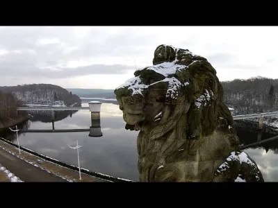
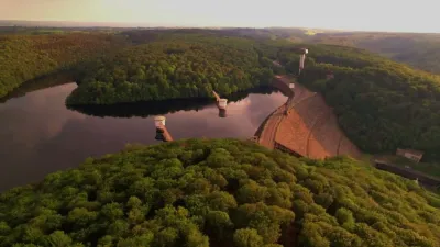
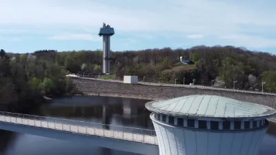
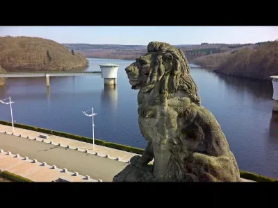
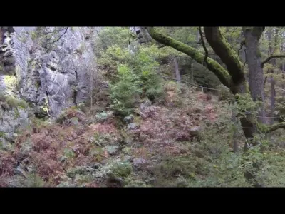
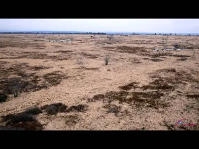
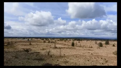
Drone footage of Barrage de la Gileppe, Gileppe Dam, Music: "A Solitary Life" by Artefact
No reviews yet
Have you flown here? Share your experience with other pilots.
+ Write the first reviewDescription
Wikipedia: The Gileppe Dam (French Barrage de la Gileppe) is an arch-gravity dam on the Gileppe river in Jalhay, Liège province, Wallonia, Belgium. It was built in the 1870s to supply water for the wool industry in nearby Verviers. The monumental structure with its unusually thick profile played an important role in establishing an international standard for masonry gravity dams as a technology for major water supply systems. It was considered one of the strongest dams in Europe at the time, and it was the first dam built in modern Belgium. In the first decade of the 21st century, it was noted as supplying most of the drinking water for Verviers, as well as industrial water, and as producing hydroelectricity.
Map and restricted areas
Open in the main mapAviation weather (METAR and TAF)
EBLG – Liège Airport VFR
METAR
METAR EBLG 210720Z 16007KT 9999 FEW043 01/00 Q1019 NOSIG
- Wind
- 160°, 13 km/h
- Visibility
- 10 km or more
- Clouds
- Few (1-2/8) at 4,300 ft (1310 m)
- Temperature
- 1 °C, dew point 0 °C
- QNH
- 1019 hPa
- Flight category
- VFR: ceiling > 3,000 ft and visibility > 5 mi
TAF
TAF EBLG 210500Z 2106/2212 20005KT 9999 FEW040 PROB30 2106/2108 2000 BR BKN003 PROB30 2204/2207 4000 BR
| Period (local time) | Change | Wind | Visibility | Weather | Clouds |
|---|---|---|---|---|---|
| 21/11 07:00 → 22/11 13:00 | Initial conditions | 200°, 9 km/h | 10 km or more | Few (1-2/8) at 4,000 ft (1220 m) | |
| 21/11 07:00 → 21/11 09:00 | probability 30% | 2.0 km | Mist | Broken (5-7/8) at 300 ft (90 m) | |
| 22/11 05:00 → 22/11 08:00 | probability 30% | 4.0 km | Mist |
Weather and Kp index
| Day | Weather | Temp. min. / max. | Wind | Rain | Max Kp |
|---|---|---|---|---|---|
| Sat 21 Nov | Clear sky | -0° / 6° | 13 km/h SW | – | 2 |
| Sun 22 Nov | Partly cloudy | -2° / 5° | 17 km/h E | – | 2 |
| Mon 23 Nov | Clear sky | -4° / 2° | 14 km/h NE | – | 4 |
| Tue 24 Nov | Clear sky | -4° / 4° | 12 km/h SE | – | 2 |
| Wed 25 Nov | Partly cloudy | -2° / 2° | 21 km/h E | – | – |
| Thu 26 Nov | Clear sky | -4° / 1° | 17 km/h E | – | – |
| Fri 27 Nov | Fair | -2° / 2° | 15 km/h S | – | – |
Hour by hour: Saturday 21 November
| Time | Weather | Temp. | Wind | Rain | Clouds | Kp |
|---|---|---|---|---|---|---|
| 08:00 | Fair | -0° | 12 km/h SW | – | 13 % | 2 |
| 09:00 | Clear sky | 1° | 12 km/h SW | – | 6 % | 2 |
| 10:00 | Clear sky | 3° | 13 km/h SW | – | 1 % | 2 |
| 11:00 | Clear sky | 4° | 12 km/h SW | – | 0 % | 2 |
| 12:00 | Clear sky | 5° | 12 km/h SW | – | 0 % | 2 |
| 13:00 | Clear sky | 6° | 12 km/h SW | – | 0 % | 1 |
| 14:00 | Clear sky | 6° | 10 km/h SW | – | 1 % | 1 |
| 15:00 | Clear sky | 6° | 9 km/h W | – | 1 % | 1 |
| 16:00 | Clear sky | 4° | 4 km/h SW | – | 5 % | 2 |
| 17:00 | Clear sky | 2° | 4 km/h SW | – | 0 % | 2 |
| 18:00 | Clear sky | 2° | 4 km/h S | – | 0 % | 2 |
| 19:00 | Clear sky | 1° | 5 km/h SE | – | 0 % | 2 |
| 20:00 | Clear sky | -0° | 7 km/h SE | – | 0 % | 2 |
| 21:00 | Clear sky | -0° | 10 km/h SE | – | 0 % | 2 |
| 22:00 | Clear sky | -0° | 11 km/h SE | – | 0 % | 2 |
Hour by hour: Sunday 22 November
| Time | Weather | Temp. | Wind | Rain | Clouds | Kp |
|---|---|---|---|---|---|---|
| 06:00 | Partly cloudy | 0° | 13 km/h E | – | 100 % | 2 |
| 07:00 | Partly cloudy | 1° | 15 km/h E | – | 100 % | 2 |
| 08:00 | Partly cloudy | 1° | 15 km/h E | – | 100 % | 2 |
| 09:00 | Partly cloudy | 2° | 15 km/h E | – | 100 % | 2 |
| 10:00 | Partly cloudy | 3° | 17 km/h E | – | 100 % | 2 |
| 11:00 | Partly cloudy | 4° | 15 km/h E | – | 100 % | 2 |
| 12:00 | Partly cloudy | 4° | 15 km/h E | – | 100 % | 2 |
| 13:00 | Partly cloudy | 5° | 14 km/h E | – | 100 % | 2 |
| 14:00 | Partly cloudy | 5° | 15 km/h E | – | 100 % | 2 |
| 15:00 | Partly cloudy | 4° | 15 km/h E | – | 100 % | 2 |
| 16:00 | Partly cloudy | 3° | 14 km/h E | – | 100 % | 2 |
| 17:00 | Cloudy | 1° | 14 km/h NE | – | 99 % | 2 |
| 18:00 | Cloudy | 1° | 14 km/h E | – | 100 % | 2 |
| 19:00 | Partly cloudy | 1° | 14 km/h E | – | 87 % | 2 |
| 20:00 | Partly cloudy | 0° | 11 km/h NE | – | 77 % | 2 |
| 21:00 | Cloudy | -0° | 10 km/h NE | – | 97 % | 2 |
| 22:00 | Fog | 0° | 11 km/h NE | – | 100 % | 2 |
Sunrise and sunset
| Day | Dawn | Sunrise | Golden hour | Sunset | Dusk | Day length |
|---|---|---|---|---|---|---|
| Sat 21 Nov | 07:24 | 08:01 | 08:01–08:54 · 15:49–16:43 | 16:43 | 17:20 | 8 h 42 |
| Sun 22 Nov | 07:25 | 08:02 | 08:02–08:56 · 15:48–16:42 | 16:42 | 17:19 | 8 h 40 |
| Mon 23 Nov | 07:27 | 08:04 | 08:04–08:58 · 15:47–16:41 | 16:41 | 17:18 | 8 h 37 |
| Tue 24 Nov | 07:28 | 08:05 | 08:05–09:00 · 15:46–16:40 | 16:40 | 17:17 | 8 h 35 |
| Wed 25 Nov | 07:30 | 08:07 | 08:07–09:02 · 15:44–16:39 | 16:39 | 17:17 | 8 h 32 |
| Thu 26 Nov | 07:31 | 08:08 | 08:08–09:03 · 15:43–16:39 | 16:39 | 17:16 | 8 h 30 |
| Fri 27 Nov | 07:32 | 08:10 | 08:10–09:05 · 15:42–16:38 | 16:38 | 17:15 | 8 h 28 |
Reviews
Log in to review this spot. Log in · Create a free account
No reviews yet. Share yours!