

Ormont Rock
No reviews yet
Have you flown here? Share your experience with other pilots.
+ Write the first reviewDescription
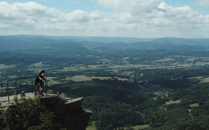
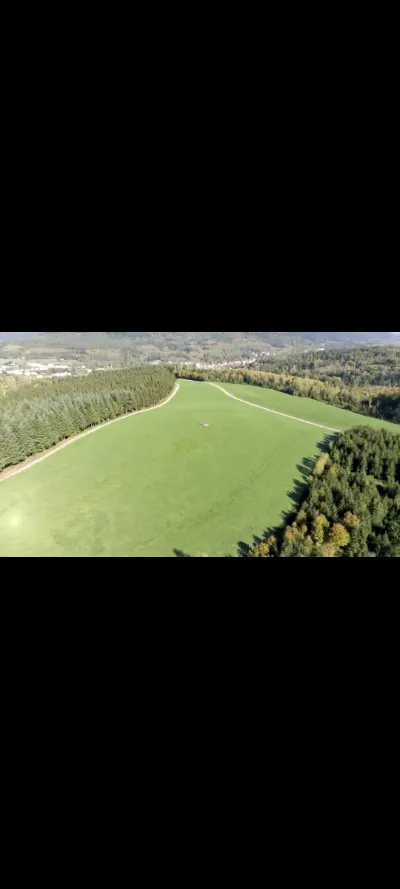
The place: A magnificent rock at an altitude of 850m with an exceptional panoramic view that is well worth the trip. It is possible to start from Naymont les fosses - de Charémont or Neuvillers sur Fave on foot in an ascent of 1h to 2h (which I recommend; there is indeed a way to vary the route via multiple forest paths). The access is also very good by car to the first "point de chute" at about 800m of altitude where you can leave your car and at this point you are only a 10 to 15min walk to reach the site.
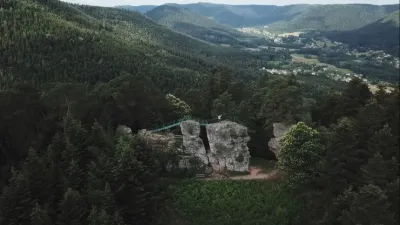
Pilot side: The takeoff is a bit sporty; it's hard to find 1m² of flat ground without trees nearby; however I took off my MavicPro on the granite "roof" of what acts as a fire cavern and there it goes very well. I doubt, however, that the drone will be able to land automatically on this site. In which case you can go up 20m by continuing the path from the rock, and from there you will have a good flat spot sheltered from the wind to take off serenely; but you will not have any more visual on your drone (area surrounded by very high trees). The wind can blow very strong up there (strong slope effect even in the absence of wind in the plain coming from west to east) and the area is covered with fir trees; in other words it is impossible to land safely other than on the take-off site or in your hand (possibly on the road below). Make sure you can bring the drone home safely before you commit to this flight.
The panorama is superb, you can observe the shadows of the clouds on the plains below and the contrasts are often playful. The classic photo of the whole hiking team on La Roche is great! You can also integrate this spot during a hike in the area.
The site is not very busy despite its relative ease of access; you can nevertheless already find small groups of walkers on La Roche on fine summer days; be a little patient to enjoy this site alone ;)
Map and restricted areas
Open in the main mapNearby aerodromes
Open aerodromes within 25 km of the spot, heliports included, with their distance and direction from the spot. Near an aerodrome, drone flying is prohibited or height-limited: check the UAS zones map.
| Aerodrome | Type | Distance | Elevation | Difference |
|---|---|---|---|---|
| Aérodrome de Saint-Dié - Remomeix | Aerodrome | 4.5 km S | 361 m | spot 430 m higher |
| Aérodrome d'Albé - Val de Villé | Aerodrome | 23 km E | 380 m | spot 411 m higher |
Aviation weather (METAR and TAF)
LFGA – Colmar-Houssen Airport VFR
METAR
METAR LFGA 210630Z AUTO VRB02KT 9999 SCT029 BKN034 BKN041 06/05 Q1019
- Wind
- Variable, 4 km/h
- Visibility
- 10 km or more
- Clouds
- Scattered (3-4/8) at 2,900 ft (880 m) ; Broken (5-7/8) at 3,400 ft (1040 m) ; Broken (5-7/8) at 4,100 ft (1250 m)
- Temperature
- 6 °C, dew point 5 °C
- QNH
- 1019 hPa
- Flight category
- VFR: ceiling > 3,000 ft and visibility > 5 mi
TAF
Weather and Kp index
Sunrise and sunset
| Day | Dawn | Sunrise | Golden hour | Sunset | Dusk | Day length |
|---|---|---|---|---|---|---|
| Sat 21 Nov | 07:13 | 07:48 | 07:48–08:38 · 15:57–16:47 | 16:47 | 17:22 | 8 h 59 |
| Sun 22 Nov | 07:15 | 07:50 | 07:50–08:40 · 15:56–16:46 | 16:46 | 17:21 | 8 h 56 |
| Mon 23 Nov | 07:16 | 07:51 | 07:51–08:42 · 15:55–16:46 | 16:46 | 17:20 | 8 h 54 |
| Tue 24 Nov | 07:17 | 07:52 | 07:52–08:43 · 15:54–16:45 | 16:45 | 17:20 | 8 h 52 |
| Wed 25 Nov | 07:19 | 07:54 | 07:54–08:45 · 15:53–16:44 | 16:44 | 17:19 | 8 h 50 |
| Thu 26 Nov | 07:20 | 07:55 | 07:55–08:46 · 15:52–16:43 | 16:43 | 17:18 | 8 h 48 |
| Fri 27 Nov | 07:21 | 07:57 | 07:57–08:48 · 15:51–16:42 | 16:42 | 17:18 | 8 h 45 |
Reviews
Log in to review this spot. Log in · Create a free account
No reviews yet. Share yours!