

Lake Roselend and its chapel
1 pilot review
“Attention de ne pas voler directement sur le Barrage, il y a des panneaux drones interdit,…” — savoienumerique, 6 years ago
Read the reviews + Write my reviewDescription
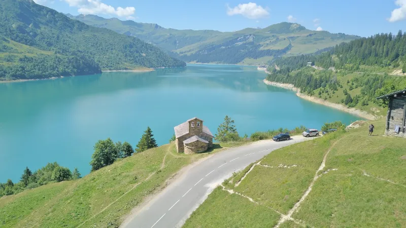
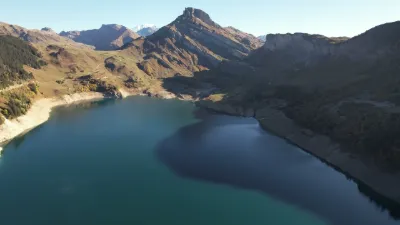
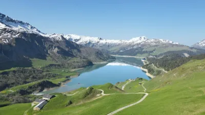
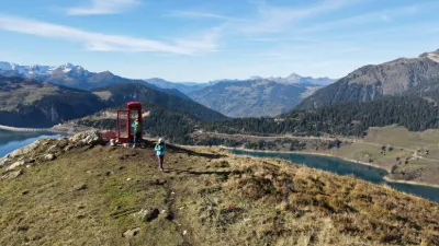
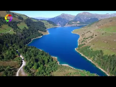
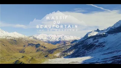
Spot that allows you to film the lake of Roselend and its chapel (which has been rebuilt because the village was submerged under the waters of the dam). Be careful not to fly too close to the chapel. Park near the chapel and go down a little lower on the flat to be more quiet. I chose to put this spot because the dam itself is unfortunately forbidden to fly over.
Map and restricted areas
Open in the main mapNearby aerodromes
Open aerodromes within 25 km of the spot, heliports included, with their distance and direction from the spot. Near an aerodrome, drone flying is prohibited or height-limited: check the UAS zones map.
| Aerodrome | Type | Distance | Elevation | Difference |
|---|---|---|---|---|
| Altiport de Vaugellaz | Aerodrome | 11 km SE | 2,020 m | spot 419 m lower |
| Megève Altiport | Aerodrome | 14 km N | 1,470 m | spot 131 m higher |
| Mont Blanc Hélicoptères | Heliport | 20 km SE | 2,031 m | spot 430 m lower |
| Crs Alpes Heliport | Heliport | 22 km W | 330 m | spot 1,271 m higher |
| Centre Hospitalier Heliport | Heliport | 22 km W | 335 m | spot 1,266 m higher |
Aviation weather (METAR and TAF)
LFLP – Annecy-Haute-Savoie-Mont Blanc Airport VFR
METAR
METAR LFLP 211130Z AUTO VRB01KT 9999 FEW052 12/07 Q1020 NOSIG
- Wind
- Variable, 2 km/h
- Visibility
- 10 km or more
- Clouds
- Few (1-2/8) at 5,200 ft (1580 m)
- Temperature
- 12 °C, dew point 7 °C
- QNH
- 1020 hPa
- Flight category
- VFR: ceiling > 3,000 ft and visibility > 5 mi
TAF
TAF LFLP 210800Z 2109/2209 VRB03KT 9999 SCT040 BECMG 2122/2124 RA BKN040 TEMPO 2200/2209 4000 RA SCT030TCU PROB40 TEMPO 2203/2209 2000 BKN012
| Period (local time) | Change | Wind | Visibility | Weather | Clouds |
|---|---|---|---|---|---|
| 21/11 10:00 → 21/11 23:00 | Initial conditions | Variable, 6 km/h | 10 km or more | Scattered (3-4/8) at 4,000 ft (1220 m) | |
| 21/11 23:00 → 22/11 10:00 | Becoming | Variable, 6 km/h | 10 km or more | Rain | Broken (5-7/8) at 4,000 ft (1220 m) |
| 22/11 01:00 → 22/11 10:00 | Temporarily | 4.0 km | Rain | Scattered (3-4/8) at 3,000 ft (910 m) (towering cumulus) | |
| 22/11 04:00 → 22/11 10:00 | Temporarily, probability 40% | 2.0 km | Broken (5-7/8) at 1,200 ft (370 m) |
Weather and Kp index
Sunrise and sunset
| Day | Dawn | Sunrise | Golden hour | Sunset | Dusk | Day length |
|---|---|---|---|---|---|---|
| Sat 21 Nov | 07:08 | 07:41 | 07:41–08:28 · 16:11–16:57 | 16:57 | 17:30 | 9 h 16 |
| Sun 22 Nov | 07:10 | 07:42 | 07:42–08:29 · 16:10–16:57 | 16:57 | 17:29 | 9 h 14 |
| Mon 23 Nov | 07:11 | 07:44 | 07:44–08:31 · 16:09–16:56 | 16:56 | 17:29 | 9 h 12 |
| Tue 24 Nov | 07:12 | 07:45 | 07:45–08:32 · 16:08–16:55 | 16:55 | 17:28 | 9 h 10 |
| Wed 25 Nov | 07:13 | 07:46 | 07:46–08:34 · 16:07–16:54 | 16:54 | 17:27 | 9 h 08 |
| Thu 26 Nov | 07:15 | 07:48 | 07:48–08:35 · 16:06–16:54 | 16:54 | 17:27 | 9 h 06 |
| Fri 27 Nov | 07:16 | 07:49 | 07:49–08:37 · 16:06–16:53 | 16:53 | 17:26 | 9 h 04 |
Reviews
Log in to review this spot. Log in · Create a free account
savoienumerique
Attention de ne pas voler directement sur le Barrage, il y a des panneaux drones interdit, mais pas signalé sur aucune application, (géoportail ou autre). Au col du pré tout proche, j'ai eu droit à la visite des gendarmes (pas de soucis, j'étais en règle) mais ils m'ont dit qu'ils étaient très régulièrement appelés par l'opérateur de vidéosurveillance situé à Lyon. Même restriction pour les barrages voisins qui font partis du même ensemble (girotte, gittaz)