

Seine-Port (77)
2 pilot reviews
“Bonjour Evil Dad, En fait c'est la mauvaise localisation de ton spot (épave) qui m'a fait…” — Eddy, 7 years ago
Read the reviews + Write my reviewDescription
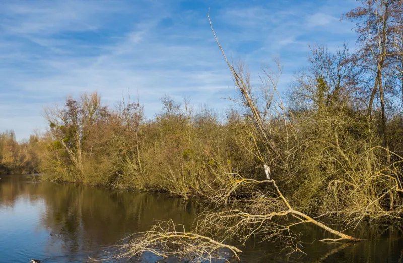
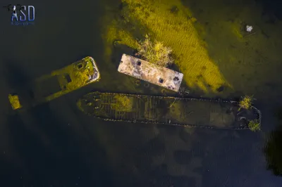
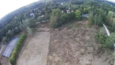
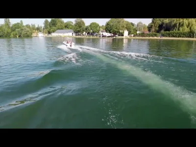
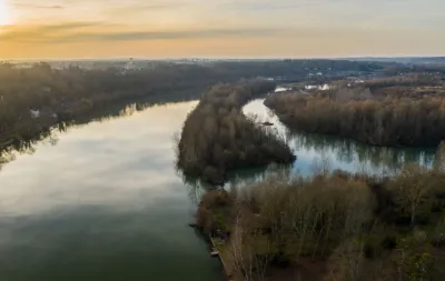
It's a good half-hour walk, but it's worth it. Natural spot, water bodies lined with trees so rather "wild" where one can have the chance to find heron swans, ducks and other water hens. Currently, in February 2019, an area on the edge of the ponds, protected and fenced gives the gite to beautiful "long-haired cows ..." sorry I'm not a specialist but they are splendid and are happy to be approached at the edge of the fence photograph lol. Clear areas allow safe take-offs and landings provided that you pay attention to the walkers who are numerous enough. This point located between two ponds offers the possibility to see a barge wreck (already identified on the site). From there, the flight over the Seine gives a view of barges and other boats ... A good breath of air, a good ride for a good flight.
Map and restricted areas
Open in the main mapNearby aerodromes
Open aerodromes within 25 km of the spot, heliports included, with their distance and direction from the spot. Near an aerodrome, drone flying is prohibited or height-limited: check the UAS zones map.
| Aerodrome | Type | Distance | Elevation | Difference |
|---|---|---|---|---|
| Centre Hospitalier Heliport | Heliport | 6.1 km NW | 78 m | spot 41 m lower |
| Centre Hospitalier Sud Francilien Heliport | Heliport | 9.4 km NW | 78 m | spot 42 m lower |
| Melun-Villaroche Air Base | Airport | 12 km NE | 92 m | spot 56 m lower |
| Cerny-La Ferté Alais Airfield | Aerodrome | 16 km SW | 138 m | spot 102 m lower |
| Paris-Orly Airport | Major airport | 22 km NW | 89 m | spot 52 m lower |
Aviation weather (METAR and TAF)
LFPM – Melun-Villaroche Air Base IFR
METAR
METAR LFPM 211030Z AUTO 14003KT 100V200 9999 3000 OVC005 09/09 Q1019
- Wind
- 140°, 6 km/h
- Visibility
- 10 km or more
- Clouds
- Overcast (8/8) at 500 ft (150 m)
- Temperature
- 9 °C, dew point 9 °C
- QNH
- 1019 hPa
- Flight category
- IFR: ceiling 500–1,000 ft or visibility 1–3 mi
TAF
Weather and Kp index
Sunrise and sunset
| Day | Dawn | Sunrise | Golden hour | Sunset | Dusk | Day length |
|---|---|---|---|---|---|---|
| Sat 21 Nov | 07:32 | 08:07 | 08:07–08:57 · 16:14–17:04 | 17:04 | 17:39 | 8 h 57 |
| Sun 22 Nov | 07:33 | 08:08 | 08:08–08:59 · 16:13–17:04 | 17:04 | 17:39 | 8 h 55 |
| Mon 23 Nov | 07:35 | 08:10 | 08:10–09:01 · 16:12–17:03 | 17:03 | 17:38 | 8 h 52 |
| Tue 24 Nov | 07:36 | 08:11 | 08:11–09:02 · 16:11–17:02 | 17:02 | 17:37 | 8 h 50 |
| Wed 25 Nov | 07:37 | 08:13 | 08:13–09:04 · 16:10–17:01 | 17:01 | 17:36 | 8 h 48 |
| Thu 26 Nov | 07:39 | 08:14 | 08:14–09:06 · 16:09–17:00 | 17:00 | 17:36 | 8 h 46 |
| Fri 27 Nov | 07:40 | 08:15 | 08:15–09:07 · 16:08–17:00 | 17:00 | 17:35 | 8 h 44 |

Reviews
Log in to review this spot. Log in · Create a free account
Eddy
Bonjour Evil Dad, En fait c'est la mauvaise localisation de ton spot (épave) qui m'a fait me garer au Pont du Maréchal Juin car sur la carte c'est ce qui me paraissait le plus proche mais au final m'a pas mal rallonger. Le spot que j'ai publié qui est différent des deux tiens concerne l'étang le plus au nord... Bref, tu as raison, il y a possibilité de se garer plus prêt. J'ai vu ton épave et c'est effectivement un très beau site. Après visionnage de mes rushs, j'ai aussi découvert une autre épave sur cet étang juste au sud du quai recouvert de graffitis... Elle est moins visible et surement plus profonde et je ne l'ai pas vu sur le retour vidéo lors du vol.
Evil Dad
Bonjour Eddy. Je pense que tu as fait un détour si tu as 30mn de marche pour accéder à ce spot, si toutefois il est bien là où se trouve le repère. (Je dis ça car les deux spots que j'ai proposé sur le même étang sont décalés de plus de 500m sur le site) En fait, il est fort possible que ton spot soit le même que le mien ! En se débrouillant bien, on peut se garer à moins d'1km. SI tu as l'occasion, va voir l'épave au sud de l'étang, elle est magnifique ! A+