

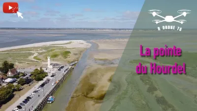
Baie de la Somme (Le Hourdel)
3 pilot reviews
“Une très bonne nouvelle pour le site.... Plusieurs photos pourront permettre de mieux illu…” — Eddy, 7 years ago
Read the reviews + Write my reviewDescription
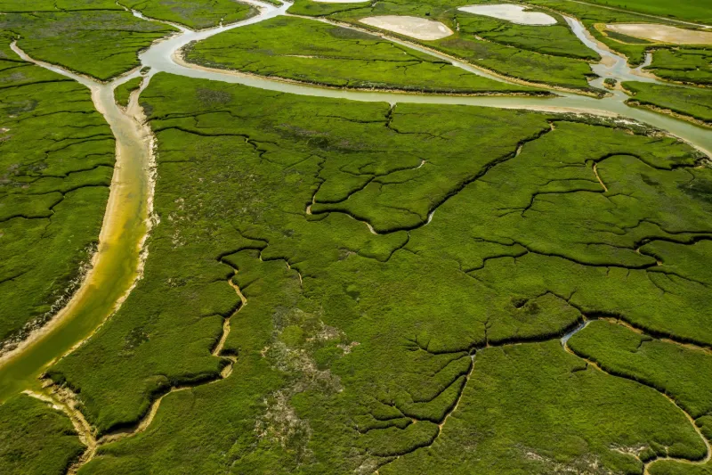
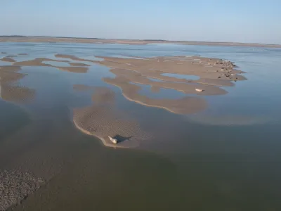
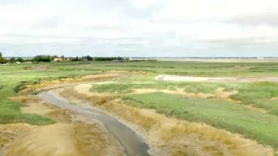
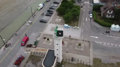
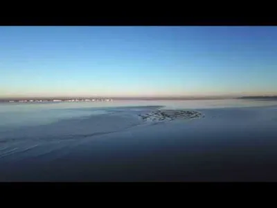
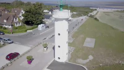
Stroll over the Bay of the Somme. At low tide, the landscapes left by the water flow and the canals thus dug are magnificent. If you are lucky, you may even see seals roaming the sandbanks. Don't get too close so as not to disturb them. Possible departure from the pointe du Hourdel but beware of a lot of people as soon as the weather is nice! Other accesses are therefore possible on foot. Good flights ;)
Map and restricted areas
Open in the main mapNearby aerodromes
Open aerodromes within 25 km of the spot, heliports included, with their distance and direction from the spot. Near an aerodrome, drone flying is prohibited or height-limited: check the UAS zones map.
| Aerodrome | Type | Distance | Elevation | Difference |
|---|---|---|---|---|
| Eu Mers Le Treport Airfield | Aerodrome | 18 km SW | 100 m | spot 95 m lower |
| Abbeville | Airport | 19 km E | 67 m | spot 62 m lower |
| Abbeville Medical Center Heliport | Heliport | 21 km SE | 25 m | spot 20 m lower |
| Centre Hospitalier Heliport | Heliport | 24 km N | 13 m | spot 8 m lower |
| Centre Hospitalier Heliport | Heliport | 24 km N | 46 m | spot 42 m lower |
Aviation weather (METAR and TAF)
LFAT – Le Touquet-Côte d'Opale Airport VFR
METAR
METAR LFAT 211230Z AUTO 13008KT CAVOK 10/05 Q1018 TEMPO OVC008
- Wind
- 130°, 15 km/h
- Visibility
- 10 km or more
- Clouds
- –
- Temperature
- 10 °C, dew point 5 °C
- QNH
- 1018 hPa
- Flight category
- VFR: ceiling > 3,000 ft and visibility > 5 mi
TAF
TAF LFAT 211100Z 2112/2121 12006KT 9999 BKN040 TEMPO 2112/2121 OVC008 PROB40 TEMPO 2115/2121 BKN004 PROB30 TEMPO 2115/2121 BKN002
| Period (local time) | Change | Wind | Visibility | Weather | Clouds |
|---|---|---|---|---|---|
| 21/11 13:00 → 21/11 22:00 | Initial conditions | 120°, 11 km/h | 10 km or more | Broken (5-7/8) at 4,000 ft (1220 m) | |
| 21/11 13:00 → 21/11 22:00 | Temporarily | Overcast (8/8) at 800 ft (240 m) | |||
| 21/11 16:00 → 21/11 22:00 | Temporarily, probability 40% | Broken (5-7/8) at 400 ft (120 m) | |||
| 21/11 16:00 → 21/11 22:00 | Temporarily, probability 30% | Broken (5-7/8) at 200 ft (60 m) |
Weather and Kp index
| Day | Weather | Temp. min. / max. | Wind | Rain | Max Kp |
|---|---|---|---|---|---|
| Sat 21 Nov | Fair | 8° / 10° | 19 km/h E | – | 2 |
| Sun 22 Nov | Cloudy | 5° / 8° | 28 km/h E | – | 2 |
| Mon 23 Nov | Partly cloudy | 1° / 5° | 23 km/h E | – | 4 |
| Tue 24 Nov | Clear sky | -0° / 4° | 22 km/h SE | – | 2 |
| Wed 25 Nov | Cloudy | 0° / 3° | 22 km/h E | – | – |
| Thu 26 Nov | Clear sky | -2° / 1° | 18 km/h E | – | – |
| Fri 27 Nov | Clear sky | -3° / 1° | 13 km/h SE | – | – |
Hour by hour: Saturday 21 November
| Time | Weather | Temp. | Wind | Rain | Clouds | Kp |
|---|---|---|---|---|---|---|
| 13:00 | Fair | 9° | 12 km/h SE | – | 36 % | 2 |
| 14:00 | Clear sky | 10° | 10 km/h SE | – | 4 % | 2 |
| 15:00 | Clear sky | 10° | 14 km/h SE | – | 1 % | 2 |
| 16:00 | Fair | 9° | 17 km/h SE | – | 30 % | 2 |
| 17:00 | Cloudy | 8° | 17 km/h SE | – | 94 % | 2 |
| 18:00 | Partly cloudy | 8° | 16 km/h SE | – | 61 % | 2 |
| 19:00 | Cloudy | 8° | 14 km/h SE | – | 87 % | 2 |
| 20:00 | Cloudy | 8° | 13 km/h SE | – | 99 % | 2 |
| 21:00 | Cloudy | 8° | 16 km/h E | – | 89 % | 2 |
| 22:00 | Cloudy | 8° | 17 km/h E | – | 98 % | 2 |
Hour by hour: Sunday 22 November
| Time | Weather | Temp. | Wind | Rain | Clouds | Kp |
|---|---|---|---|---|---|---|
| 06:00 | Cloudy | 7° | 26 km/h E | – | 100 % | 2 |
| 07:00 | Cloudy | 7° | 26 km/h E | – | 100 % | 2 |
| 08:00 | Cloudy | 7° | 27 km/h E | – | 100 % | 2 |
| 09:00 | Cloudy | 7° | 28 km/h E | – | 100 % | 2 |
| 10:00 | Cloudy | 7° | 28 km/h E | – | 100 % | 2 |
| 11:00 | Cloudy | 7° | 25 km/h E | – | 99 % | 2 |
| 12:00 | Cloudy | 8° | 23 km/h E | – | 100 % | 2 |
| 13:00 | Cloudy | 8° | 23 km/h E | – | 100 % | 2 |
| 14:00 | Cloudy | 8° | 23 km/h E | – | 100 % | 2 |
| 15:00 | Cloudy | 8° | 22 km/h E | – | 100 % | 2 |
| 16:00 | Cloudy | 8° | 22 km/h E | – | 100 % | 2 |
| 17:00 | Cloudy | 7° | 22 km/h E | – | 99 % | 2 |
| 18:00 | Cloudy | 6° | 21 km/h E | – | 100 % | 2 |
| 19:00 | Cloudy | 6° | 20 km/h E | – | 100 % | 2 |
| 20:00 | Cloudy | 6° | 23 km/h E | – | 100 % | 2 |
| 21:00 | Cloudy | 5° | 26 km/h E | – | 100 % | 2 |
| 22:00 | Cloudy | 5° | 26 km/h E | – | 100 % | 2 |
Sunrise and sunset
| Day | Dawn | Sunrise | Golden hour | Sunset | Dusk | Day length |
|---|---|---|---|---|---|---|
| Sat 21 Nov | 07:40 | 08:17 | 08:17–09:10 · 16:09–17:02 | 17:02 | 17:39 | 8 h 45 |
| Sun 22 Nov | 07:42 | 08:18 | 08:18–09:12 · 16:08–17:01 | 17:01 | 17:38 | 8 h 43 |
| Mon 23 Nov | 07:43 | 08:20 | 08:20–09:14 · 16:07–17:00 | 17:00 | 17:37 | 8 h 40 |
| Tue 24 Nov | 07:45 | 08:21 | 08:21–09:15 · 16:05–16:59 | 16:59 | 17:36 | 8 h 38 |
| Wed 25 Nov | 07:46 | 08:23 | 08:23–09:17 · 16:04–16:59 | 16:59 | 17:35 | 8 h 35 |
| Thu 26 Nov | 07:47 | 08:24 | 08:24–09:19 · 16:03–16:58 | 16:58 | 17:35 | 8 h 33 |
| Fri 27 Nov | 07:49 | 08:26 | 08:26–09:20 · 16:02–16:57 | 16:57 | 17:34 | 8 h 31 |
Reviews
Log in to review this spot. Log in · Create a free account
Eddy
Une très bonne nouvelle pour le site.... Plusieurs photos pourront permettre de mieux illustrer le spot sans pour autant nécessiter de vidéo qui prend plus de temps et de compétences à mettre en oeuvre ! Bravo pour cette évolution :)
ThoutmesIV
La semaine prochaine, le site Drone-Spot permettra d'ajouter plusieurs photos à un spot.
Eddy
Ci-joint un lien avec plus de photos https://www.facebook.com/permalink.php?story_fbid=368832350407972&id=308444426446765