

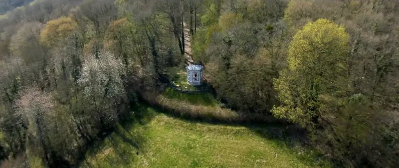
Kiosk Châtillon forest of Rosny-sur-Seine
1 pilot review
“Le spot a été restauré, très peu de passage, beaucoup d'arbre et pas bcp de passages possi…” — cyrilz94, 6 years ago
Read the reviews + Write my reviewDescription
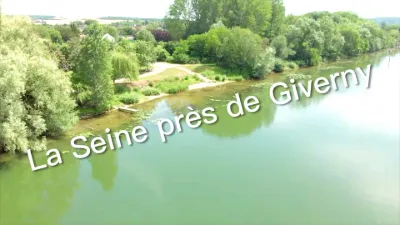
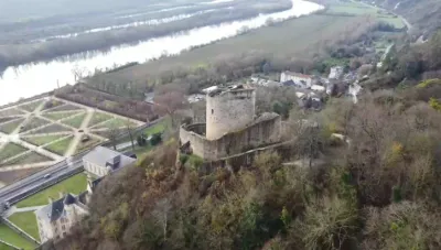
Lovers of nature and peace and quiet now have a unique place in the Paris region. The forest of Rosny-sur-Seine, near Mantes-la-Jolie, has just found its kiosk overlooking the Seine valley*. Set on a belvedere, at a height of about 100 metres, this magnificent little pavilion with its exceptional architecture has a special history.
A jewel of the 1900 World's Fair
Built at the very end of the 19th century from local wood, it first served as a reception desk for the 1900 Universal Exhibition in Paris. After a few weeks spent in the heart of the capital, the kiosk was then bought by a wealthy local owner who transformed it into a hunting lodge at the beginning of the 20th century. This large hut then became the "Belvédère de Châtillon" (Hauts-de-Seine). But this new life marked the beginning of his agony. Over time, the Italian buildings, framework and mosaics have deteriorated. He's even been the victim of vandals.
In 2009, the Ile-de-France Green Spaces Agency (AEV) decided to restore it. An architect was recruited for this mission and in 2013, the kiosk was dismantled and renovated. Eighteen months of meticulous construction work has preserved its exceptional character. "This kiosk is emblematic of the Art Nouveau era, a period when mosaicists arrived in Paris to offer their expertise," says Fabienne Scouflaire, mosaic restorer for the Socra company.
The work cost the AEV EUR 170 000. To protect this little gem, the agency decided to use a rather novel means by installing a video surveillance system in the forest, close to the premises.
* Access from the D 113, at the entrance of Rolleboise. Free parking.
Map and restricted areas
Open in the main mapNearby aerodromes
Open aerodromes within 25 km of the spot, heliports included, with their distance and direction from the spot. Near an aerodrome, drone flying is prohibited or height-limited: check the UAS zones map.
| Aerodrome | Type | Distance | Elevation | Difference |
|---|---|---|---|---|
| Centre Hospitalier F. Quesnay Heliport | Heliport | 4.8 km E | 28 m | spot 53 m higher |
| Mantes Chérence Airfield | Aerodrome | 9.5 km NE | 156 m | spot 75 m lower |
| Flins Heliport | Heliport | 19 km E | 25 m | spot 56 m higher |
| Base Paramoteurs d' Avernes | Aerodrome | 22 km NE | 139 m | spot 58 m lower |
| Les Mureaux Airfield | Aerodrome | 24 km E | 27 m | spot 54 m higher |
Aviation weather (METAR and TAF)
LFOE – Évreux-Fauville (BA 105) Air Base IFR
METAR
METAR LFOE 211130Z AUTO 18007KT 140V200 9999 OVC008 09/08 Q1018
- Wind
- 180°, 13 km/h
- Visibility
- 10 km or more
- Clouds
- Overcast (8/8) at 800 ft (240 m)
- Temperature
- 9 °C, dew point 8 °C
- QNH
- 1018 hPa
- Flight category
- IFR: ceiling 500–1,000 ft or visibility 1–3 mi
TAF
TAF AMD LFOE 211120Z 2111/2209 14004KT 9999 OVC008 BECMG 2113/2115 BKN015 BECMG 2123/2202 4000 RA BKN004
| Period (local time) | Change | Wind | Visibility | Weather | Clouds |
|---|---|---|---|---|---|
| 21/11 12:00 → 21/11 14:00 | Initial conditions | 140°, 7 km/h | 10 km or more | Overcast (8/8) at 800 ft (240 m) | |
| 21/11 14:00 → 22/11 00:00 | Becoming | 140°, 7 km/h | 10 km or more | Broken (5-7/8) at 1,500 ft (460 m) | |
| 22/11 00:00 → 22/11 10:00 | Becoming | 140°, 7 km/h | 4.0 km | Rain | Broken (5-7/8) at 400 ft (120 m) |
Weather and Kp index
Sunrise and sunset
| Day | Dawn | Sunrise | Golden hour | Sunset | Dusk | Day length |
|---|---|---|---|---|---|---|
| Sat 21 Nov | 07:37 | 08:12 | 08:12–09:03 · 16:15–17:07 | 17:07 | 17:42 | 8 h 54 |
| Sun 22 Nov | 07:38 | 08:14 | 08:14–09:05 · 16:14–17:06 | 17:06 | 17:41 | 8 h 51 |
| Mon 23 Nov | 07:40 | 08:15 | 08:15–09:07 · 16:13–17:05 | 17:05 | 17:40 | 8 h 49 |
| Tue 24 Nov | 07:41 | 08:17 | 08:17–09:09 · 16:12–17:04 | 17:04 | 17:39 | 8 h 47 |
| Wed 25 Nov | 07:42 | 08:18 | 08:18–09:10 · 16:11–17:03 | 17:03 | 17:39 | 8 h 44 |
| Thu 26 Nov | 07:44 | 08:19 | 08:19–09:12 · 16:10–17:02 | 17:02 | 17:38 | 8 h 42 |
| Fri 27 Nov | 07:45 | 08:21 | 08:21–09:13 · 16:09–17:01 | 17:01 | 17:37 | 8 h 40 |
Reviews
Log in to review this spot. Log in · Create a free account
cyrilz94
Le spot a été restauré, très peu de passage, beaucoup d'arbre et pas bcp de passages possibles