

Lake Jouarres
No reviews yet
Have you flown here? Share your experience with other pilots.
+ Write the first reviewDescription
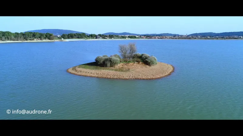
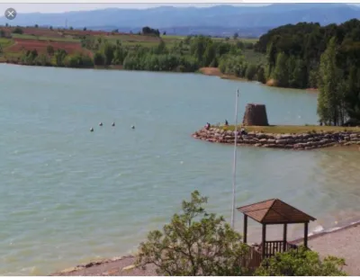
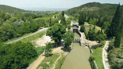
Situated between Carcassonne and Narbonne, 10 km from the city of Minerve and only 2 km from the Canal du Midi, the lake of Jouarres is ideal, especially on windy days on the coast. The sun heats up the Minervois and its vineyards for a good part of the year, to the delight of visitors and winegrowers of this southern terroir. A cool break becomes a luxury when the thermometer rises above 30 degrees. After a stroll to discover the heritage (Minerve, Homps, Maison des Vins) or a beautiful bike ride along the Canal du Midi, what could be more appreciated than a swim? On 110 hectares, the lake will offer you superb horizons of pine forests and hills, and the leisure to bathe in complete tranquility. Its grass or pebble beaches, in the shade of a pine forest, with lifeguards, are an invitation to rest and relaxation. Swimming is supervised in July and August. You can enjoy the place in complete safety and tranquillity. The children will be able to spend a relaxing moment with the inflatable water games (in season) and to let off steam on the pontoons with refreshing dives. Rest and relaxation guaranteed on the grassy beach with shaded areas and gravel (shoes suitable for swimming should be provided). The lake can be the ideal place for a lunch break thanks to the facilities: barbecue and picnic area. Fishing enthusiasts will not be outdone in a quiet setting with a superb view of the Minervois and its hills. The more sporty will have the opportunity to go hiking or jogging in a superb setting with the 5 km tour of the lake.
Map and restricted areas
Open in the main mapNearby aerodromes
Open aerodromes within 25 km of the spot, heliports included, with their distance and direction from the spot. Near an aerodrome, drone flying is prohibited or height-limited: check the UAS zones map.
| Aerodrome | Type | Distance | Elevation | Difference |
|---|---|---|---|---|
| Lézignan-Corbières Airfield | Aerodrome | 11 km S | 63 m | spot 7 m lower |
Aviation weather (METAR and TAF)
LFMK – Carcassonne Airport VFR
METAR
METAR LFMK 210630Z AUTO 00000KT CAVOK 07/06 Q1020 NOSIG
- Wind
- Calm
- Visibility
- 10 km or more
- Clouds
- –
- Temperature
- 7 °C, dew point 6 °C
- QNH
- 1020 hPa
- Flight category
- VFR: ceiling > 3,000 ft and visibility > 5 mi
TAF
TAF LFMK 210200Z 2103/2203 VRB03KT CAVOK BECMG 2112/2114 09012KT BKN025 PROB40 TEMPO 2113/2119 09015G25KT
| Period (local time) | Change | Wind | Visibility | Weather | Clouds |
|---|---|---|---|---|---|
| 21/11 04:00 → 21/11 13:00 | Initial conditions | Variable, 6 km/h | 10 km or more | No significant weather | No significant cloud |
| 21/11 13:00 → 22/11 04:00 | Becoming | 090°, 22 km/h | 10 km or more | No significant weather | Broken (5-7/8) at 2,500 ft (760 m) |
| 21/11 14:00 → 21/11 20:00 | Temporarily, probability 40% | 090°, 28 km/h, gusts 46 km/h |
Weather and Kp index
Sunrise and sunset
| Day | Dawn | Sunrise | Golden hour | Sunset | Dusk | Day length |
|---|---|---|---|---|---|---|
| Sat 21 Nov | 07:19 | 07:50 | 07:50–08:34 · 16:36–17:20 | 17:20 | 17:51 | 9 h 30 |
| Sun 22 Nov | 07:20 | 07:51 | 07:51–08:35 · 16:36–17:20 | 17:20 | 17:51 | 9 h 28 |
| Mon 23 Nov | 07:21 | 07:52 | 07:52–08:36 · 16:35–17:19 | 17:19 | 17:50 | 9 h 26 |
| Tue 24 Nov | 07:22 | 07:53 | 07:53–08:38 · 16:34–17:18 | 17:18 | 17:50 | 9 h 24 |
| Wed 25 Nov | 07:23 | 07:55 | 07:55–08:39 · 16:33–17:18 | 17:18 | 17:49 | 9 h 23 |
| Thu 26 Nov | 07:24 | 07:56 | 07:56–08:40 · 16:32–17:17 | 17:17 | 17:49 | 9 h 21 |
| Fri 27 Nov | 07:25 | 07:57 | 07:57–08:42 · 16:32–17:17 | 17:17 | 17:48 | 9 h 19 |

Reviews
Log in to review this spot. Log in · Create a free account
No reviews yet. Share yours!