

Mountain
Leyssard
3 pilot reviews
“Depuis le déco de parapente” — Maurtycia, 5 years ago
Read the reviews + Write my reviewDescription
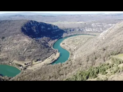
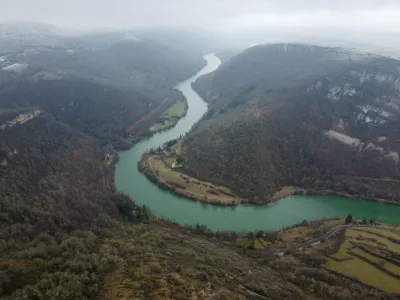
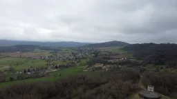
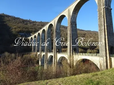
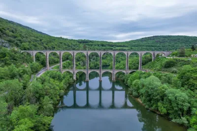
Canyon seen from above
Map and restricted areas
Open in the main mapNearby aerodromes
Open aerodromes within 25 km of the spot, heliports included, with their distance and direction from the spot. Near an aerodrome, drone flying is prohibited or height-limited: check the UAS zones map.
| Aerodrome | Type | Distance | Elevation | Difference |
|---|---|---|---|---|
| Bourg-Ceyzériat Airport | Aerodrome | 14 km W | 261 m | spot 352 m higher |
| Corlier Altiport | Aerodrome | 15 km S | 842 m | spot 229 m lower |
| La Tranclière Private Airstrip | Aerodrome | 17 km SW | 250 m | spot 363 m higher |
| Aérodrome d'Oyonnax-Arbent | Aerodrome | 19 km NE | 535 m | spot 78 m higher |
| Ambérieu Air Base (BA 278) | Airport | 23 km SW | 251 m | spot 362 m higher |
Aviation weather (METAR and TAF)
No METAR station within 50 km.
Weather and Kp index
Sunrise and sunset
| Day | Dawn | Sunrise | Golden hour | Sunset | Dusk | Day length |
|---|---|---|---|---|---|---|
| Sat 21 Nov | 07:14 | 07:47 | 07:47–08:34 · 16:13–17:01 | 17:01 | 17:34 | 9 h 13 |
| Sun 22 Nov | 07:16 | 07:49 | 07:49–08:36 · 16:12–17:00 | 17:00 | 17:33 | 9 h 11 |
| Mon 23 Nov | 07:17 | 07:50 | 07:50–08:38 · 16:11–16:59 | 16:59 | 17:32 | 9 h 09 |
| Tue 24 Nov | 07:18 | 07:51 | 07:51–08:39 · 16:11–16:58 | 16:58 | 17:32 | 9 h 06 |
| Wed 25 Nov | 07:19 | 07:53 | 07:53–08:41 · 16:10–16:58 | 16:58 | 17:31 | 9 h 04 |
| Thu 26 Nov | 07:20 | 07:54 | 07:54–08:42 · 16:09–16:57 | 16:57 | 17:30 | 9 h 03 |
| Fri 27 Nov | 07:22 | 07:55 | 07:55–08:43 · 16:08–16:56 | 16:56 | 17:30 | 9 h 01 |
Reviews
Log in to review this spot. Log in · Create a free account
Maurtycia
Depuis le déco de parapente
Fox7614
Merci de l'info ... A l'occasion, car j'ai fait voler mon drone à cet endroit sur le chemin des sports d'hiver !
Maurtycia
Depuis le mont Balvay on dispose de beaucoup plus de points de vue, c'est une petite rando qui vaut le coup ;-) Je n'ai pas encore voler là bas mais pour m'être souvent rendu là bas avant l'achat de mon drone il fait parti de mes sites à faire.