

Algrange - Limestone orchid lawns
No reviews yet
Have you flown here? Share your experience with other pilots.
+ Write the first reviewDescription
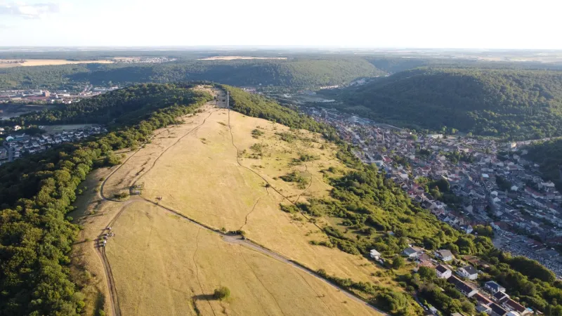
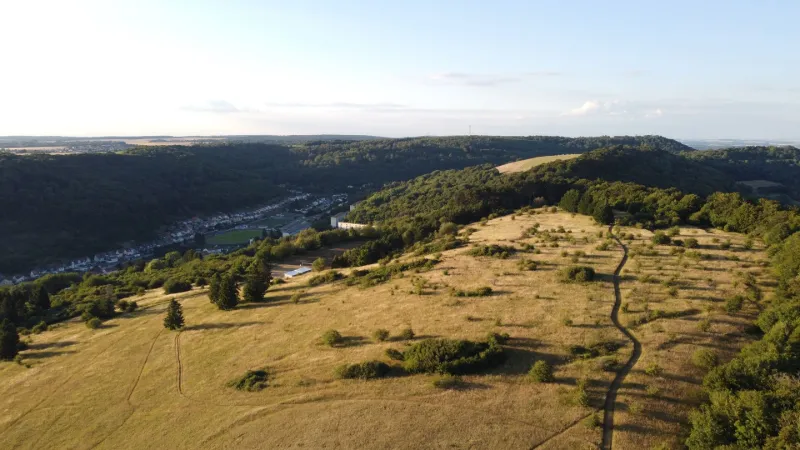
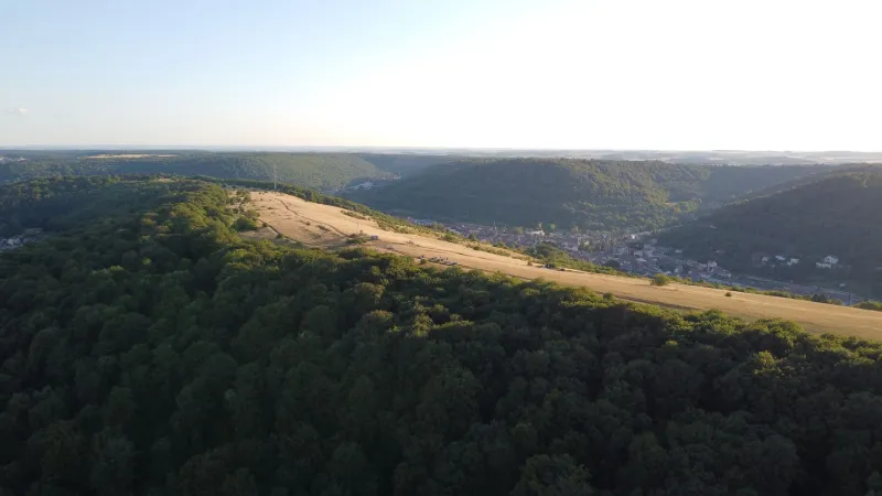
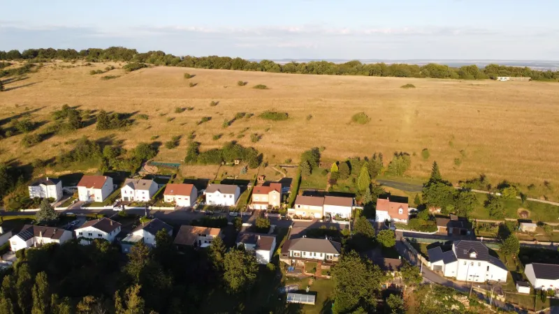
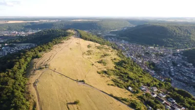
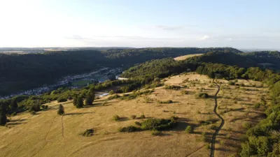
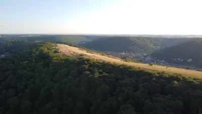
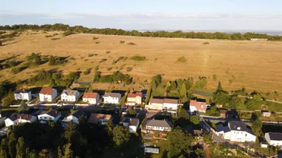
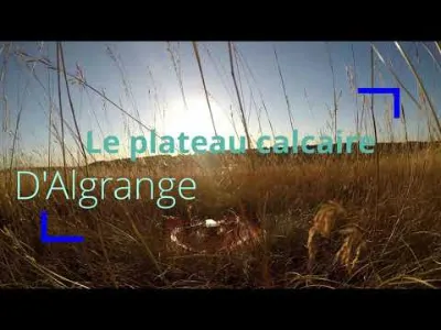
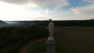
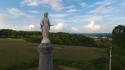
Flying site located on a ridge separating Algrange from Beuvange and vast limestone lawns sheltering orchids visible from April to June for the most part. At the top, the Witten plateau has a short and well-maintained concrete runway belonging to the Algrange Model Club, an aeromodelling club.
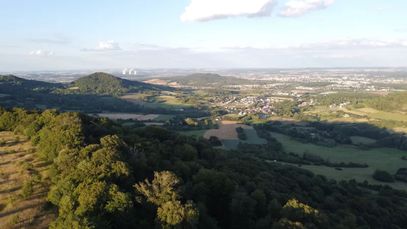
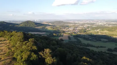
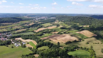
From this spot, you will have a clear view of the working valleys of the iron mines and the beginning of the high country. As the lawns are mostly exposed to the west, the flying area is particularly impressive at sunset.
Attention, the maximum flight altitude is limited to 100 m, a take-off area for ULMs and paramotors is located to the west on the plateau. Also take care not to fly too low, as the lawns are inhabited by ground nesting birds that should not be disturbed. These species are being eliminated by mowers in the fields and have only a few stable living areas left, of which these lawns are a part.
In spite of several antennas located at the very South of the spot, no interference was observed on the evening of the flight.
Have a good flight!
Map and restricted areas
Open in the main mapNearby aerodromes
Open aerodromes within 25 km of the spot, heliports included, with their distance and direction from the spot. Near an aerodrome, drone flying is prohibited or height-limited: check the UAS zones map.
| Aerodrome | Type | Distance | Elevation | Difference |
|---|---|---|---|---|
| Villerupt Aerodrome | Aerodrome | 13 km NW | 396 m | spot 17 m lower |
| Centre Hospitalier Emile Mayrisch Heliport | Heliport | 16 km N | 296 m | spot 83 m higher |
Aviation weather (METAR and TAF)
ELLX – Luxembourg-Findel International Airport VFR
METAR
METAR ELLX 210950Z 16003KT 090V210 CAVOK 04/02 Q1019 NOSIG
- Wind
- 160°, 6 km/h
- Visibility
- 10 km or more
- Clouds
- –
- Temperature
- 4 °C, dew point 2 °C
- QNH
- 1019 hPa
- Flight category
- VFR: ceiling > 3,000 ft and visibility > 5 mi
TAF
TAF ELLX 210500Z 2106/2212 20005KT 9999 FEW045
| Period (local time) | Change | Wind | Visibility | Weather | Clouds |
|---|---|---|---|---|---|
| 21/11 07:00 → 22/11 13:00 | Initial conditions | 200°, 9 km/h | 10 km or more | Few (1-2/8) at 4,500 ft (1370 m) |
Weather and Kp index
| Day | Weather | Temp. min. / max. | Wind | Rain | Max Kp |
|---|---|---|---|---|---|
| Sat 21 Nov | Clear sky | 3° / 8° | 6 km/h NE | – | 2 |
| Sun 22 Nov | Cloudy | 0° / 6° | 16 km/h E | – | 2 |
| Mon 23 Nov | Fair | -3° / 2° | 16 km/h NE | – | 4 |
| Tue 24 Nov | Clear sky | -4° / 3° | 13 km/h E | – | 2 |
| Wed 25 Nov | Cloudy | -3° / 1° | 14 km/h NE | – | – |
| Thu 26 Nov | Fair | -3° / 1° | 13 km/h NE | – | – |
| Fri 27 Nov | Cloudy | -1° / 2° | 5 km/h SW | – | – |
Hour by hour: Saturday 21 November
| Time | Weather | Temp. | Wind | Rain | Clouds | Kp |
|---|---|---|---|---|---|---|
| 11:00 | Clear sky | 5° | 3 km/h SE | – | 6 % | 2 |
| 12:00 | Clear sky | 6° | 3 km/h SE | – | 0 % | 2 |
| 13:00 | Clear sky | 7° | 3 km/h SE | – | 0 % | 1 |
| 14:00 | Clear sky | 8° | 4 km/h SE | – | 12 % | 1 |
| 15:00 | Clear sky | 7° | 5 km/h SE | – | 10 % | 1 |
| 16:00 | Fair | 6° | 4 km/h SE | – | 17 % | 2 |
| 17:00 | Clear sky | 4° | 5 km/h E | – | 9 % | 2 |
| 18:00 | Clear sky | 4° | 5 km/h E | – | 10 % | 2 |
| 19:00 | Fair | 3° | 6 km/h SE | – | 18 % | 2 |
| 20:00 | Partly cloudy | 3° | 5 km/h SE | – | 66 % | 2 |
| 21:00 | Cloudy | 3° | 6 km/h E | – | 100 % | 2 |
| 22:00 | Cloudy | 4° | 6 km/h NE | – | 100 % | 2 |
Hour by hour: Sunday 22 November
| Time | Weather | Temp. | Wind | Rain | Clouds | Kp |
|---|---|---|---|---|---|---|
| 06:00 | Cloudy | 2° | 13 km/h NE | – | 100 % | 2 |
| 07:00 | Cloudy | 2° | 14 km/h E | – | 100 % | 2 |
| 08:00 | Cloudy | 2° | 15 km/h NE | – | 100 % | 2 |
| 09:00 | Cloudy | 3° | 16 km/h E | – | 100 % | 2 |
| 10:00 | Cloudy | 4° | 12 km/h NE | – | 100 % | 2 |
| 11:00 | Cloudy | 5° | 13 km/h NE | – | 100 % | 2 |
| 12:00 | Cloudy | 5° | 14 km/h E | – | 100 % | 2 |
| 13:00 | Cloudy | 5° | 12 km/h E | – | 100 % | 2 |
| 14:00 | Cloudy | 6° | 13 km/h E | – | 100 % | 2 |
| 15:00 | Cloudy | 6° | 14 km/h E | – | 100 % | 2 |
| 16:00 | Cloudy | 5° | 13 km/h NE | – | 100 % | 2 |
| 17:00 | Cloudy | 4° | 12 km/h NE | – | 100 % | 2 |
| 18:00 | Cloudy | 4° | 12 km/h NE | – | 100 % | 2 |
| 19:00 | Cloudy | 3° | 13 km/h NE | – | 100 % | 2 |
| 20:00 | Partly cloudy | 2° | 14 km/h NE | – | 99 % | 2 |
| 21:00 | Partly cloudy | 1° | 13 km/h N | – | 100 % | 2 |
| 22:00 | Partly cloudy | 1° | 13 km/h N | – | 87 % | 2 |
Sunrise and sunset
| Day | Dawn | Sunrise | Golden hour | Sunset | Dusk | Day length |
|---|---|---|---|---|---|---|
| Sat 21 Nov | 07:20 | 07:56 | 07:56–08:47 · 15:56–16:48 | 16:48 | 17:23 | 8 h 51 |
| Sun 22 Nov | 07:22 | 07:57 | 07:57–08:49 · 15:55–16:47 | 16:47 | 17:22 | 8 h 49 |
| Mon 23 Nov | 07:23 | 07:59 | 07:59–08:51 · 15:53–16:46 | 16:46 | 17:21 | 8 h 46 |
| Tue 24 Nov | 07:24 | 08:00 | 08:00–08:53 · 15:52–16:45 | 16:45 | 17:21 | 8 h 44 |
| Wed 25 Nov | 07:26 | 08:02 | 08:02–08:54 · 15:51–16:44 | 16:44 | 17:20 | 8 h 42 |
| Thu 26 Nov | 07:27 | 08:03 | 08:03–08:56 · 15:50–16:43 | 16:43 | 17:19 | 8 h 40 |
| Fri 27 Nov | 07:28 | 08:04 | 08:04–08:58 · 15:49–16:42 | 16:42 | 17:19 | 8 h 37 |


Reviews
Log in to review this spot. Log in · Create a free account
No reviews yet. Share yours!