

Water
Champs
1 pilot review
“Salut, Coin sympa, directement accessible en voiture (tout le matos à proximité). Pas gran…” — Boblelezard, 5 years ago
Read the reviews + Write my reviewDescription
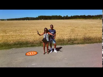
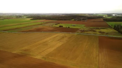
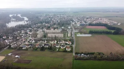
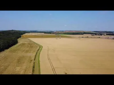
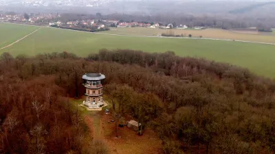
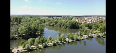
Spot in Essonne to fly his drone near Paris in Ile de France.
Map and restricted areas
Open in the main mapNearby aerodromes
Open aerodromes within 25 km of the spot, heliports included, with their distance and direction from the spot. Near an aerodrome, drone flying is prohibited or height-limited: check the UAS zones map.
| Aerodrome | Type | Distance | Elevation | Difference |
|---|---|---|---|---|
| Centre Hospitalier Heliport | Heliport | 7.8 km NE | 78 m | spot 9 m lower |
| Centre Hospitalier Sud Francilien Heliport | Heliport | 8.0 km NE | 78 m | spot 9 m lower |
| Cerny-La Ferté Alais Airfield | Aerodrome | 8.4 km SW | 138 m | spot 69 m lower |
| Paris-Orly Airport | Major airport | 17 km N | 89 m | spot 20 m lower |
| Base ULM de Genevrelle à Maisse | Aerodrome | 20 km S | 128 m | spot 59 m lower |
Aviation weather (METAR and TAF)
LFPO – Paris-Orly Airport IFR
METAR
METAR LFPO 211030Z VRB03KT 3000 -DZ OVC005 10/09 Q1019 BECMG 9999 NSW
- Wind
- Variable, 6 km/h
- Visibility
- 3.0 km
- Weather
- Drizzle light
- Clouds
- Overcast (8/8) at 500 ft (150 m)
- Temperature
- 10 °C, dew point 9 °C
- QNH
- 1019 hPa
- Flight category
- IFR: ceiling 500–1,000 ft or visibility 1–3 mi
TAF
TAF AMD LFPO 211014Z 2110/2212 17003KT 9999 BKN006 OVC016 PROB40 TEMPO 2110/2112 4000 -DZ BKN004 BECMG 2112/2114 BKN016 BECMG 2206/2208 4000 -RA TEMPO 2209/2212 BKN008
| Period (local time) | Change | Wind | Visibility | Weather | Clouds |
|---|---|---|---|---|---|
| 21/11 11:00 → 21/11 13:00 | Initial conditions | 170°, 6 km/h | 10 km or more | Broken (5-7/8) at 600 ft (180 m) ; Overcast (8/8) at 1,600 ft (490 m) | |
| 21/11 11:00 → 21/11 13:00 | Temporarily, probability 40% | 4.0 km | Drizzle light | Broken (5-7/8) at 400 ft (120 m) | |
| 21/11 13:00 → 22/11 07:00 | Becoming | 170°, 6 km/h | 10 km or more | Broken (5-7/8) at 1,600 ft (490 m) | |
| 22/11 07:00 → 22/11 13:00 | Becoming | 170°, 6 km/h | 4.0 km | Rain light | Broken (5-7/8) at 1,600 ft (490 m) |
| 22/11 10:00 → 22/11 13:00 | Temporarily | Broken (5-7/8) at 800 ft (240 m) |
Weather and Kp index
Sunrise and sunset
| Day | Dawn | Sunrise | Golden hour | Sunset | Dusk | Day length |
|---|---|---|---|---|---|---|
| Sat 21 Nov | 07:33 | 08:08 | 08:08–08:58 · 16:15–17:05 | 17:05 | 17:40 | 8 h 57 |
| Sun 22 Nov | 07:34 | 08:09 | 08:09–09:00 · 16:13–17:04 | 17:04 | 17:39 | 8 h 55 |
| Mon 23 Nov | 07:35 | 08:10 | 08:10–09:01 · 16:12–17:03 | 17:03 | 17:38 | 8 h 52 |
| Tue 24 Nov | 07:37 | 08:12 | 08:12–09:03 · 16:11–17:02 | 17:02 | 17:38 | 8 h 50 |
| Wed 25 Nov | 07:38 | 08:13 | 08:13–09:05 · 16:10–17:02 | 17:02 | 17:37 | 8 h 48 |
| Thu 26 Nov | 07:39 | 08:15 | 08:15–09:06 · 16:09–17:01 | 17:01 | 17:36 | 8 h 46 |
| Fri 27 Nov | 07:41 | 08:16 | 08:16–09:08 · 16:08–17:00 | 17:00 | 17:36 | 8 h 44 |

Reviews
Log in to review this spot. Log in · Create a free account
Boblelezard
Salut, Coin sympa, directement accessible en voiture (tout le matos à proximité). Pas grand chose a y voir, mais excellent spot pour des tests :) Bons vols