

Heritage
Hollogne sur Geer (province of Liege Belgium)
3 pilot reviews
“Merci pour votre retour, j’ignorais l’interdiction de vol au dessus des étangs, mais c’est…” — Former member, 4 years ago
Read the reviews + Write my reviewDescription
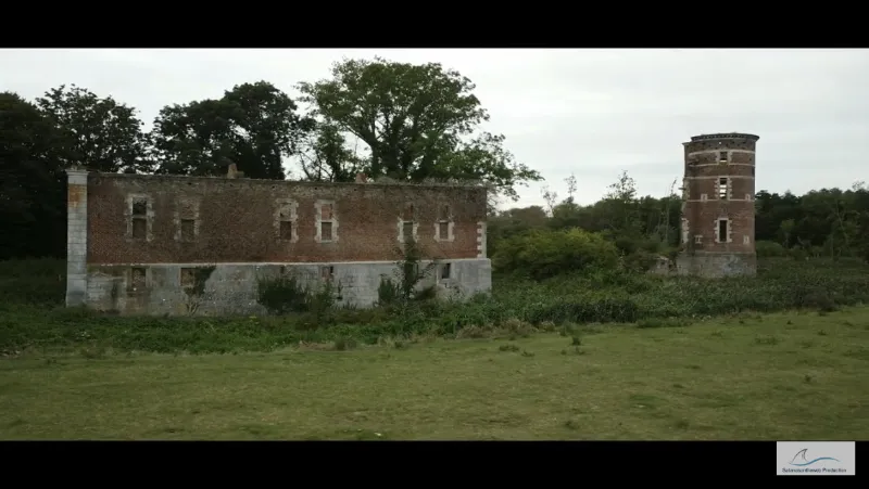
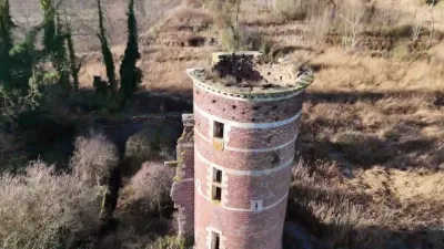
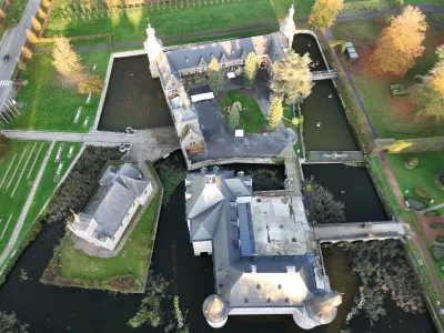
Close to the nature reserve of Hollogne sur Geer, the ruins of this castle are easily accessible. Surrounded by bucolic meadows, this site is in the middle of nature and allows you to legally
Map and restricted areas
Open in the main mapAviation weather (METAR and TAF)
EBLG – Liège Airport VFR
METAR
METAR EBLG 210720Z 16007KT 9999 FEW043 01/00 Q1019 NOSIG
- Wind
- 160°, 13 km/h
- Visibility
- 10 km or more
- Clouds
- Few (1-2/8) at 4,300 ft (1310 m)
- Temperature
- 1 °C, dew point 0 °C
- QNH
- 1019 hPa
- Flight category
- VFR: ceiling > 3,000 ft and visibility > 5 mi
TAF
TAF EBLG 210500Z 2106/2212 20005KT 9999 FEW040 PROB30 2106/2108 2000 BR BKN003 PROB30 2204/2207 4000 BR
| Period (local time) | Change | Wind | Visibility | Weather | Clouds |
|---|---|---|---|---|---|
| 21/11 07:00 → 22/11 13:00 | Initial conditions | 200°, 9 km/h | 10 km or more | Few (1-2/8) at 4,000 ft (1220 m) | |
| 21/11 07:00 → 21/11 09:00 | probability 30% | 2.0 km | Mist | Broken (5-7/8) at 300 ft (90 m) | |
| 22/11 05:00 → 22/11 08:00 | probability 30% | 4.0 km | Mist |
Weather and Kp index
Sunrise and sunset
| Day | Dawn | Sunrise | Golden hour | Sunset | Dusk | Day length |
|---|---|---|---|---|---|---|
| Sat 21 Nov | 07:27 | 08:04 | 08:04–08:58 · 15:52–16:46 | 16:46 | 17:23 | 8 h 42 |
| Sun 22 Nov | 07:29 | 08:06 | 08:06–09:00 · 15:51–16:45 | 16:45 | 17:22 | 8 h 39 |
| Mon 23 Nov | 07:30 | 08:07 | 08:07–09:02 · 15:49–16:44 | 16:44 | 17:21 | 8 h 36 |
| Tue 24 Nov | 07:31 | 08:09 | 08:09–09:04 · 15:48–16:43 | 16:43 | 17:20 | 8 h 34 |
| Wed 25 Nov | 07:33 | 08:10 | 08:10–09:05 · 15:47–16:42 | 16:42 | 17:19 | 8 h 31 |
| Thu 26 Nov | 07:34 | 08:12 | 08:12–09:07 · 15:46–16:41 | 16:41 | 17:19 | 8 h 29 |
| Fri 27 Nov | 07:36 | 08:13 | 08:13–09:09 · 15:45–16:40 | 16:40 | 17:18 | 8 h 27 |

Reviews
Log in to review this spot. Log in · Create a free account
Former member
Merci pour votre retour, j’ignorais l’interdiction de vol au dessus des étangs, mais c’est normal, c’est une réserve naturelle
Flyontheweb
Merci pour votre retour, j’ignorais l’interdiction de vol au dessus des étangs, mais c’est normal, c’est une réserve naturelle
pili-pili
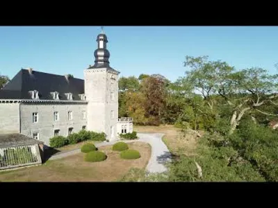
Superbe spot... Cela aurait été génial de pouvoir survoler le site. Malheureusement, il y a un panneau sur le sol : propriété privée. Quand vous êtes face au château, à 50 mètres d'une réserve naturelle, pictogramme, survol interdit. On se contentera de vos superbes prises de vues. Merci à vous.