

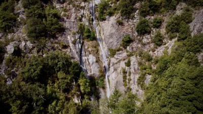
The pozzines of Val d'Eze.
No reviews yet
Have you flown here? Share your experience with other pilots.
+ Write the first reviewDescription
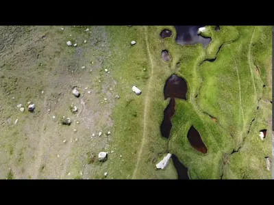
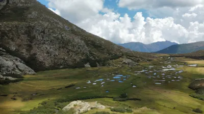
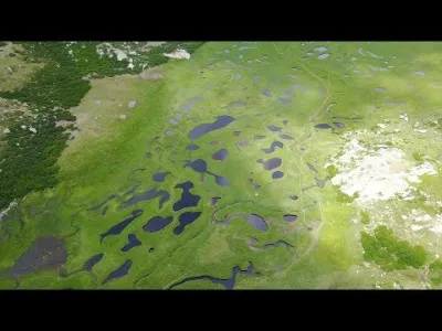
If there is one place you shouldn't miss when visiting Corse-du-Sud, it's the Pozzines of Bastelica. As a simple lover of pretty Corsican landscapes, the name may not mean much to you. Pozzines are actually grassy meadows crossed by streams and dotted with small ponds. They are also called pozzi when the ponds are a bit bigger. Either way, it's an extraordinary landscape!
The pozzines are located in the heart of the mountains. To get to Bastelica, the easiest way is to start from Ajaccio. You'll be there after about 40 kilometers. Then you'll need to get to the Val d'Ese resort.
Once you arrive at the resort, you'll have to park your car, put on good hiking shoes, grab a windbreaker and a backpack, and start the climb! The round trip, depending on the walk you choose, is estimated at 4 to 5 hours of walking. The hike is perfectly doable with the family. You'll cross the Ese plateau, go through forests and sometimes a bit of rocky ground, but it's well worth the effort!
Map and restricted areas
Open in the main mapNearby aerodromes
Open aerodromes within 25 km of the spot, heliports included, with their distance and direction from the spot. Near an aerodrome, drone flying is prohibited or height-limited: check the UAS zones map.
| Aerodrome | Type | Distance | Elevation | Difference |
|---|---|---|---|---|
| Aérodrome de Ghisonaccia - Alzitone | Aerodrome | 22 km E | 54 m | spot 1,731 m higher |
| Base ULM d'Aghione Casone | Aerodrome | 24 km E | 51 m | spot 1,734 m higher |
Aviation weather (METAR and TAF)
LFKS – Solenzara (BA 126) Air Base VFR
METAR
METAR LFKS 211030Z AUTO 28006KT 220V350 CAVOK 20/02 Q1017
- Wind
- 280°, 11 km/h
- Visibility
- 10 km or more
- Clouds
- –
- Temperature
- 20 °C, dew point 2 °C
- QNH
- 1017 hPa
- Flight category
- VFR: ceiling > 3,000 ft and visibility > 5 mi
TAF
Weather and Kp index
Sunrise and sunset
| Day | Dawn | Sunrise | Golden hour | Sunset | Dusk | Day length |
|---|---|---|---|---|---|---|
| Sat 21 Nov | 06:50 | 07:21 | 07:21–08:03 · 16:15–16:58 | 16:58 | 17:28 | 9 h 37 |
| Sun 22 Nov | 06:51 | 07:22 | 07:22–08:05 · 16:14–16:57 | 16:57 | 17:28 | 9 h 35 |
| Mon 23 Nov | 06:52 | 07:23 | 07:23–08:06 · 16:14–16:57 | 16:57 | 17:27 | 9 h 33 |
| Tue 24 Nov | 06:54 | 07:24 | 07:24–08:07 · 16:13–16:56 | 16:56 | 17:27 | 9 h 31 |
| Wed 25 Nov | 06:55 | 07:25 | 07:25–08:09 · 16:12–16:56 | 16:56 | 17:26 | 9 h 30 |
| Thu 26 Nov | 06:56 | 07:26 | 07:26–08:10 · 16:12–16:55 | 16:55 | 17:26 | 9 h 28 |
| Fri 27 Nov | 06:57 | 07:28 | 07:28–08:11 · 16:11–16:55 | 16:55 | 17:25 | 9 h 27 |


Reviews
Log in to review this spot. Log in · Create a free account
No reviews yet. Share yours!