

Ennery / Hauconcourt - Barbier bridge over the Moselle

No reviews yet
Have you flown here? Share your experience with other pilots.
+ Write the first reviewDescription
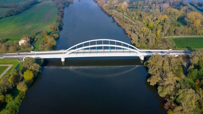
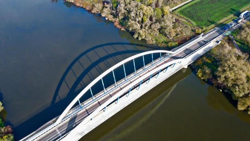
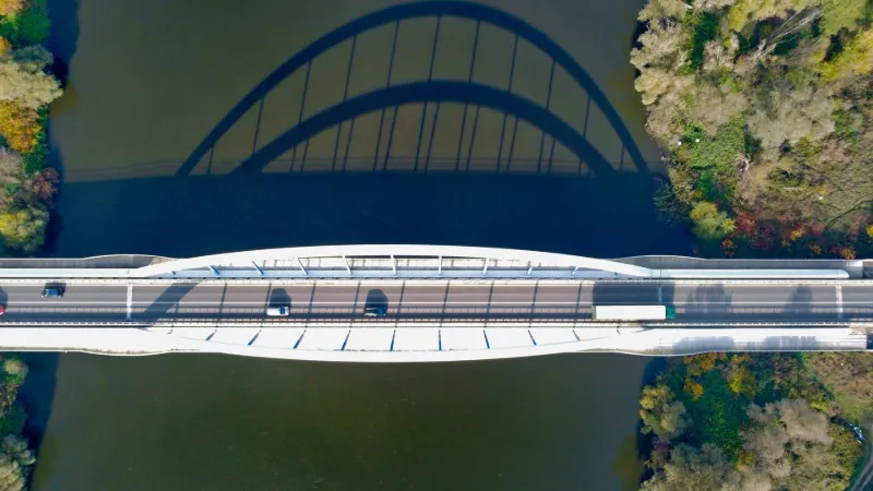
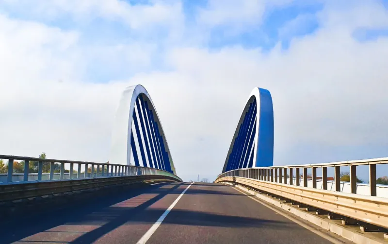
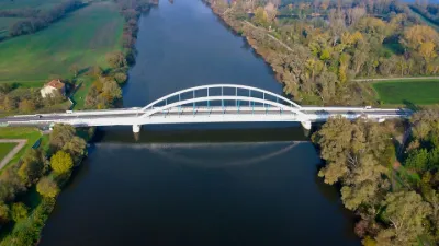
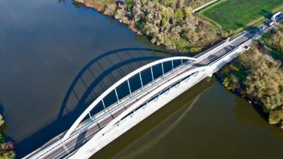
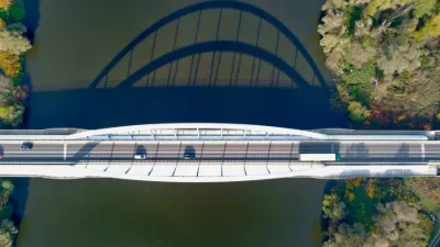
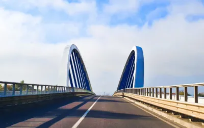
Discover a rather special kind of engineering structure here: the Laurent Barbier bridge, a "bow string" type, or tied-arch bridge with hangers. Its unique look makes it especially graphic. Two offset arches support the 108 m deck spanning the Moselle between the towns of Hauconcourt and Ennery, while two secondary decks of 34 m each, resting on piers in the riverbed, complete the link between the two banks.
The 1,605-tonne steel structure replaces the Rapilly bridge, built between 1949 and 1952 and demolished in 2012 after structural weaknesses were discovered that required its replacement. That bridge had itself replaced a structure built under German annexation at the end of the 19th century and destroyed in 1940.
The new bridge made it possible to widen the traffic lanes and add pedestrian and bike lanes on both sides. It sits amid the former gravel pits along the Moselle riverbed, which have become fishing ponds.
Built between 2012 and 2014 at a cost of 13.5 million euros, the structure bears the name of its architect, Laurent Barbier, who sadly passed away in February 2014, before his work was even inaugurated in May.
The takeoff area is on the right bank, a little downstream, on the old towpath. Flight altitude is limited to 150 m. The flight area is fairly small above the Moselle and within a 500 m radius, before reaching the first inhabited areas. Of course, it is forbidden to fly over the farms and the building marking the site of the pre-1800 river ferry crossing, located on the left bank right next to the bridge. Be careful: a lot of interference was noticed on the day of the flight, perhaps caused by the metal mass of the bridge?!?
Happy flying!
https://youtu.be/rE5BlwbXRsY
Map and restricted areas
Open in the main mapNearby aerodromes
Open aerodromes within 25 km of the spot, heliports included, with their distance and direction from the spot. Near an aerodrome, drone flying is prohibited or height-limited: check the UAS zones map.
| Aerodrome | Type | Distance | Elevation | Difference |
|---|---|---|---|---|
| Technopole 2000 Heliport | Heliport | 15 km S | 220 m | spot 60 m lower |
| Doncourt Les Conflans Airfield | Aerodrome | 21 km SW | 245 m | spot 84 m lower |
Aviation weather (METAR and TAF)
LFJL – Metz-Nancy-Lorraine Airport VFR
METAR
METAR LFJL 210930Z AUTO VRB02KT CAVOK 07/04 Q1020 TEMPO BKN006
- Wind
- Variable, 4 km/h
- Visibility
- 10 km or more
- Clouds
- –
- Temperature
- 7 °C, dew point 4 °C
- QNH
- 1020 hPa
- Flight category
- VFR: ceiling > 3,000 ft and visibility > 5 mi
TAF
TAF LFJL 210500Z 2106/2206 05003KT CAVOK PROB30 TEMPO 2106/2112 BKN006 PROB30 TEMPO 2200/2206 4000 BR
| Period (local time) | Change | Wind | Visibility | Weather | Clouds |
|---|---|---|---|---|---|
| 21/11 07:00 → 22/11 07:00 | Initial conditions | 050°, 6 km/h | 10 km or more | No significant weather | No significant cloud |
| 21/11 07:00 → 21/11 13:00 | Temporarily, probability 30% | Broken (5-7/8) at 600 ft (180 m) | |||
| 22/11 01:00 → 22/11 07:00 | Temporarily, probability 30% | 4.0 km | Mist |
Weather and Kp index
Sunrise and sunset
| Day | Dawn | Sunrise | Golden hour | Sunset | Dusk | Day length |
|---|---|---|---|---|---|---|
| Sat 21 Nov | 07:19 | 07:55 | 07:55–08:46 · 15:56–16:47 | 16:47 | 17:23 | 8 h 52 |
| Sun 22 Nov | 07:21 | 07:56 | 07:56–08:48 · 15:55–16:47 | 16:47 | 17:22 | 8 h 50 |
| Mon 23 Nov | 07:22 | 07:58 | 07:58–08:50 · 15:54–16:46 | 16:46 | 17:21 | 8 h 47 |
| Tue 24 Nov | 07:23 | 07:59 | 07:59–08:51 · 15:52–16:45 | 16:45 | 17:20 | 8 h 45 |
| Wed 25 Nov | 07:25 | 08:00 | 08:00–08:53 · 15:51–16:44 | 16:44 | 17:20 | 8 h 43 |
| Thu 26 Nov | 07:26 | 08:02 | 08:02–08:55 · 15:50–16:43 | 16:43 | 17:19 | 8 h 41 |
| Fri 27 Nov | 07:27 | 08:03 | 08:03–08:56 · 15:49–16:42 | 16:42 | 17:18 | 8 h 38 |

Reviews
Log in to review this spot. Log in · Create a free account
No reviews yet. Share yours!