

"Rabhiesel" shelter on the Altenberg
Description
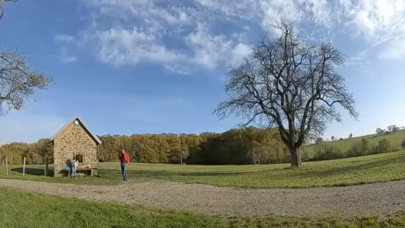
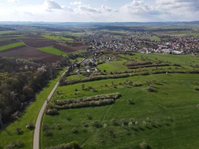
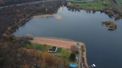
Small shelter at the top of a hill above Mulhausen. There is a bench and a window ledge where you can sit and set down your gear. Ideal for long range flying, with an unobstructed view over several kilometers. There are meadows all around for soft landings. A few tall trees for gaps and freestyle tricks. Ideal spot for beginners. 30 minutes' walk on a trail marked by the Club Vosgien from Mulhausen.
Map and restricted areas
Open in the main mapNearby aerodromes
Open aerodromes within 25 km of the spot, heliports included, with their distance and direction from the spot. Near an aerodrome, drone flying is prohibited or height-limited: check the UAS zones map.
| Aerodrome | Type | Distance | Elevation | Difference |
|---|---|---|---|---|
| Centre Hospitalier Heliport | Heliport | 6.8 km W | 201 m | spot 36 m higher |
| Base ULM de Batzendorf | Aerodrome | 15 km SE | 171 m | spot 66 m higher |
| Centre Hospitalier Heliport | Heliport | 18 km SE | 162 m | spot 75 m higher |
| Saverne Steinbourg Airfield | Aerodrome | 19 km SW | 192 m | spot 44 m higher |
| Haguenau Airfield | Aerodrome | 21 km SE | 150 m | spot 87 m higher |
Aviation weather (METAR and TAF)
LFST – Strasbourg Airport MVFR
METAR
METAR LFST 210700Z AUTO 01005KT 9999 BKN021 OVC078 06/05 Q1019 TEMPO 4000 -SHRA FEW025TCU
- Wind
- 010°, 9 km/h
- Visibility
- 10 km or more
- Clouds
- Broken (5-7/8) at 2,100 ft (640 m) ; Overcast (8/8) at 7,800 ft (2380 m)
- Temperature
- 6 °C, dew point 5 °C
- QNH
- 1019 hPa
- Flight category
- MVFR: ceiling 1,000–3,000 ft or visibility 3–5 mi
TAF
TAF LFST 210500Z 2106/2206 35005KT 9999 SCT020 BKN050 TEMPO 2106/2108 4000 -SHRA FEW025TCU PROB40 TEMPO 2203/2206 3000 BR BKN007
| Period (local time) | Change | Wind | Visibility | Weather | Clouds |
|---|---|---|---|---|---|
| 21/11 07:00 → 22/11 07:00 | Initial conditions | 350°, 9 km/h | 10 km or more | Scattered (3-4/8) at 2,000 ft (610 m) ; Broken (5-7/8) at 5,000 ft (1520 m) | |
| 21/11 07:00 → 21/11 09:00 | Temporarily | 4.0 km | Showers of rain light | Few (1-2/8) at 2,500 ft (760 m) (towering cumulus) | |
| 22/11 04:00 → 22/11 07:00 | Temporarily, probability 40% | 3.0 km | Mist | Broken (5-7/8) at 700 ft (210 m) |
Weather and Kp index
Sunrise and sunset
| Day | Dawn | Sunrise | Golden hour | Sunset | Dusk | Day length |
|---|---|---|---|---|---|---|
| Sat 21 Nov | 07:13 | 07:48 | 07:48–08:39 · 15:52–16:43 | 16:43 | 17:18 | 8 h 55 |
| Sun 22 Nov | 07:14 | 07:49 | 07:49–08:41 · 15:51–16:42 | 16:42 | 17:17 | 8 h 52 |
| Mon 23 Nov | 07:16 | 07:51 | 07:51–08:42 · 15:50–16:41 | 16:41 | 17:17 | 8 h 50 |
| Tue 24 Nov | 07:17 | 07:52 | 07:52–08:44 · 15:49–16:40 | 16:40 | 17:16 | 8 h 48 |
| Wed 25 Nov | 07:18 | 07:54 | 07:54–08:46 · 15:48–16:40 | 16:40 | 17:15 | 8 h 45 |
| Thu 26 Nov | 07:19 | 07:55 | 07:55–08:47 · 15:47–16:39 | 16:39 | 17:14 | 8 h 43 |
| Fri 27 Nov | 07:21 | 07:57 | 07:57–08:49 · 15:46–16:38 | 16:38 | 17:14 | 8 h 41 |

Reviews
Log in to review this spot. Log in · Create a free account
tyeb54230
Sympa merci