

Unusual
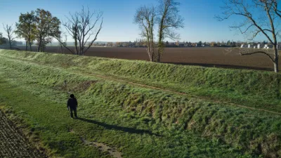
Behind the Mennecy rugby stadium, in the fields, along the old aqueduct
No reviews yet
Have you flown here? Share your experience with other pilots.
+ Write the first reviewDescription
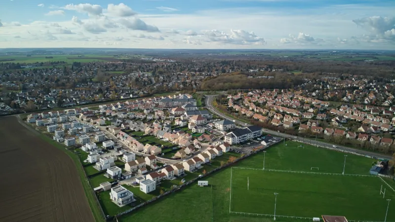
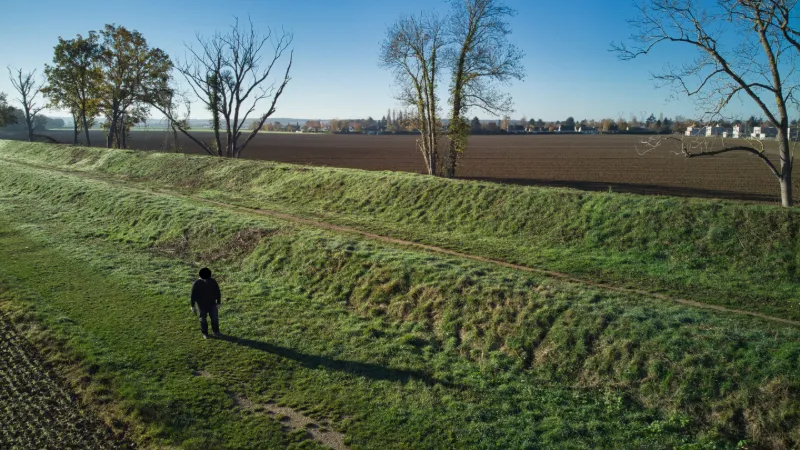
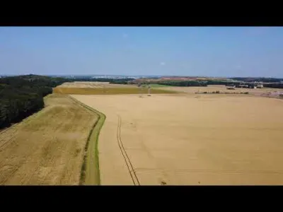
Over a thousand meters of fields in front of you in every direction, just 250m on foot from the roadside. A good training spot, and also a great place to shoot a beautiful panorama. Be careful: at the far end (about 1,700 meters away) there are high-voltage lines. Likewise, do not fly over houses or roads, it goes without saying.
Map and restricted areas
Open in the main mapNearby aerodromes
Open aerodromes within 25 km of the spot, heliports included, with their distance and direction from the spot. Near an aerodrome, drone flying is prohibited or height-limited: check the UAS zones map.
| Aerodrome | Type | Distance | Elevation | Difference |
|---|---|---|---|---|
| Centre Hospitalier Heliport | Heliport | 4.9 km NE | 78 m | spot 6 m higher |
| Centre Hospitalier Sud Francilien Heliport | Heliport | 7.0 km N | 78 m | spot 6 m higher |
| Cerny-La Ferté Alais Airfield | Aerodrome | 10 km SW | 138 m | spot 54 m lower |
| Melun-Villaroche Air Base | Airport | 17 km E | 92 m | spot 8 m lower |
| Paris-Orly Airport | Major airport | 19 km N | 89 m | spot 5 m lower |
Aviation weather (METAR and TAF)
LFPM – Melun-Villaroche Air Base IFR
METAR
METAR LFPM 211100Z AUTO VRB03KT 9000 BKN005 BKN011 OVC038 09/09 Q1019
- Wind
- Variable, 6 km/h
- Visibility
- 9 km
- Clouds
- Broken (5-7/8) at 500 ft (150 m) ; Broken (5-7/8) at 1,100 ft (340 m) ; Overcast (8/8) at 3,800 ft (1160 m)
- Temperature
- 9 °C, dew point 9 °C
- QNH
- 1019 hPa
- Flight category
- IFR: ceiling 500–1,000 ft or visibility 1–3 mi
TAF
Weather and Kp index
Sunrise and sunset
| Day | Dawn | Sunrise | Golden hour | Sunset | Dusk | Day length |
|---|---|---|---|---|---|---|
| Sat 21 Nov | 07:32 | 08:07 | 08:07–08:58 · 16:14–17:05 | 17:05 | 17:40 | 8 h 57 |
| Sun 22 Nov | 07:34 | 08:09 | 08:09–08:59 · 16:13–17:04 | 17:04 | 17:39 | 8 h 55 |
| Mon 23 Nov | 07:35 | 08:10 | 08:10–09:01 · 16:12–17:03 | 17:03 | 17:38 | 8 h 52 |
| Tue 24 Nov | 07:36 | 08:12 | 08:12–09:03 · 16:11–17:02 | 17:02 | 17:37 | 8 h 50 |
| Wed 25 Nov | 07:38 | 08:13 | 08:13–09:04 · 16:10–17:01 | 17:01 | 17:37 | 8 h 48 |
| Thu 26 Nov | 07:39 | 08:14 | 08:14–09:06 · 16:09–17:01 | 17:01 | 17:36 | 8 h 46 |
| Fri 27 Nov | 07:40 | 08:16 | 08:16–09:08 · 16:08–17:00 | 17:00 | 17:35 | 8 h 44 |

Reviews
Log in to review this spot. Log in · Create a free account
No reviews yet. Share yours!