

Husseg

No reviews yet
Have you flown here? Share your experience with other pilots.
+ Write the first reviewDescription
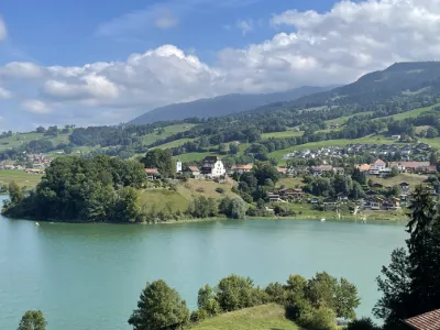
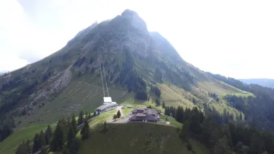
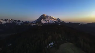
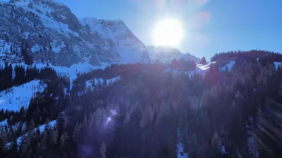
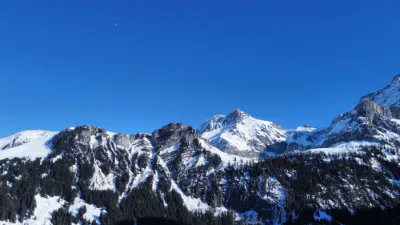
Husegg 1998 m - BE Small triangular summit located at the end of the Abländschen valley, very close to the village of Jaun. It lies southeast of the long Gastlosen mountain range, above the Grubenberg hut of the CAS. The slopes on this side are good for skiing and offer a magnificent panorama, especially over the Dt de Ruth, Savigny and Wandfue. Access: From Jaun, 21 km from Bulle, take the road on the right toward Abländschen and park at the end. Start altitude: 1212 m Summit altitude: 1998 m From Abländschen, go up the road, then across the fields toward Mittelberg. From Mittelberg 1640m, climb a road on the right up to the Gruebenberg Hut 1840m. From there, go up the south slopes to the summit.
Map and restricted areas
Open in the main mapAviation weather (METAR and TAF)
LSGS – Sion Airport VFR
METAR
METAR LSGS 210720Z VRB01KT 9999 -RA SCT012 BKN060 06/06 Q1021
- Wind
- Variable, 2 km/h
- Visibility
- 10 km or more
- Weather
- Rain light
- Clouds
- Scattered (3-4/8) at 1,200 ft (370 m) ; Broken (5-7/8) at 6,000 ft (1830 m)
- Temperature
- 6 °C, dew point 6 °C
- QNH
- 1021 hPa
- Flight category
- VFR: ceiling > 3,000 ft and visibility > 5 mi
TAF
TAF LSGS 210525Z 2106/2115 VRB01KT 9999 BKN065 TEMPO 2106/2111 SHRA
| Period (local time) | Change | Wind | Visibility | Weather | Clouds |
|---|---|---|---|---|---|
| 21/11 07:00 → 21/11 16:00 | Initial conditions | Variable, 2 km/h | 10 km or more | Broken (5-7/8) at 6,500 ft (1980 m) | |
| 21/11 07:00 → 21/11 12:00 | Temporarily | Showers of rain |
Weather and Kp index
Sunrise and sunset
| Day | Dawn | Sunrise | Golden hour | Sunset | Dusk | Day length |
|---|---|---|---|---|---|---|
| Sat 21 Nov | 07:08 | 07:41 | 07:41–08:29 · 16:05–16:52 | 16:52 | 17:26 | 9 h 10 |
| Sun 22 Nov | 07:09 | 07:43 | 07:43–08:31 · 16:04–16:51 | 16:51 | 17:25 | 9 h 08 |
| Mon 23 Nov | 07:11 | 07:44 | 07:44–08:32 · 16:03–16:51 | 16:51 | 17:24 | 9 h 06 |
| Tue 24 Nov | 07:12 | 07:45 | 07:45–08:34 · 16:02–16:50 | 16:50 | 17:23 | 9 h 04 |
| Wed 25 Nov | 07:13 | 07:47 | 07:47–08:35 · 16:01–16:49 | 16:49 | 17:23 | 9 h 02 |
| Thu 26 Nov | 07:14 | 07:48 | 07:48–08:37 · 16:00–16:48 | 16:48 | 17:22 | 9 h 00 |
| Fri 27 Nov | 07:16 | 07:49 | 07:49–08:38 · 15:59–16:48 | 16:48 | 17:22 | 8 h 58 |

Reviews
Log in to review this spot. Log in · Create a free account
No reviews yet. Share yours!