Skip to content
Mountain

Airolo

Switzerland

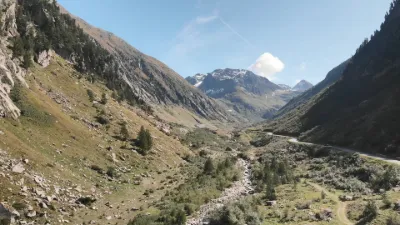
Airolo – photo 1

No reviews yet

Have you flown here? Share your experience with other pilots.

+ Write the first review

Description

Just after the Saint-Gotthard tunnel in Airolo, Ticino

Automatic translation.

Aviation weather (METAR and TAF)

LSMM – Meiringen Airport · 45 km NW ?

METAR

Observed 21/11 07:50 · 31 min ago

METAR LSMM 210650Z AUTO 09008KT 9999NDV -SHRA SCT013 BKN025 OVC056 04/03 Q1020 RMK

Wind
090°, 15 km/h
Visibility
–
Weather
Showers of rain light
Clouds
Scattered (3-4/8) at 1,300 ft (400 m) ; Broken (5-7/8) at 2,500 ft (760 m) ; Overcast (8/8) at 5,600 ft (1710 m)
Temperature
4 °C, dew point 3 °C
QNH
1020 hPa
Flight category
Unknown category

TAF

This station does not issue a TAF (or none is currently valid).

METAR and TAF from NOAA (Aviation Weather Center), for guidance only: they do not replace flight planning with official sources (SIA, Météo-France). Nearest station that issues a METAR, not necessarily the nearest aerodrome.

Plan the light

Weather and Kp index

Loading forecast…

Sunrise and sunset

Local times at the spot (UTC+01:00). The golden hour, the warm, low light sought after for photos and videos, runs from sunrise until the sun reaches 6° above the horizon, and in the evening from 6° until sunset.

Day Dawn Sunrise Golden hour Sunset Dusk Day length
Sat 21 Nov07:03 07:36 07:36–08:24 · 15:59–16:47 16:47 17:209 h 11
Sun 22 Nov07:04 07:37 07:37–08:25 · 15:58–16:46 16:46 17:199 h 08
Mon 23 Nov07:05 07:39 07:39–08:27 · 15:57–16:45 16:45 17:199 h 06
Tue 24 Nov07:06 07:40 07:40–08:28 · 15:56–16:45 16:45 17:189 h 04
Wed 25 Nov07:08 07:41 07:41–08:30 · 15:55–16:44 16:44 17:179 h 02
Thu 26 Nov07:09 07:43 07:43–08:31 · 15:55–16:43 16:43 17:179 h 00
Fri 27 Nov07:10 07:44 07:44–08:33 · 15:54–16:42 16:42 17:168 h 58

Nearby on Wikipedia

  • Airolo · 0.6 km away

    Airolo (en dialecte local lombard : Airö(u), Aire(u) Lexikon der schweizerischen Gemeindenamen. Centre de Dialectologie, Université de Neuchâtel, Andres Kristol. Huber, Frauenfeld/Stuttgart/Wien 2005, et Éditions Payot, Lausanne 2005, , S. 80 (...)

  • Réduit national · 1.8 km away

    Le « Réduit national » ou « Réduit » désigne en Suisse le système de fortifications dans les Alpes suisses. Au cours de la Seconde Guerre mondiale, il est devenu l'incarnation même de la volonté de résistance de la Suisse face au Reich allemand d'une part et, d'autre part, le symbole de la capacité (...)

  • Bataille du Saint-Gothard · 4.1 km away

    La bataille du Saint-Gothard se déroula du 24 au 26 septembre 1799 au col du Saint-Gothard, en Suisse, dans le cadre de la guerre de la Deuxième Coalition. Elle opposa une armée impériale russe dirigée par le feld-maréchal Alexandre Souvorov, soutenue par deux brigades autrichiennes, à une division (...)

  • Liste de statues équestres de Suisse · 4.1 km away

    Cet article recense les statues équestres en Suisse. (...)

  • Massif du Saint-Gothard · 4.6 km away

    Le massif du Saint-Gothard est une région montagneuse située dans la chaîne des Alpes, en Suisse, à la frontière de quatre cantons suisses : le Valais, le Tessin, Uri et les Grisons. Ce massif donne son nom à un col permettant de le franchir (...)

Articles found by GeoNames from the spot's position.

Nearby spots

Reviews

Log in to review this spot. Log in · Create a free account

No reviews yet. Share yours!

Connection to the site lost. Trying again…

The site is not responding. Trying again in seconds.

The site is no longer responding.

The site has been updated. Reloading the page…

This page has expired.

Resuming failed. Please reload the page.

The site is no longer responding.