

Heritage
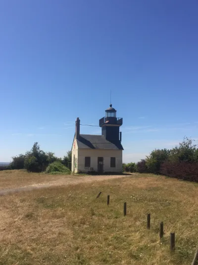
Phare de la Roque



1 pilot review
“dommage installation de barrières de chantier....pour encore nous faire reculer de ce magn…” — Jéjé 1250, 5 months ago
Read the reviews + Write my reviewDescription
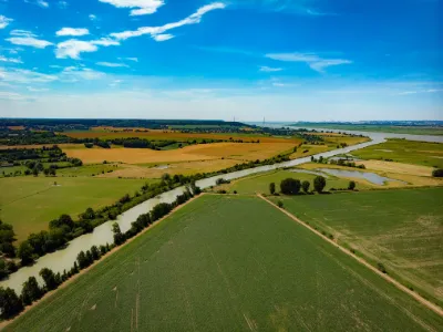
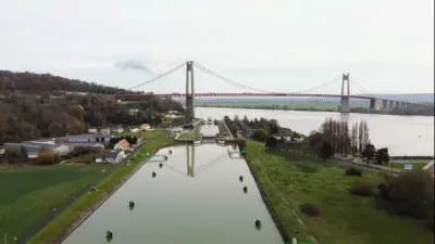
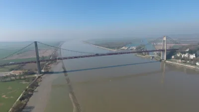
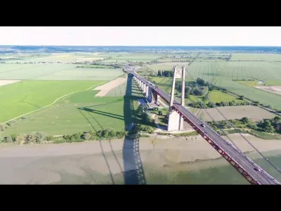
Old lighthouse with a view over the Seine
Map and restricted areas
Open in the main mapNearby aerodromes
Open aerodromes within 25 km of the spot, heliports included, with their distance and direction from the spot. Near an aerodrome, drone flying is prohibited or height-limited: check the UAS zones map.
| Aerodrome | Type | Distance | Elevation | Difference |
|---|---|---|---|---|
| Usine Renault Heliport | Heliport | 9.6 km W | 5 m | spot 45 m higher |
| Aérodrome du Havre - Saint-Romain | Aerodrome | 12 km NW | 129 m | spot 79 m lower |
| La Ferme Saint Siméon Heliport | Heliport | 15 km W | 31 m | spot 19 m higher |
| Hopital Jacques Monod Heliport | Heliport | 20 km NW | 12 m | spot 38 m higher |
| Deauville-Saint-Gatien Airport | Airport | 21 km SW | 146 m | spot 96 m lower |
Aviation weather (METAR and TAF)
LFRG – Deauville-Saint-Gatien Airport LIFR
METAR
METAR LFRG 210630Z AUTO 20005KT 8000 BKN003 BKN008 OVC012 08/08 Q1017 TEMPO 0300 FG VV///
- Wind
- 200°, 9 km/h
- Visibility
- 8 km
- Clouds
- Broken (5-7/8) at 300 ft (90 m) ; Broken (5-7/8) at 800 ft (240 m) ; Overcast (8/8) at 1,200 ft (370 m)
- Temperature
- 8 °C, dew point 8 °C
- QNH
- 1017 hPa
- Flight category
- LIFR: ceiling < 500 ft or visibility < 1 mi
TAF
TAF LFRG 210500Z 2106/2115 VRB05KT 3000 BR BKN003 TEMPO 2106/2110 0300 FG VV/// BECMG 2110/2112 9999 NSW BKN006 BECMG 2112/2114 14010KT BKN012
| Period (local time) | Change | Wind | Visibility | Weather | Clouds |
|---|---|---|---|---|---|
| 21/11 07:00 → 21/11 11:00 | Initial conditions | Variable, 9 km/h | 3.0 km | Mist | Broken (5-7/8) at 300 ft (90 m) |
| 21/11 07:00 → 21/11 11:00 | Temporarily | 300 m | Fog | ||
| 21/11 11:00 → 21/11 13:00 | Becoming | Variable, 9 km/h | 10 km or more | No significant weather | Broken (5-7/8) at 600 ft (180 m) |
| 21/11 13:00 → 21/11 16:00 | Becoming | 140°, 19 km/h | 10 km or more | No significant weather | Broken (5-7/8) at 1,200 ft (370 m) |
Weather and Kp index
Sunrise and sunset
| Day | Dawn | Sunrise | Golden hour | Sunset | Dusk | Day length |
|---|---|---|---|---|---|---|
| Sat 21 Nov | 07:43 | 08:19 | 08:19–09:10 · 16:18–17:10 | 17:10 | 17:45 | 8 h 51 |
| Sun 22 Nov | 07:44 | 08:20 | 08:20–09:12 · 16:17–17:09 | 17:09 | 17:45 | 8 h 48 |
| Mon 23 Nov | 07:46 | 08:22 | 08:22–09:14 · 16:15–17:08 | 17:08 | 17:44 | 8 h 46 |
| Tue 24 Nov | 07:47 | 08:23 | 08:23–09:16 · 16:14–17:07 | 17:07 | 17:43 | 8 h 43 |
| Wed 25 Nov | 07:48 | 08:24 | 08:24–09:17 · 16:13–17:06 | 17:06 | 17:42 | 8 h 41 |
| Thu 26 Nov | 07:50 | 08:26 | 08:26–09:19 · 16:12–17:05 | 17:05 | 17:41 | 8 h 39 |
| Fri 27 Nov | 07:51 | 08:27 | 08:27–09:21 · 16:11–17:05 | 17:05 | 17:41 | 8 h 37 |

Reviews
Log in to review this spot. Log in · Create a free account
Jéjé 1250
dommage installation de barrières de chantier....pour encore nous faire reculer de ce magnifique point de vue heureusement le drone nous permet de prendre dr magnifique image dr ce spot