

The Morsalines battery

No reviews yet
Have you flown here? Share your experience with other pilots.
+ Write the first reviewDescription
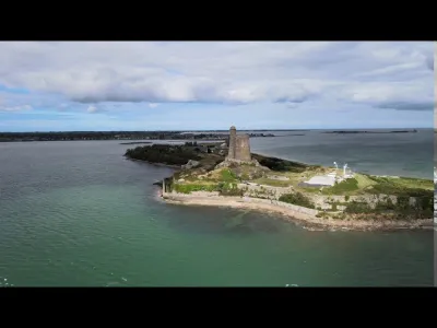
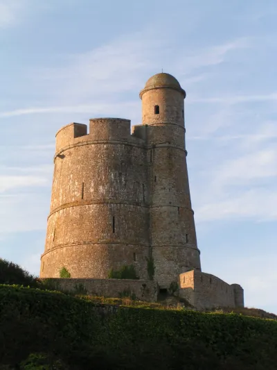
The Morsalines battery is a landmark in the Manche department, located in Quettehou, in the delegated commune of Morsalines. It is part of the German Atlantic Wall defense system, under the code name Stp 141.
During the Second World War, the Morsalines battery, set up as early as 1941, was the oldest on the eastern coast of the Cotentin. It consisted of six French 155 mm guns dating from the First World War, installed in the open air on concrete platforms. Because of their range, they could reach the Varreville sector, where the Americans had chosen to land.
Quite cleverly camouflaged, it escaped the Allies' attention for a long time, but eventually suffered a devastating bombardment in May 1944 that destroyed or damaged half of its guns. It was then moved further back.
Because of this new position, and because the Americans mistakenly came ashore on 6 June on a beach two kilometers south of the planned location, the Morsalines battery was unable to hinder the landing operations in any way. Having become useless where they stood, its guns were transported inside the Cherbourg fortress.
Video
Map and restricted areas
Open in the main mapNearby aerodromes
Open aerodromes within 25 km of the spot, heliports included, with their distance and direction from the spot. Near an aerodrome, drone flying is prohibited or height-limited: check the UAS zones map.
| Aerodrome | Type | Distance | Elevation | Difference |
|---|---|---|---|---|
| Cherbourg-Maupertus Airport | Airport | 15 km NW | 140 m | spot 136 m lower |
| Centre Hospitalier Heliport | Heliport | 23 km W | 19 m | spot 15 m lower |
Aviation weather (METAR and TAF)
LFRC – Cherbourg-Maupertus Airport LIFR
METAR
METAR LFRC 211130Z AUTO 15009KT 0350 0300 R28/0400N FG VV/// 09/09 Q1016 BECMG 6000 NSW BKN003
- Wind
- 150°, 17 km/h
- Visibility
- 350 m
- Weather
- Fog
- Clouds
- –
- Temperature
- 9 °C, dew point 9 °C
- QNH
- 1016 hPa
- Flight category
- LIFR: ceiling < 500 ft or visibility < 1 mi
TAF
TAF LFRC 211100Z 2112/2121 17010KT 0300 FG VV/// BECMG 2112/2114 6000 NSW BKN003 BECMG 2114/2116 BKN008 TEMPO 2116/2120 BKN011 BECMG 2119/2121 13015G25KT
| Period (local time) | Change | Wind | Visibility | Weather | Clouds |
|---|---|---|---|---|---|
| 21/11 13:00 → 21/11 22:00 | Initial conditions | 170°, 19 km/h | 300 m | Fog | |
| 21/11 13:00 → 21/11 15:00 | Becoming | 170°, 19 km/h | 6 km | No significant weather | Broken (5-7/8) at 300 ft (90 m) |
| 21/11 15:00 → 21/11 20:00 | Becoming | 170°, 19 km/h | 6 km | No significant weather | Broken (5-7/8) at 800 ft (240 m) |
| 21/11 17:00 → 21/11 21:00 | Temporarily | Broken (5-7/8) at 1,100 ft (340 m) | |||
| 21/11 20:00 → 21/11 22:00 | Becoming | 130°, 28 km/h, gusts 46 km/h | 6 km | No significant weather | Broken (5-7/8) at 800 ft (240 m) |
Weather and Kp index
Sunrise and sunset
| Day | Dawn | Sunrise | Golden hour | Sunset | Dusk | Day length |
|---|---|---|---|---|---|---|
| Sat 21 Nov | 07:50 | 08:26 | 08:26–09:18 · 16:24–17:16 | 17:16 | 17:52 | 8 h 50 |
| Sun 22 Nov | 07:52 | 08:27 | 08:27–09:20 · 16:23–17:15 | 17:15 | 17:51 | 8 h 47 |
| Mon 23 Nov | 07:53 | 08:29 | 08:29–09:22 · 16:22–17:14 | 17:14 | 17:50 | 8 h 45 |
| Tue 24 Nov | 07:54 | 08:30 | 08:30–09:23 · 16:21–17:13 | 17:13 | 17:49 | 8 h 42 |
| Wed 25 Nov | 07:56 | 08:32 | 08:32–09:25 · 16:19–17:13 | 17:13 | 17:49 | 8 h 40 |
| Thu 26 Nov | 07:57 | 08:33 | 08:33–09:27 · 16:18–17:12 | 17:12 | 17:48 | 8 h 38 |
| Fri 27 Nov | 07:58 | 08:35 | 08:35–09:28 · 16:17–17:11 | 17:11 | 17:47 | 8 h 36 |


Reviews
Log in to review this spot. Log in · Create a free account
No reviews yet. Share yours!