

Saint-Vaast-la-Hougue
No reviews yet
Have you flown here? Share your experience with other pilots.
+ Write the first reviewDescription
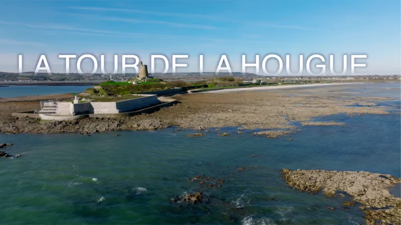
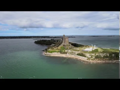
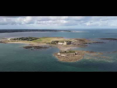
THE FORT de la HOUGUE and its VAUBAN TOWER The Fort de la Hougue evolved over time, notably in step with advances in artillery, and was therefore reorganized militarily several times, the last being its incorporation into the Atlantic Wall during the Second World War, as the many structures and firing positions bear witness.
From 1858, the introduction of rifled artillery and the abandonment of the cannonball made it necessary to rethink the principles of fortification. However, this only brought about a slow modification of the coastal defense works. In 1875, the battery at the point of the Fort de la Hougue was decommissioned as it had become too vulnerable. Three new batteries were built in 1878 and 1881: one on the east front, the second on the west front, and the last at the foot of the tower, currently occupied by the French Navy's semaphore station. Part of the earthworks of the east bastion can still be seen. The introduction of the torpedo shell from 1885, despite its destructive effects, led to little work at La Hougue, apart from the digging of a deep cave shelter used as a powder magazine.
From then on, the Fort de la Hougue no longer served any military function, except for the presence of the semaphore. As for the tower, once a guarantee of defense, it now acts as a peaceful sentinel that has captured the eye of many painters. Since the Vauban tower was inscribed on the UNESCO list in 2008, the fort has been divided into three clearly distinct parts to allow visits, which take place through a side gate, the Porte aux Dames. Public access is via the path laid out along the west fortification during the fort's restoration in 1991.
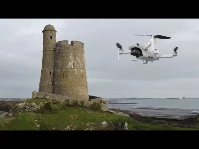
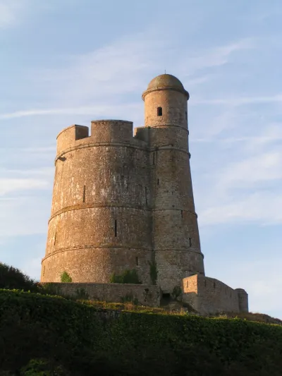
Built in the central part of the Fort de la Hougue, on the highest promontory, from which it takes its name (from Old Norse haugr, meaning height, elevation), the Vauban tower of La Hougue has three levels of rooms reached by a spiral staircase housed in a turret attached outside the northwest side. The stairwell is protected by a sentry box with a semi-hemispherical dome.
The top terrace consists of an artillery platform protected by a crenellated parapet whose six embrasures could each take a cannon.
The tower is open to the public thanks to an agreement signed between the Ministry of Defense, owner of the site, and the town of Saint-Vaast-la-Hougue. PARKING NEARBY
Map and restricted areas
Open in the main mapNearby aerodromes
Open aerodromes within 25 km of the spot, heliports included, with their distance and direction from the spot. Near an aerodrome, drone flying is prohibited or height-limited: check the UAS zones map.
| Aerodrome | Type | Distance | Elevation | Difference |
|---|---|---|---|---|
| Cherbourg-Maupertus Airport | Airport | 17 km NW | 140 m | spot 140 m lower |
Aviation weather (METAR and TAF)
LFRC – Cherbourg-Maupertus Airport MVFR
METAR
METAR LFRC 210630Z AUTO 18006KT 7000 NSC 05/05 Q1016 TEMPO 0300 FG VV///
- Wind
- 180°, 11 km/h
- Visibility
- 7 km
- Clouds
- –
- Temperature
- 5 °C, dew point 5 °C
- QNH
- 1016 hPa
- Flight category
- MVFR: ceiling 1,000–3,000 ft or visibility 3–5 mi
TAF
TAF LFRC 210500Z 2106/2115 VRB05KT 9999 SCT020 BECMG 2106/2108 15010KT 3000 BR BKN003 PROB40 TEMPO 2106/2110 0300 FG VV/// BECMG 2110/2112 9999 NSW BECMG 2113/2115 BKN006
| Period (local time) | Change | Wind | Visibility | Weather | Clouds |
|---|---|---|---|---|---|
| 21/11 07:00 → 21/11 16:00 | Initial conditions | Variable, 9 km/h | 10 km or more | Scattered (3-4/8) at 2,000 ft (610 m) | |
| 21/11 07:00 → 21/11 11:00 | Becoming | 150°, 19 km/h | 3.0 km | Mist | Broken (5-7/8) at 300 ft (90 m) |
| 21/11 07:00 → 21/11 11:00 | Temporarily, probability 40% | 300 m | Fog | ||
| 21/11 11:00 → 21/11 14:00 | Becoming | 150°, 19 km/h | 10 km or more | No significant weather | Broken (5-7/8) at 300 ft (90 m) |
| 21/11 14:00 → 21/11 16:00 | Becoming | 150°, 19 km/h | 10 km or more | No significant weather | Broken (5-7/8) at 600 ft (180 m) |
Weather and Kp index
Sunrise and sunset
| Day | Dawn | Sunrise | Golden hour | Sunset | Dusk | Day length |
|---|---|---|---|---|---|---|
| Sat 21 Nov | 07:50 | 08:26 | 08:26–09:18 · 16:24–17:16 | 17:16 | 17:52 | 8 h 50 |
| Sun 22 Nov | 07:51 | 08:27 | 08:27–09:20 · 16:23–17:15 | 17:15 | 17:51 | 8 h 47 |
| Mon 23 Nov | 07:53 | 08:29 | 08:29–09:21 · 16:22–17:14 | 17:14 | 17:50 | 8 h 45 |
| Tue 24 Nov | 07:54 | 08:30 | 08:30–09:23 · 16:20–17:13 | 17:13 | 17:49 | 8 h 42 |
| Wed 25 Nov | 07:56 | 08:32 | 08:32–09:25 · 16:19–17:12 | 17:12 | 17:49 | 8 h 40 |
| Thu 26 Nov | 07:57 | 08:33 | 08:33–09:27 · 16:18–17:12 | 17:12 | 17:48 | 8 h 38 |
| Fri 27 Nov | 07:58 | 08:35 | 08:35–09:28 · 16:17–17:11 | 17:11 | 17:47 | 8 h 36 |

Reviews
Log in to review this spot. Log in · Create a free account
No reviews yet. Share yours!