

Cap Corse
No reviews yet
Have you flown here? Share your experience with other pilots.
+ Write the first reviewDescription
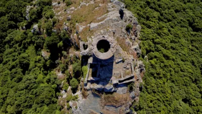
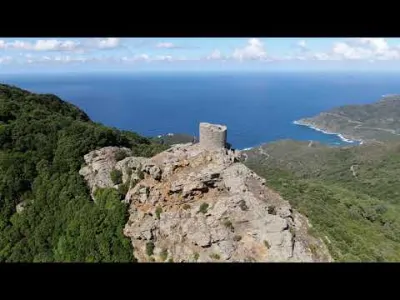
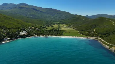
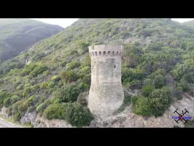
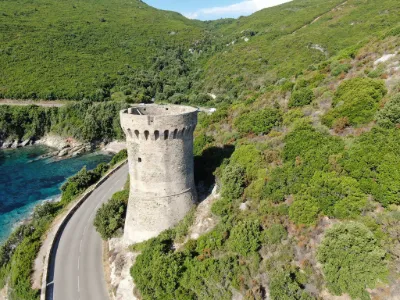
Human settlement in the Cap developed according to the terrain, following a very characteristic relationship between villages and marinas. Almost all the communes of the Cap group their hamlets at altitude, around often richly decorated churches and chapels, while opening onto the sea through one or two "marinas". In the past, these tiny fishing ports, nestled at the back of coves and along beaches, were threatened by Barbary raids. They were therefore protected by one or more watchtowers and, in case of alert, depended on the hilltop main villages as a refuge for their population. Today the marinas are pleasure and fishing ports that attract more people than their main villages, and are often overrun by tourists in summer.
Along the coast from Bastia to Saint-Florent, you will find the following marinas:
Pietranera and Grigione (commune of San-Martino-di-Lota) Miomo (Santa-Maria-di-Lota) Lavasina and Erbalunga (Brando) Marine de Sisco (Sisco) Marine de Pietracorbara (Pietracorbara) Porticciolo (Cagnano) Santa Severa (Luri) Marine de Meria (Meria) Macinaggio (Rogliano) Barcaggio and Tollare (Ersa) Marine de Centuri (Centuri) Mute (Morsiglia) Scalo (Pino) Giottani (Barrettali) Scala and Cannelle (Canari) Albo (Ogliastro) Negro (Olmeta-di-Capocorso) Marine de Farinole (Farinole).
Among the ten communes of the "historic" Cap, only Olcani has no access to the sea; Nonza, a perched village overlooking its famous grey pebble beach, no longer has a marina.
Through its marinas, Cap Corse is the part of Corsica most turned toward the sea. The two largest fishing ports on the island are still found there today: Centuri and Macinaghju.
The Cap is also fertile land, suited to a variety of crops: vines, olive trees, fruit trees. The cultivation and trade of citron, in particular, was for a very long time an important source of income for the people of Cap Corse. Today, large vineyards stretch across its eastern slope (AOC "Muscat du Cap Corse" at Pietracorbara and Rogliano) and in its southern part (AOC "Patrimonio" at Patrimonio and Barbaggio).
In the first volume of his work Voyages en Corse, à l'île d'Elbe et en Sardaigne, published in 1837, Antoine Claude Valery briefly describes its main riches: "The communal cultivation of the vine, which signals security, comfort and the progress of civilization, is no less well understood in Cap Corse than on the mainland. Annual wine exports amount to three to four hundred thousand francs; these warm, light, generous wines, which keep well, are taken and sold as Spanish wines. It is only in Cap Corse that silk production has been attempted, and successfully, so easy and so natural in this climate where it neither rains nor thunders during the time of the silkworms' work. This silk, recognized as superior even to that of Piedmont, is one of the many sources of wealth and prosperity neglected on the island."
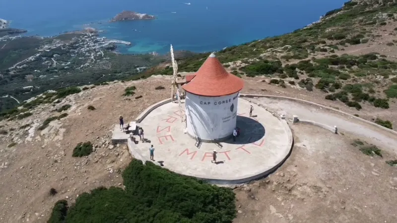
Cap Corse notably gave its name to a drink invented in 1872 by Louis-Napoléon Mattei, a blend of mistelle and quinine.
Map and restricted areas
Open in the main mapNearby aerodromes
Open aerodromes within 25 km of the spot, heliports included, with their distance and direction from the spot. Near an aerodrome, drone flying is prohibited or height-limited: check the UAS zones map.
No known open aerodrome within 25 km.
Aviation weather (METAR and TAF)
LFKB – Bastia-Poretta Airport VFR
METAR
METAR LFKB 211130Z AUTO 10006KT CAVOK 20/09 Q1017 NOSIG
- Wind
- 100°, 11 km/h
- Visibility
- 10 km or more
- Clouds
- –
- Temperature
- 20 °C, dew point 9 °C
- QNH
- 1017 hPa
- Flight category
- VFR: ceiling > 3,000 ft and visibility > 5 mi
TAF
TAF LFKB 210800Z 2109/2209 VRB04KT CAVOK TX20/2112Z TN11/2205Z PROB30 TEMPO 2122/2203 SHRA FEW040TCU
| Period (local time) | Change | Wind | Visibility | Weather | Clouds |
|---|---|---|---|---|---|
| 21/11 10:00 → 22/11 10:00 | Initial conditions | Variable, 7 km/h | 10 km or more | No significant cloud | |
| 21/11 23:00 → 22/11 04:00 | Temporarily, probability 30% | Showers of rain | Few (1-2/8) at 4,000 ft (1220 m) (towering cumulus) |
Weather and Kp index
Sunrise and sunset
| Day | Dawn | Sunrise | Golden hour | Sunset | Dusk | Day length |
|---|---|---|---|---|---|---|
| Sat 21 Nov | 06:51 | 07:22 | 07:22–08:05 · 16:11–16:55 | 16:55 | 17:26 | 9 h 32 |
| Sun 22 Nov | 06:52 | 07:23 | 07:23–08:07 · 16:10–16:54 | 16:54 | 17:25 | 9 h 30 |
| Mon 23 Nov | 06:53 | 07:24 | 07:24–08:08 · 16:10–16:53 | 16:53 | 17:24 | 9 h 29 |
| Tue 24 Nov | 06:54 | 07:25 | 07:25–08:09 · 16:09–16:53 | 16:53 | 17:24 | 9 h 27 |
| Wed 25 Nov | 06:55 | 07:27 | 07:27–08:11 · 16:08–16:52 | 16:52 | 17:23 | 9 h 25 |
| Thu 26 Nov | 06:57 | 07:28 | 07:28–08:12 · 16:07–16:52 | 16:52 | 17:23 | 9 h 23 |
| Fri 27 Nov | 06:58 | 07:29 | 07:29–08:13 · 16:07–16:51 | 16:51 | 17:22 | 9 h 22 |
Reviews
Log in to review this spot. Log in · Create a free account
No reviews yet. Share yours!