

between Pino and Luri, Cap Corse
No reviews yet
Have you flown here? Share your experience with other pilots.
+ Write the first reviewDescription
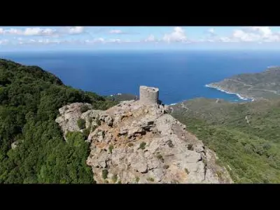
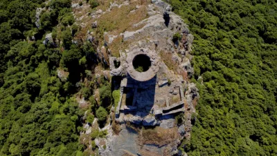
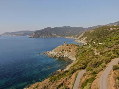
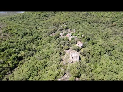
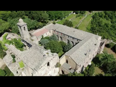
The Seneca Tower (Torra di Seneca in Corsican) is an old Genoese tower located between Pino and Luri, in the Cap Corse region. This tower, known as an old keep, was built in the 16th century and was part of a series of defenses built by the Republic of Genoa between 1530 and 1620 to hold back attacks by Barbary pirates. It has a cistern (you can see the ruins on site) and was built on the site of an older tower that the Romans are said to have built as a lookout post. It was added to the official list of historic monuments of France in 1840. How to get to the start of the trail If you are coming from the west of Cap Corse, take the D35 near Morsiglia. If you are arriving from the east side of Cap Corse, you also need to take this D35, near the marina of Meria. The road will take you through a pine forest up to the Col de Ste-Lucie, and you then need to turn left or right (depending on which side you are coming from) toward the Seneca Tower (there is a sign at the roadside), then drive up a narrow old road to the tower's parking lot.
Located at the top of a rocky peak, at an altitude of 564 meters, the tower was built in the second half of the 16th century by the dei Moti family, on the spot where Seneca is said to have lived between 41 and 49 AD, after being exiled for seducing the niece of Emperor Claudius. And his generally bad behavior did not stop there. During his exile, Seneca is said to have come down from his rock to try to approach a Corsican woman, for which he was attacked with nettles by her family: hence, it is said, the profusion of these plants around the foot of the tower. A variety of these stinging plants is even called "urtica di Seneca"! At this spot, he wrote a few bitter verses about the place and its surroundings: "What can be found so bare, what is so rugged as this rock? What is more barren? What is cruder in its inhabitants? What is more horrible in the very situation of the place? What climate is more intemperate? Yet there are more foreigners than natives. Even so, the change of place is unpleasant. Even this place has made some people flee from their country." Path to the Seneca Tower From the parking lot, you might (almost) be a little daunted by the climb up to the Seneca Tower, it looks really far away perched on that high rocky peak!
Map and restricted areas
Open in the main mapNearby aerodromes
Open aerodromes within 25 km of the spot, heliports included, with their distance and direction from the spot. Near an aerodrome, drone flying is prohibited or height-limited: check the UAS zones map.
No known open aerodrome within 25 km.
Aviation weather (METAR and TAF)
LFKB – Bastia-Poretta Airport VFR
METAR
METAR LFKB 211130Z AUTO 10006KT CAVOK 20/09 Q1017 NOSIG
- Wind
- 100°, 11 km/h
- Visibility
- 10 km or more
- Clouds
- –
- Temperature
- 20 °C, dew point 9 °C
- QNH
- 1017 hPa
- Flight category
- VFR: ceiling > 3,000 ft and visibility > 5 mi
TAF
TAF LFKB 210800Z 2109/2209 VRB04KT CAVOK TX20/2112Z TN11/2205Z PROB30 TEMPO 2122/2203 SHRA FEW040TCU
| Period (local time) | Change | Wind | Visibility | Weather | Clouds |
|---|---|---|---|---|---|
| 21/11 10:00 → 22/11 10:00 | Initial conditions | Variable, 7 km/h | 10 km or more | No significant cloud | |
| 21/11 23:00 → 22/11 04:00 | Temporarily, probability 30% | Showers of rain | Few (1-2/8) at 4,000 ft (1220 m) (towering cumulus) |
Weather and Kp index
Sunrise and sunset
| Day | Dawn | Sunrise | Golden hour | Sunset | Dusk | Day length |
|---|---|---|---|---|---|---|
| Sat 21 Nov | 06:51 | 07:22 | 07:22–08:06 · 16:11–16:55 | 16:55 | 17:26 | 9 h 32 |
| Sun 22 Nov | 06:52 | 07:23 | 07:23–08:07 · 16:10–16:54 | 16:54 | 17:25 | 9 h 30 |
| Mon 23 Nov | 06:53 | 07:24 | 07:24–08:08 · 16:09–16:53 | 16:53 | 17:24 | 9 h 28 |
| Tue 24 Nov | 06:55 | 07:26 | 07:26–08:10 · 16:09–16:53 | 16:53 | 17:24 | 9 h 27 |
| Wed 25 Nov | 06:56 | 07:27 | 07:27–08:11 · 16:08–16:52 | 16:52 | 17:23 | 9 h 25 |
| Thu 26 Nov | 06:57 | 07:28 | 07:28–08:12 · 16:07–16:52 | 16:52 | 17:23 | 9 h 23 |
| Fri 27 Nov | 06:58 | 07:29 | 07:29–08:14 · 16:07–16:51 | 16:51 | 17:22 | 9 h 21 |

Reviews
Log in to review this spot. Log in · Create a free account
No reviews yet. Share yours!