

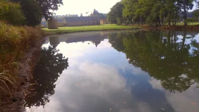
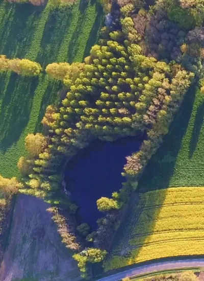
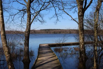
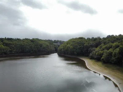
The Peaceful Lake of Combourg in the 35, Ille-et-Vilaine

No reviews yet
Have you flown here? Share your experience with other pilots.
+ Write the first reviewDescription
Overview The town's reputation is linked to the Romantic writer François-René de Chateaubriand and to its castle, well known to fans of the supernatural. Its nickname, the "cradle of Romanticism", comes from the writer, who spent part of his youth at the castle: "The whole castle, proudly perched on its rock, with its pond and its woods, the church and the houses of the little town around it, the valley opening up in front of it and the vast horizon of moorland that closes it off, has a character of melancholy grandeur that is not without charm"2. The inhabitants of Combourg were nicknamed "the Big Horses". According to Charles Lecomte, this nickname comes from the fact that the roads leading to the town were very poorly maintained and farmers looked for big draft horses for their plowing.
Geography Location and neighboring municipalities A town of Upper Brittany, Combourg is also on the Portes de Bretagne route. It is located between Rennes and Saint-Malo, in Ille-et-Vilaine, 386 km from Paris, 39 km from Rennes and 36 km from Saint-Malo.
Map and restricted areas
Open in the main mapNearby aerodromes
Open aerodromes within 25 km of the spot, heliports included, with their distance and direction from the spot. Near an aerodrome, drone flying is prohibited or height-limited: check the UAS zones map.
No known open aerodrome within 25 km.
Aviation weather (METAR and TAF)
LFRD – Dinard-Pleurtuit-Saint-Malo Airport VFR
METAR
METAR LFRD 210630Z AUTO 18007KT CAVOK 05/05 Q1016 TEMPO 0300 FG VV///
- Wind
- 180°, 13 km/h
- Visibility
- 10 km or more
- Clouds
- –
- Temperature
- 5 °C, dew point 5 °C
- QNH
- 1016 hPa
- Flight category
- VFR: ceiling > 3,000 ft and visibility > 5 mi
TAF
TAF LFRD 210500Z 2106/2206 VRB05KT 6000 NSC BECMG 2106/2108 3000 BR BKN003 TEMPO 2106/2110 0300 FG VV/// BECMG 2110/2112 14010KT 9999 NSW BECMG 2112/2114 BKN006 TEMPO 2118/2204 14015G25KT BECMG 2120/2122 BKN012 TEMPO 2120/2206 2000 RA BKN006 BKN015CB PROB30 TEMPO 2122/2204 1200 TSRA BKN003
| Period (local time) | Change | Wind | Visibility | Weather | Clouds |
|---|---|---|---|---|---|
| 21/11 07:00 → 22/11 07:00 | Initial conditions | Variable, 9 km/h | 6 km | No significant cloud | |
| 21/11 07:00 → 21/11 11:00 | Becoming | Variable, 9 km/h | 3.0 km | Mist | Broken (5-7/8) at 300 ft (90 m) |
| 21/11 07:00 → 21/11 11:00 | Temporarily | 300 m | Fog | ||
| 21/11 11:00 → 21/11 13:00 | Becoming | 140°, 19 km/h | 10 km or more | No significant weather | Broken (5-7/8) at 300 ft (90 m) |
| 21/11 13:00 → 21/11 21:00 | Becoming | 140°, 19 km/h | 10 km or more | No significant weather | Broken (5-7/8) at 600 ft (180 m) |
| 21/11 19:00 → 22/11 05:00 | Temporarily | 140°, 28 km/h, gusts 46 km/h | |||
| 21/11 21:00 → 22/11 07:00 | Becoming | 140°, 19 km/h | 10 km or more | No significant weather | Broken (5-7/8) at 1,200 ft (370 m) |
| 21/11 21:00 → 22/11 07:00 | Temporarily | 2.0 km | Rain | Broken (5-7/8) at 600 ft (180 m) ; Broken (5-7/8) at 1,500 ft (460 m) (cumulonimbus) | |
| 21/11 23:00 → 22/11 05:00 | Temporarily, probability 30% | 1.2 km | Thunderstorm rain | Broken (5-7/8) at 300 ft (90 m) |
Weather and Kp index
| Day | Weather | Temp. min. / max. | Wind | Rain | Max Kp |
|---|---|---|---|---|---|
| Sat 21 Nov | Fog | 5° / 12° | 24 km/h SE | 4.4 mm | 2 |
| Sun 22 Nov | Light rain | 9° / 11° | 27 km/h W | 19 mm | 2 |
| Mon 23 Nov | Partly cloudy | 8° / 11° | 31 km/h W | 8.1 mm | 4 |
| Tue 24 Nov | Clear sky | 4° / 6° | 17 km/h SE | – | 2 |
| Wed 25 Nov | Cloudy | 4° / 6° | 15 km/h SE | 2.6 mm | – |
| Thu 26 Nov | Clear sky | -1° / 3° | 11 km/h NE | – | – |
| Fri 27 Nov | Light rain | -1° / 9° | 26 km/h SE | 7.5 mm | – |
Hour by hour: Saturday 21 November
| Time | Weather | Temp. | Wind | Rain | Clouds | Kp |
|---|---|---|---|---|---|---|
| 07:00 | Fair | 5° | 10 km/h S | – | 30 % | 2 |
| 08:00 | Fog | 6° | 10 km/h S | – | 95 % | 2 |
| 09:00 | Fog | 6° | 9 km/h SE | – | 99 % | 2 |
| 10:00 | Fog | 7° | 11 km/h SE | – | 100 % | 2 |
| 11:00 | Fog | 8° | 12 km/h SE | – | 100 % | 2 |
| 12:00 | Fog | 9° | 14 km/h SE | – | 100 % | 2 |
| 13:00 | Fog | 10° | 16 km/h SE | – | 100 % | 1 |
| 14:00 | Cloudy | 11° | 17 km/h SE | – | 100 % | 1 |
| 15:00 | Cloudy | 11° | 17 km/h SE | – | 100 % | 1 |
| 16:00 | Cloudy | 12° | 20 km/h SE | – | 100 % | 2 |
| 17:00 | Cloudy | 11° | 18 km/h SE | – | 100 % | 2 |
| 18:00 | Cloudy | 11° | 19 km/h SE | – | 99 % | 2 |
| 19:00 | Cloudy | 11° | 21 km/h SE | – | 99 % | 2 |
| 20:00 | Light rain | 10° | 21 km/h SE | 0.3 mm | 100 % | 2 |
| 21:00 | Rain | 10° | 22 km/h SE | 0.6 mm | 100 % | 2 |
| 22:00 | Heavy rain | 10° | 23 km/h SE | 2.4 mm | 100 % | 2 |
Hour by hour: Sunday 22 November
| Time | Weather | Temp. | Wind | Rain | Clouds | Kp |
|---|---|---|---|---|---|---|
| 06:00 | Heavy rain | 10° | 17 km/h SE | 1.3 mm | 100 % | 2 |
| 07:00 | Heavy rain | 10° | 13 km/h SE | 1.3 mm | 100 % | 2 |
| 08:00 | Heavy rain | 10° | 9 km/h S | 2.8 mm | 100 % | 2 |
| 09:00 | Heavy rain | 10° | 13 km/h S | 4.2 mm | 100 % | 2 |
| 10:00 | Rain | 11° | 26 km/h W | 0.7 mm | 100 % | 2 |
| 11:00 | Rain | 11° | 26 km/h W | 0.5 mm | 100 % | 2 |
| 12:00 | Light rain | 11° | 27 km/h W | 0.4 mm | 100 % | 2 |
| 13:00 | Light rain | 11° | 27 km/h W | 0.3 mm | 100 % | 2 |
| 14:00 | Light rain | 11° | 27 km/h W | 0.1 mm | 100 % | 2 |
| 15:00 | Cloudy | 11° | 27 km/h W | – | 100 % | 2 |
| 16:00 | Cloudy | 11° | 27 km/h W | – | 100 % | 2 |
| 17:00 | Cloudy | 11° | 26 km/h W | – | 100 % | 2 |
| 18:00 | Cloudy | 11° | 24 km/h W | – | 100 % | 2 |
| 19:00 | Cloudy | 11° | 24 km/h W | – | 100 % | 2 |
| 20:00 | Cloudy | 10° | 25 km/h W | – | 99 % | 2 |
| 21:00 | Partly cloudy | 10° | 25 km/h W | – | 83 % | 2 |
| 22:00 | Showers | 10° | 26 km/h W | 0.2 mm | 79 % | 2 |
Sunrise and sunset
| Day | Dawn | Sunrise | Golden hour | Sunset | Dusk | Day length |
|---|---|---|---|---|---|---|
| Sat 21 Nov | 07:49 | 08:24 | 08:24–09:14 · 16:32–17:22 | 17:22 | 17:57 | 8 h 58 |
| Sun 22 Nov | 07:50 | 08:25 | 08:25–09:15 · 16:31–17:21 | 17:21 | 17:56 | 8 h 56 |
| Mon 23 Nov | 07:52 | 08:26 | 08:26–09:17 · 16:30–17:20 | 17:20 | 17:55 | 8 h 53 |
| Tue 24 Nov | 07:53 | 08:28 | 08:28–09:19 · 16:29–17:19 | 17:19 | 17:54 | 8 h 51 |
| Wed 25 Nov | 07:54 | 08:29 | 08:29–09:20 · 16:28–17:19 | 17:19 | 17:54 | 8 h 49 |
| Thu 26 Nov | 07:55 | 08:31 | 08:31–09:22 · 16:27–17:18 | 17:18 | 17:53 | 8 h 47 |
| Fri 27 Nov | 07:57 | 08:32 | 08:32–09:24 · 16:26–17:17 | 17:17 | 17:53 | 8 h 45 |

Reviews
Log in to review this spot. Log in · Create a free account
No reviews yet. Share yours!