

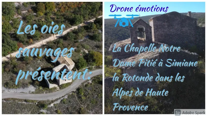
Simiane la Rotonde, Notre Dame de Pitié chapel
No reviews yet
Have you flown here? Share your experience with other pilots.
+ Write the first reviewDescription
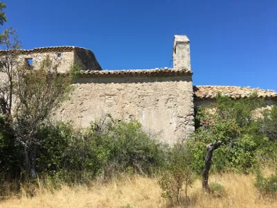
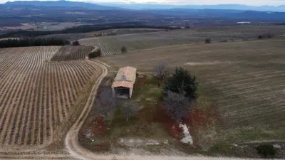
Data What is there to say about this building? The date 1635 is carved on its lintel, but this is only a repair, as the archives suggest it is much older. It is first described in a 1859 text as being located outside the walls, in the Moulins district. An 1906 inventory then states that the chapel was built by the Pélissier des Granges family, who had established their burial place there. Finally, another document mentions an old text by Abbé Corriol, which provides a notarial deed dated 1573 and estimates that it dates back to the 16th century.
There was indeed a Jean Pélissier, born around 1566 in Simiane and died in 1628, who was bishop of Apt from 1607 until his death. The chapel could therefore have belonged to his family. The function of the remains of the adjoining building is unknown, but one of the stones of its doorway jambs is cut in a curve, indicating the reuse of an old arched door.
Further along the path stand three more windmills, two of which are in ruins and the third, on private land, has been fully restored.
Map and restricted areas
Open in the main mapNearby aerodromes
Open aerodromes within 25 km of the spot, heliports included, with their distance and direction from the spot. Near an aerodrome, drone flying is prohibited or height-limited: check the UAS zones map.
| Aerodrome | Type | Distance | Elevation | Difference |
|---|---|---|---|---|
| Altisurface de Banon | Aerodrome | 12 km NE | 1,135 m | spot 377 m lower |
| Saint Martin de Castillon | Aerodrome | 14 km S | 335 m | spot 423 m higher |
| Hôtel La Coquillade Heliport | Heliport | 22 km SW | 249 m | spot 509 m higher |
Aviation weather (METAR and TAF)
No METAR station within 50 km.
Weather and Kp index
Sunrise and sunset
| Day | Dawn | Sunrise | Golden hour | Sunset | Dusk | Day length |
|---|---|---|---|---|---|---|
| Sat 21 Nov | 07:09 | 07:40 | 07:40–08:25 · 16:22–17:07 | 17:07 | 17:38 | 9 h 26 |
| Sun 22 Nov | 07:10 | 07:42 | 07:42–08:26 · 16:21–17:06 | 17:06 | 17:38 | 9 h 24 |
| Mon 23 Nov | 07:11 | 07:43 | 07:43–08:28 · 16:20–17:05 | 17:05 | 17:37 | 9 h 22 |
| Tue 24 Nov | 07:12 | 07:44 | 07:44–08:29 · 16:20–17:05 | 17:05 | 17:37 | 9 h 20 |
| Wed 25 Nov | 07:13 | 07:45 | 07:45–08:31 · 16:19–17:04 | 17:04 | 17:36 | 9 h 18 |
| Thu 26 Nov | 07:15 | 07:47 | 07:47–08:32 · 16:18–17:04 | 17:04 | 17:35 | 9 h 17 |
| Fri 27 Nov | 07:16 | 07:48 | 07:48–08:33 · 16:17–17:03 | 17:03 | 17:35 | 9 h 15 |



Reviews
Log in to review this spot. Log in · Create a free account
No reviews yet. Share yours!