

Etang de la Bonde
No reviews yet
Have you flown here? Share your experience with other pilots.
+ Write the first reviewDescription
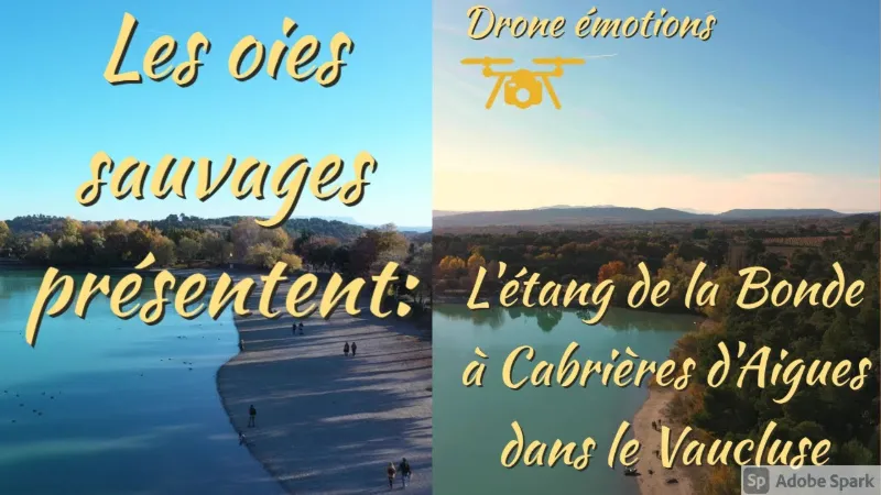
A favorite of the Luberon locals for swimming and fishing!
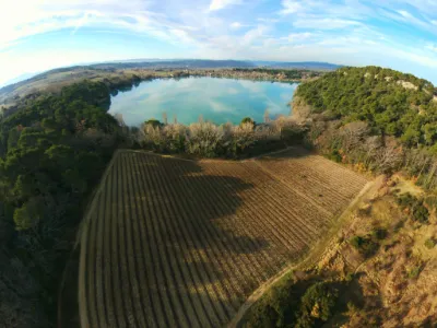
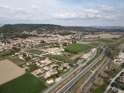
The Étang de la Bonde, in a wooded and naturally green setting, welcomes you for walks and water fun.
A bit of history:
Lord Fouquet d'Agoult, baron of Sault and chamberlain to King René of Anjou, Count of Provence, decided to create a water reserve for the château of La Tour d'Aigues and had an aqueduct built in the 15th century. The pond created in this way was the supply point of an irrigation network that fed the whole Aigues valley, contributing to the expansion of agriculture.
Good to know:
The Étang de la Bonde is open for swimming all year round but is not supervised. Note that depending on the intensity of rainfall and the flow of the Eze during winter, the pond's level varies from season to season. It is not unusual for the beaches to be submerged (2010) or, on the contrary, for the water level to be very low throughout the summer.
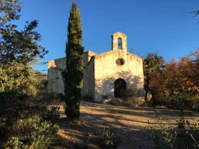
Entry to this beach's parking lot is paid during the summer period, but you can park freely near the south dike in the lake restaurant's parking lot (now closed). Another access is possible on the east side of the lake past the château; it can also take you to the little village of Cabrières d'Aigues (3 km).
An outdoor snack bar and a refreshment stand, next to the campsite, are open in high season. Four tennis courts are available all year round.
Quiet off-season and great for walks among the Aleppo pines lining the pond, this place is very popular as soon as the good weather arrives. Note that boating is prohibited (canoeing, windsurfing) as well as all other watercraft.
Traditionally, locals come here for family picnics on weekends in the shade of the trees along the west beach. Major tree felling and pruning work has been carried out along the banks next to the campsite, giving this beach sunny areas until the evening again.
Why not take advantage of the natural space the Étang de la Bonde offers and come fishing with family or friends? Fishing license required. The site will delight you with its beauty and tranquility.
Map and restricted areas
Open in the main mapNearby aerodromes
Open aerodromes within 25 km of the spot, heliports included, with their distance and direction from the spot. Near an aerodrome, drone flying is prohibited or height-limited: check the UAS zones map.
| Aerodrome | Type | Distance | Elevation | Difference |
|---|---|---|---|---|
| Saint Martin de Castillon | Aerodrome | 10 km N | 335 m | spot 17 m higher |
| Hôtel La Coquillade Heliport | Heliport | 20 km NW | 249 m | spot 103 m higher |
| Saint Suffren private UL strip | Aerodrome | 21 km SW | 270 m | spot 82 m higher |
| Aérodrome de Vinon | Aerodrome | 22 km E | 275 m | spot 77 m higher |
Aviation weather (METAR and TAF)
LFMY – Salon-de-Provence (BA 701) Air Base VFR
METAR
METAR LFMY 210630Z AUTO 00000KT CAVOK 04/04 Q1020
- Wind
- Calm
- Visibility
- 10 km or more
- Clouds
- –
- Temperature
- 4 °C, dew point 4 °C
- QNH
- 1020 hPa
- Flight category
- VFR: ceiling > 3,000 ft and visibility > 5 mi
TAF
Weather and Kp index
Sunrise and sunset
| Day | Dawn | Sunrise | Golden hour | Sunset | Dusk | Day length |
|---|---|---|---|---|---|---|
| Sat 21 Nov | 07:09 | 07:40 | 07:40–08:24 · 16:23–17:08 | 17:08 | 17:39 | 9 h 27 |
| Sun 22 Nov | 07:10 | 07:41 | 07:41–08:26 · 16:22–17:07 | 17:07 | 17:38 | 9 h 25 |
| Mon 23 Nov | 07:11 | 07:42 | 07:42–08:27 · 16:22–17:06 | 17:06 | 17:38 | 9 h 23 |
| Tue 24 Nov | 07:12 | 07:44 | 07:44–08:29 · 16:21–17:06 | 17:06 | 17:37 | 9 h 21 |
| Wed 25 Nov | 07:13 | 07:45 | 07:45–08:30 · 16:20–17:05 | 17:05 | 17:37 | 9 h 20 |
| Thu 26 Nov | 07:14 | 07:46 | 07:46–08:31 · 16:19–17:04 | 17:04 | 17:36 | 9 h 18 |
| Fri 27 Nov | 07:15 | 07:47 | 07:47–08:33 · 16:19–17:04 | 17:04 | 17:36 | 9 h 16 |


Reviews
Log in to review this spot. Log in · Create a free account
No reviews yet. Share yours!