

Montfort, the Chapelle Saint Donat
No reviews yet
Have you flown here? Share your experience with other pilots.
+ Write the first reviewDescription
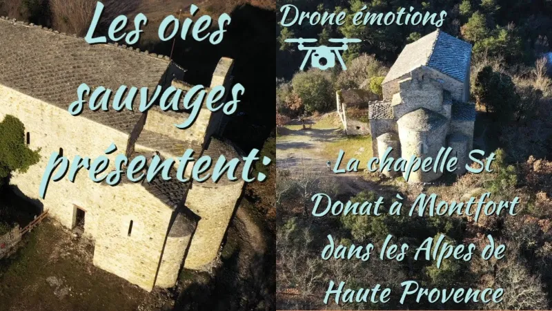
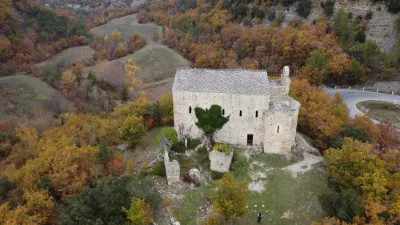
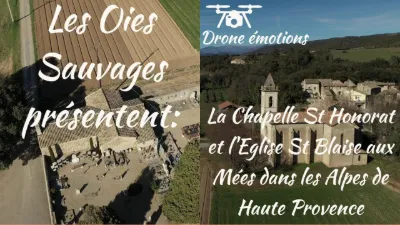
On the road to Mallefougasse, the Chapelle Saint-Donat is typical of early Provençal Romanesque art. This Romanesque church with its pared-down architecture is one of the oldest in France and one of the oldest medieval buildings in Haute Provence.
You catch sight of it around a bend when you are heading to Châteauneuf Val Saint-Donat or to Mallefougasse. Built on a hillock in a wild setting, it commands attention with the balance of its volumes and the majesty of its lines.
It was built around the year 1040 and shows all the characteristics of early southern Romanesque buildings. This church is a witness to the oldest medieval architecture, which has no equivalent anywhere else in Provence.
It is a church with a basilica plan, made up of a large, tall nave flanked by narrow side aisles and a low transept opening onto three apses.
It is built of roughly squared rubble stone, where only the arches, the jambs and the corner quoins are carefully dressed.
Long used as a sheepfold and as a dwelling, it was on the verge of collapse when, in 1970, a Preservation Committee undertook its restoration under the supervision of the Monuments Historiques. The work ended in the 1980s. The building is a listed Monument Historique.
Map and restricted areas
Open in the main mapNearby aerodromes
Open aerodromes within 25 km of the spot, heliports included, with their distance and direction from the spot. Near an aerodrome, drone flying is prohibited or height-limited: check the UAS zones map.
| Aerodrome | Type | Distance | Elevation | Difference |
|---|---|---|---|---|
| Aérodrome de Château-Arnoux - Saint-Auban | Aerodrome | 4.0 km E | 460 m | spot 17 m higher |
| Altisurface de Banon | Aerodrome | 24 km W | 1,135 m | spot 658 m lower |
Aviation weather (METAR and TAF)
No METAR station within 50 km.
Weather and Kp index
Sunrise and sunset
| Day | Dawn | Sunrise | Golden hour | Sunset | Dusk | Day length |
|---|---|---|---|---|---|---|
| Sat 21 Nov | 07:08 | 07:39 | 07:39–08:24 · 16:20–17:05 | 17:05 | 17:37 | 9 h 26 |
| Sun 22 Nov | 07:09 | 07:40 | 07:40–08:25 · 16:20–17:04 | 17:04 | 17:36 | 9 h 24 |
| Mon 23 Nov | 07:10 | 07:42 | 07:42–08:27 · 16:19–17:04 | 17:04 | 17:35 | 9 h 22 |
| Tue 24 Nov | 07:11 | 07:43 | 07:43–08:28 · 16:18–17:03 | 17:03 | 17:35 | 9 h 20 |
| Wed 25 Nov | 07:12 | 07:44 | 07:44–08:29 · 16:17–17:02 | 17:02 | 17:34 | 9 h 18 |
| Thu 26 Nov | 07:13 | 07:45 | 07:45–08:31 · 16:16–17:02 | 17:02 | 17:34 | 9 h 16 |
| Fri 27 Nov | 07:14 | 07:46 | 07:46–08:32 · 16:16–17:01 | 17:01 | 17:33 | 9 h 14 |


Reviews
Log in to review this spot. Log in · Create a free account
No reviews yet. Share yours!