

Lac de Sainte-Croix - Les Salles-sur-Verdon
No reviews yet
Have you flown here? Share your experience with other pilots.
+ Write the first reviewDescription
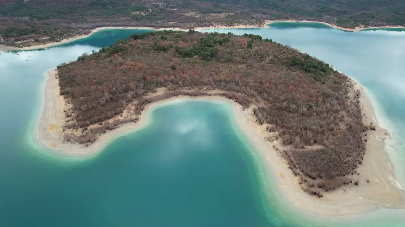
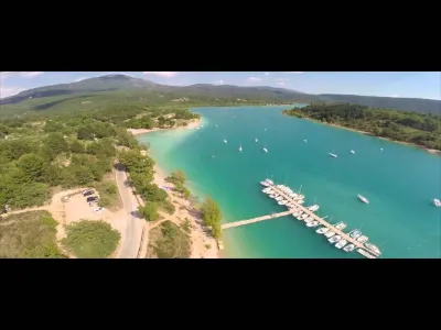
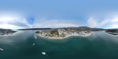
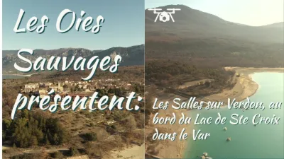
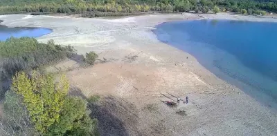
Lac de Sainte-Croix - Les Salles-sur-Verdon - Gorges du Verdon - Drone 4K/UHD - December 2021
The project of flooding the Salles valley to create a lake is nothing new. In 1908, Georges Clemenceau, then President of the Council, set out on a donkey-back trek along the whole course of the Verdon between Fontaine-l'Évêque and Lac d'Allos: even then, they were considering developing the Verdon and building dams at certain strategic points along its course.
The project was put on hold because of the twists of history, without being completely abandoned. Between the two wars, the Schneider company was in charge of building the dam, which remained only a project.
Events moved quickly from 1962.
The chosen project was to create a "big lake" up to the 500 level. Besides Les Salles-sur-Verdon, located at the bottom of the valley, it would have flooded the village of Bauduen, while Sainte-Croix-du-Verdon would have become uninhabitable.
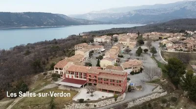
Because of the Vaucluse-type resurgence of the Fontaine L'Évêque, there was a risk that this "big lake" would drain through a siphon effect. In addition, the determination of the expropriated residents of the three villages most affected by the project did not weaken. At the end of 1968, the level chosen for the future lake was lowered to 482. The villages of Sainte-Croix and Bauduen were saved, and Les-Salles-sur-Verdon was the only village condemned by the filling of the future lake.
The dam was first filled in August 1973, and the final filling took place on November 15, 1973.
Map and restricted areas
Open in the main mapNearby aerodromes
Open aerodromes within 25 km of the spot, heliports included, with their distance and direction from the spot. Near an aerodrome, drone flying is prohibited or height-limited: check the UAS zones map.
| Aerodrome | Type | Distance | Elevation | Difference |
|---|---|---|---|---|
| Puimoisson Airfield | Aerodrome | 11 km N | 769 m | spot 261 m lower |
| Col de Lèques | Aerodrome | 23 km NE | 1,126 m | spot 618 m lower |
Aviation weather (METAR and TAF)
LFMC – Le Luc-Le Cannet Airport VFR
METAR
METAR LFMC 211100Z AUTO 26011KT CAVOK 17/06 Q1018
- Wind
- 260°, 20 km/h
- Visibility
- 10 km or more
- Clouds
- –
- Temperature
- 17 °C, dew point 6 °C
- QNH
- 1018 hPa
- Flight category
- VFR: ceiling > 3,000 ft and visibility > 5 mi
TAF
Weather and Kp index
| Day | Weather | Temp. min. / max. | Wind | Rain | Max Kp |
|---|---|---|---|---|---|
| Sat 21 Nov | Fair | 7° / 14° | 15 km/h W | – | 2 |
| Sun 22 Nov | Showers | 6° / 12° | 31 km/h NW | 15 mm | 2 |
| Mon 23 Nov | Partly cloudy | 4° / 10° | 37 km/h NW | – | 4 |
| Tue 24 Nov | Cloudy | 3° / 12° | 16 km/h SE | 0.4 mm | 2 |
| Wed 25 Nov | Light rain | 6° / 8° | 33 km/h E | 16 mm | – |
| Thu 26 Nov | Fair | 2° / 9° | 8 km/h N | 14 mm | – |
| Fri 27 Nov | Clear sky | 2° / 10° | 4 km/h NE | – | – |
Hour by hour: Saturday 21 November
| Time | Weather | Temp. | Wind | Rain | Clouds | Kp |
|---|---|---|---|---|---|---|
| 12:00 | Fair | 13° | 14 km/h NW | – | 35 % | 2 |
| 13:00 | Fair | 13° | 14 km/h NW | – | 20 % | 1 |
| 14:00 | Fair | 14° | 15 km/h W | – | 34 % | 1 |
| 15:00 | Partly cloudy | 13° | 15 km/h W | – | 59 % | 1 |
| 16:00 | Partly cloudy | 12° | 13 km/h W | – | 69 % | 2 |
| 17:00 | Partly cloudy | 9° | 8 km/h W | – | 75 % | 2 |
| 18:00 | Partly cloudy | 8° | 7 km/h W | – | 69 % | 2 |
| 19:00 | Partly cloudy | 8° | 7 km/h NE | – | 86 % | 2 |
| 20:00 | Partly cloudy | 7° | 6 km/h E | – | 91 % | 2 |
| 21:00 | Partly cloudy | 7° | 7 km/h E | – | 67 % | 2 |
| 22:00 | Cloudy | 7° | 7 km/h E | – | 99 % | 2 |
Hour by hour: Sunday 22 November
| Time | Weather | Temp. | Wind | Rain | Clouds | Kp |
|---|---|---|---|---|---|---|
| 06:00 | Rain | 11° | 20 km/h SE | 0.8 mm | 100 % | 2 |
| 07:00 | Heavy rain | 12° | 21 km/h SE | 1.2 mm | 100 % | 2 |
| 08:00 | Heavy rain | 12° | 20 km/h SE | 3.1 mm | 100 % | 2 |
| 09:00 | Heavy rain | 11° | 16 km/h S | 1.8 mm | 100 % | 2 |
| 10:00 | Rain | 11° | 14 km/h SW | 0.4 mm | 100 % | 2 |
| 11:00 | Fog | 12° | 26 km/h W | – | 100 % | 2 |
| 12:00 | Light rain | 11° | 27 km/h W | 0.3 mm | 99 % | 2 |
| 13:00 | Showers | 11° | 28 km/h W | 0.2 mm | 29 % | 2 |
| 14:00 | Showers | 12° | 30 km/h NW | 0.5 mm | 57 % | 2 |
| 15:00 | Showers | 12° | 31 km/h NW | 0.2 mm | 36 % | 2 |
| 16:00 | Showers | 11° | 29 km/h NW | 0.5 mm | 25 % | 2 |
| 17:00 | Showers | 9° | 27 km/h NW | 0.2 mm | 44 % | 2 |
| 18:00 | Showers | 8° | 23 km/h NW | 0.1 mm | 23 % | 2 |
| 19:00 | Showers | 8° | 24 km/h W | 0.2 mm | 30 % | 2 |
| 20:00 | Fair | 7° | 24 km/h W | – | 31 % | 2 |
| 21:00 | Showers | 6° | 25 km/h W | 0.2 mm | 34 % | 2 |
| 22:00 | Partly cloudy | 6° | 26 km/h NW | – | 44 % | 2 |
Sunrise and sunset
| Day | Dawn | Sunrise | Golden hour | Sunset | Dusk | Day length |
|---|---|---|---|---|---|---|
| Sat 21 Nov | 07:06 | 07:37 | 07:37–08:22 · 16:20–17:05 | 17:05 | 17:36 | 9 h 27 |
| Sun 22 Nov | 07:07 | 07:38 | 07:38–08:23 · 16:20–17:04 | 17:04 | 17:36 | 9 h 25 |
| Mon 23 Nov | 07:08 | 07:40 | 07:40–08:24 · 16:19–17:03 | 17:03 | 17:35 | 9 h 23 |
| Tue 24 Nov | 07:09 | 07:41 | 07:41–08:26 · 16:18–17:03 | 17:03 | 17:34 | 9 h 21 |
| Wed 25 Nov | 07:10 | 07:42 | 07:42–08:27 · 16:17–17:02 | 17:02 | 17:34 | 9 h 20 |
| Thu 26 Nov | 07:12 | 07:43 | 07:43–08:28 · 16:16–17:02 | 17:02 | 17:33 | 9 h 18 |
| Fri 27 Nov | 07:13 | 07:44 | 07:44–08:30 · 16:16–17:01 | 17:01 | 17:33 | 9 h 16 |

Reviews
Log in to review this spot. Log in · Create a free account
No reviews yet. Share yours!