

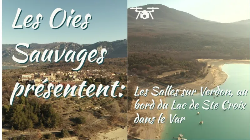
Les Salles sur Verdon
No reviews yet
Have you flown here? Share your experience with other pilots.
+ Write the first reviewDescription
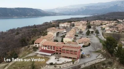
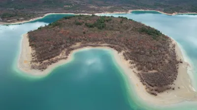
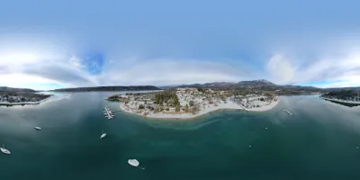
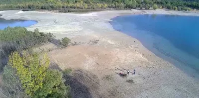
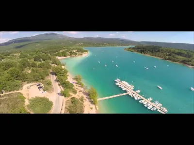
LES SALLES SUR VERDON When you arrive in Les Salles-sur-Verdon, you will quickly notice that it is a village with recent buildings, as the old village lies under the lake. Indeed, when the dam was built, the village of Les Salles sur Verdon was moved and rebuilt at its current location in the early 1970s. The new village has a few shops and restaurants, some of which offer a superb view of Lake Sainte Croix, ideal for a candlelit dinner on summer evenings with your partner. Swimmers will find a large beach at the bottom of the village, which can be reached on foot from the village's main square (not recommended for strollers) or by car, with parking available and a shaded picnic area, but you will have to get up early to enjoy the only table (!). Opposite the village is the island of Coste-Belle. You can cross over by pedal boat or kayak, available for rent on the beach. Les Salles is ideally located between Aups, Moustiers Sainte Marie and Aiguines with its panorama. The many rental options (campsites, etc.) make the village a very good base for visiting the Verdon. Les Salles is one of the three villages bordering Lake Sainte Croix, along with Bauduen and Sainte Croix du Verdon.
Map and restricted areas
Open in the main mapNearby aerodromes
Open aerodromes within 25 km of the spot, heliports included, with their distance and direction from the spot. Near an aerodrome, drone flying is prohibited or height-limited: check the UAS zones map.
| Aerodrome | Type | Distance | Elevation | Difference |
|---|---|---|---|---|
| Puimoisson Airfield | Aerodrome | 12 km N | 769 m | spot 286 m lower |
| Col de Lèques | Aerodrome | 23 km NE | 1,126 m | spot 643 m lower |
Aviation weather (METAR and TAF)
LFMC – Le Luc-Le Cannet Airport VFR
METAR
METAR LFMC 210730Z AUTO 27013KT CAVOK 12/05 Q1018
- Wind
- 270°, 24 km/h
- Visibility
- 10 km or more
- Clouds
- –
- Temperature
- 12 °C, dew point 5 °C
- QNH
- 1018 hPa
- Flight category
- VFR: ceiling > 3,000 ft and visibility > 5 mi
TAF
Weather and Kp index
| Day | Weather | Temp. min. / max. | Wind | Rain | Max Kp |
|---|---|---|---|---|---|
| Sat 21 Nov | Fair | 6° / 13° | 22 km/h N | – | 2 |
| Sun 22 Nov | Showers | 6° / 12° | 31 km/h NW | 15 mm | 2 |
| Mon 23 Nov | Partly cloudy | 4° / 10° | 37 km/h NW | – | 4 |
| Tue 24 Nov | Cloudy | 2° / 12° | 16 km/h SE | 0.4 mm | 2 |
| Wed 25 Nov | Light rain | 6° / 7° | 33 km/h E | 16 mm | – |
| Thu 26 Nov | Fair | 2° / 8° | 8 km/h N | 14 mm | – |
| Fri 27 Nov | Clear sky | 1° / 10° | 4 km/h NE | – | – |
Hour by hour: Saturday 21 November
| Time | Weather | Temp. | Wind | Rain | Clouds | Kp |
|---|---|---|---|---|---|---|
| 09:00 | Partly cloudy | 9° | 22 km/h N | – | 100 % | 2 |
| 10:00 | Cloudy | 10° | 18 km/h N | – | 97 % | 2 |
| 11:00 | Partly cloudy | 12° | 16 km/h NW | – | 68 % | 2 |
| 12:00 | Fair | 13° | 14 km/h NW | – | 35 % | 2 |
| 13:00 | Fair | 13° | 14 km/h NW | – | 20 % | 1 |
| 14:00 | Fair | 13° | 15 km/h W | – | 34 % | 1 |
| 15:00 | Partly cloudy | 13° | 15 km/h W | – | 59 % | 1 |
| 16:00 | Partly cloudy | 12° | 13 km/h W | – | 69 % | 2 |
| 17:00 | Partly cloudy | 9° | 8 km/h W | – | 75 % | 2 |
| 18:00 | Partly cloudy | 8° | 7 km/h W | – | 69 % | 2 |
| 19:00 | Partly cloudy | 7° | 7 km/h NE | – | 86 % | 2 |
| 20:00 | Partly cloudy | 7° | 6 km/h E | – | 91 % | 2 |
| 21:00 | Partly cloudy | 7° | 7 km/h E | – | 67 % | 2 |
| 22:00 | Cloudy | 6° | 7 km/h E | – | 99 % | 2 |
Hour by hour: Sunday 22 November
| Time | Weather | Temp. | Wind | Rain | Clouds | Kp |
|---|---|---|---|---|---|---|
| 06:00 | Rain | 11° | 20 km/h SE | 0.8 mm | 100 % | 2 |
| 07:00 | Heavy rain | 11° | 21 km/h SE | 1.2 mm | 100 % | 2 |
| 08:00 | Heavy rain | 11° | 20 km/h SE | 3.1 mm | 100 % | 2 |
| 09:00 | Heavy rain | 11° | 16 km/h S | 1.8 mm | 100 % | 2 |
| 10:00 | Rain | 11° | 14 km/h SW | 0.4 mm | 100 % | 2 |
| 11:00 | Fog | 11° | 26 km/h W | – | 100 % | 2 |
| 12:00 | Light rain | 11° | 27 km/h W | 0.3 mm | 99 % | 2 |
| 13:00 | Showers | 10° | 28 km/h W | 0.2 mm | 29 % | 2 |
| 14:00 | Showers | 12° | 30 km/h NW | 0.5 mm | 57 % | 2 |
| 15:00 | Showers | 11° | 31 km/h NW | 0.2 mm | 36 % | 2 |
| 16:00 | Showers | 10° | 29 km/h NW | 0.5 mm | 25 % | 2 |
| 17:00 | Showers | 9° | 27 km/h NW | 0.2 mm | 44 % | 2 |
| 18:00 | Showers | 8° | 23 km/h NW | 0.1 mm | 23 % | 2 |
| 19:00 | Showers | 7° | 24 km/h W | 0.2 mm | 30 % | 2 |
| 20:00 | Fair | 7° | 24 km/h W | – | 31 % | 2 |
| 21:00 | Showers | 6° | 25 km/h W | 0.2 mm | 34 % | 2 |
| 22:00 | Partly cloudy | 6° | 26 km/h NW | – | 44 % | 2 |
Sunrise and sunset
| Day | Dawn | Sunrise | Golden hour | Sunset | Dusk | Day length |
|---|---|---|---|---|---|---|
| Sat 21 Nov | 07:06 | 07:37 | 07:37–08:22 · 16:20–17:05 | 17:05 | 17:36 | 9 h 27 |
| Sun 22 Nov | 07:07 | 07:38 | 07:38–08:23 · 16:20–17:04 | 17:04 | 17:36 | 9 h 25 |
| Mon 23 Nov | 07:08 | 07:40 | 07:40–08:24 · 16:19–17:03 | 17:03 | 17:35 | 9 h 23 |
| Tue 24 Nov | 07:09 | 07:41 | 07:41–08:26 · 16:18–17:03 | 17:03 | 17:34 | 9 h 21 |
| Wed 25 Nov | 07:10 | 07:42 | 07:42–08:27 · 16:17–17:02 | 17:02 | 17:34 | 9 h 20 |
| Thu 26 Nov | 07:11 | 07:43 | 07:43–08:28 · 16:16–17:02 | 17:02 | 17:33 | 9 h 18 |
| Fri 27 Nov | 07:13 | 07:44 | 07:44–08:30 · 16:16–17:01 | 17:01 | 17:33 | 9 h 16 |

Reviews
Log in to review this spot. Log in · Create a free account
No reviews yet. Share yours!