

Le Dramont & L'Île d'Or
No reviews yet
Have you flown here? Share your experience with other pilots.
+ Write the first reviewDescription
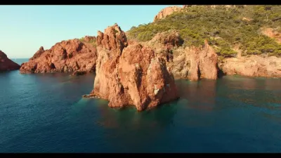
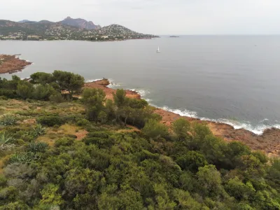
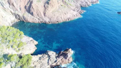
Le Dramont & L'Île d'Or - Massif de l'Esterel - Saint Raphael - Drone 4K/UHD - December 2021
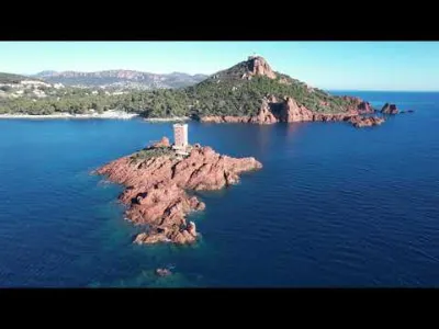
Le Dramont is one of the emblematic places of the commune of Saint Raphael. Its most precious pearl: L'Île d'Or.
Île d'Or, privately owned since 1897, was claimed as the "kingdom" of its first owner, who had this sublime crenellated tower built there from red Esterel stone.
The large Dramont beach, or Landing Beach, still bears traces of recent history: it was indeed one of the main Allied landing sites in Provence. More than 20,000 GIs of the 36th Division from Texas landed there with armored vehicles and heavy artillery on August 15, 1944.
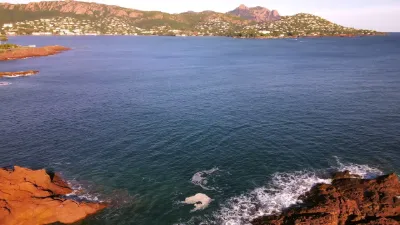
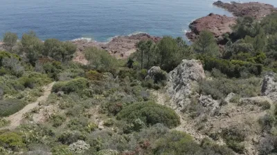
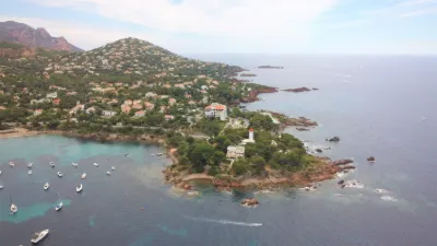
Another remarkable site: Cap Dramont, an integral part of the Esterel state forest, accessible via the coastal path. At its foot, peaceful and picturesque, lie the small fishing port of Poussaï and a very pleasant little beach, both rocky and wooded, one of the curiosities of the bay of Agay.
At its summit still stands the Sémaphore, built in 1860 on the ruins of a 16th-century watchtower! Sea surveillance is still active there, both for the safety of sailors and for pollution control.
Lac du Dramont is also the place for water sports. Facilities have been set up on the artificial lake covering former quarries, so that everyone can come and spend good family time there.
Map and restricted areas
Open in the main mapNearby aerodromes
Open aerodromes within 25 km of the spot, heliports included, with their distance and direction from the spot. Near an aerodrome, drone flying is prohibited or height-limited: check the UAS zones map.
| Aerodrome | Type | Distance | Elevation | Difference |
|---|---|---|---|---|
| Hôpital Bonnet Heliport | Heliport | 8.9 km W | 21 m | spot 85 m higher |
| Cannes-Mandelieu Airport | Airport | 16 km NE | 4 m | spot 102 m higher |
| Quai Du Large Heliport | Heliport | 19 km NE | 3 m | spot 103 m higher |
| Croisette Heliport | Heliport | 20 km NE | 0 m | spot 106 m higher |
| Hôpital Clavary Heliport | Heliport | 23 km N | 168 m | spot 62 m lower |
Aviation weather (METAR and TAF)
LFMD – Cannes-Mandelieu Airport VFR
METAR
METAR LFMD 211030Z AUTO 12006KT 070V160 CAVOK 17/07 Q1016 BECMG 26010G20KT
- Wind
- 120°, 11 km/h
- Visibility
- 10 km or more
- Clouds
- –
- Temperature
- 17 °C, dew point 7 °C
- QNH
- 1016 hPa
- Flight category
- VFR: ceiling > 3,000 ft and visibility > 5 mi
TAF
TAF LFMD 210800Z 2109/2209 26010G20KT CAVOK PROB30 TEMPO 2109/2111 VRB02KT BECMG 2120/2122 VRB02KT TEMPO 2122/2209 4000 RA BKN010 SCT030TCU
| Period (local time) | Change | Wind | Visibility | Weather | Clouds |
|---|---|---|---|---|---|
| 21/11 10:00 → 21/11 21:00 | Initial conditions | 260°, 19 km/h, gusts 37 km/h | 10 km or more | No significant weather | No significant cloud |
| 21/11 10:00 → 21/11 12:00 | Temporarily, probability 30% | Variable, 4 km/h | |||
| 21/11 21:00 → 22/11 10:00 | Becoming | Variable, 4 km/h | 10 km or more | No significant weather | No significant cloud |
| 21/11 23:00 → 22/11 10:00 | Temporarily | 4.0 km | Rain | Broken (5-7/8) at 1,000 ft (300 m) ; Scattered (3-4/8) at 3,000 ft (910 m) (towering cumulus) |
Weather and Kp index
| Day | Weather | Temp. min. / max. | Wind | Rain | Max Kp |
|---|---|---|---|---|---|
| Sat 21 Nov | Fair | 9° / 17° | 40 km/h W | – | 2 |
| Sun 22 Nov | Partly cloudy | 10° / 17° | 55 km/h W | 11 mm | 2 |
| Mon 23 Nov | Clear sky | 7° / 16° | 56 km/h W | – | 4 |
| Tue 24 Nov | Cloudy | 7° / 14° | 23 km/h E | 1.1 mm | 2 |
| Wed 25 Nov | Rain | 10° / 11° | 32 km/h E | 17 mm | – |
| Thu 26 Nov | Cloudy | 8° / 12° | 12 km/h NE | 13 mm | – |
| Fri 27 Nov | Clear sky | 4° / 12° | 6 km/h W | – | – |
Hour by hour: Saturday 21 November
| Time | Weather | Temp. | Wind | Rain | Clouds | Kp |
|---|---|---|---|---|---|---|
| 12:00 | Partly cloudy | 16° | 36 km/h W | – | 62 % | 2 |
| 13:00 | Fair | 17° | 38 km/h W | – | 27 % | 1 |
| 14:00 | Clear sky | 17° | 40 km/h W | – | 12 % | 1 |
| 15:00 | Partly cloudy | 17° | 39 km/h W | – | 51 % | 1 |
| 16:00 | Fair | 17° | 35 km/h W | – | 28 % | 2 |
| 17:00 | Partly cloudy | 15° | 33 km/h W | – | 44 % | 2 |
| 18:00 | Partly cloudy | 14° | 31 km/h W | – | 62 % | 2 |
| 19:00 | Partly cloudy | 12° | 26 km/h W | – | 68 % | 2 |
| 20:00 | Partly cloudy | 11° | 21 km/h W | – | 56 % | 2 |
| 21:00 | Partly cloudy | 10° | 18 km/h W | – | 43 % | 2 |
| 22:00 | Cloudy | 9° | 17 km/h W | – | 98 % | 2 |
Hour by hour: Sunday 22 November
| Time | Weather | Temp. | Wind | Rain | Clouds | Kp |
|---|---|---|---|---|---|---|
| 06:00 | Heavy rain | 11° | 20 km/h N | 1.8 mm | 93 % | 2 |
| 07:00 | Heavy rain | 11° | 21 km/h NE | 1.2 mm | 100 % | 2 |
| 08:00 | Heavy rain | 11° | 19 km/h NE | 1.8 mm | 100 % | 2 |
| 09:00 | Heavy rain | 11° | 18 km/h NE | 2.0 mm | 100 % | 2 |
| 10:00 | Rain | 12° | 14 km/h N | 0.6 mm | 98 % | 2 |
| 11:00 | Showers | 13° | 10 km/h W | 0.2 mm | 65 % | 2 |
| 12:00 | Partly cloudy | 15° | 37 km/h W | – | 75 % | 2 |
| 13:00 | Partly cloudy | 17° | 45 km/h W | – | 72 % | 2 |
| 14:00 | Clear sky | 17° | 48 km/h W | – | 6 % | 2 |
| 15:00 | Fair | 17° | 50 km/h W | – | 14 % | 2 |
| 16:00 | Fair | 16° | 46 km/h W | – | 17 % | 2 |
| 17:00 | Clear sky | 15° | 45 km/h W | – | 7 % | 2 |
| 18:00 | Fair | 14° | 42 km/h W | – | 18 % | 2 |
| 19:00 | Clear sky | 13° | 46 km/h W | – | 12 % | 2 |
| 20:00 | Fair | 13° | 49 km/h W | – | 20 % | 2 |
| 21:00 | Fair | 12° | 50 km/h W | – | 32 % | 2 |
| 22:00 | Partly cloudy | 12° | 51 km/h W | – | 41 % | 2 |
Sunrise and sunset
| Day | Dawn | Sunrise | Golden hour | Sunset | Dusk | Day length |
|---|---|---|---|---|---|---|
| Sat 21 Nov | 07:02 | 07:34 | 07:34–08:18 · 16:19–17:03 | 17:03 | 17:34 | 9 h 29 |
| Sun 22 Nov | 07:04 | 07:35 | 07:35–08:19 · 16:18–17:03 | 17:03 | 17:34 | 9 h 27 |
| Mon 23 Nov | 07:05 | 07:36 | 07:36–08:20 · 16:18–17:02 | 17:02 | 17:33 | 9 h 25 |
| Tue 24 Nov | 07:06 | 07:37 | 07:37–08:22 · 16:17–17:01 | 17:01 | 17:33 | 9 h 24 |
| Wed 25 Nov | 07:07 | 07:38 | 07:38–08:23 · 16:16–17:01 | 17:01 | 17:32 | 9 h 22 |
| Thu 26 Nov | 07:08 | 07:40 | 07:40–08:24 · 16:15–17:00 | 17:00 | 17:32 | 9 h 20 |
| Fri 27 Nov | 07:09 | 07:41 | 07:41–08:26 · 16:15–17:00 | 17:00 | 17:31 | 9 h 18 |
Reviews
Log in to review this spot. Log in · Create a free account
No reviews yet. Share yours!