

Tatihou Island
No reviews yet
Have you flown here? Share your experience with other pilots.
+ Write the first reviewDescription
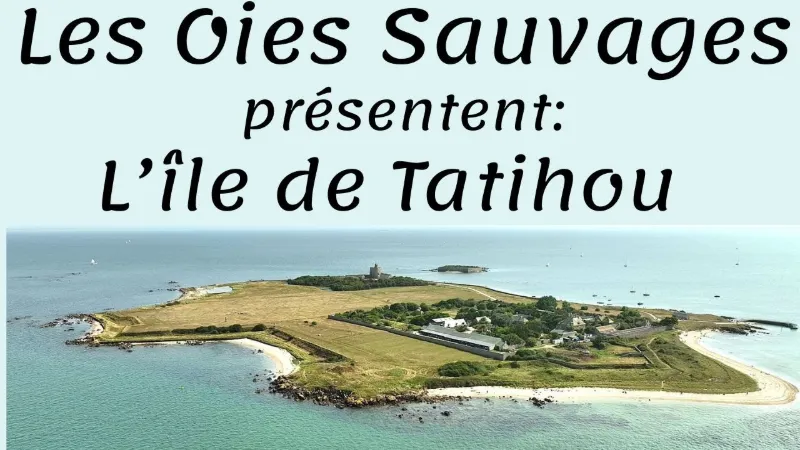
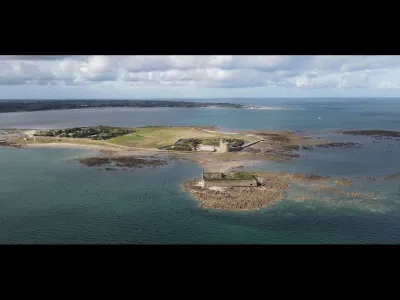
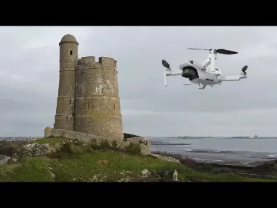
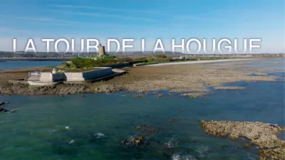
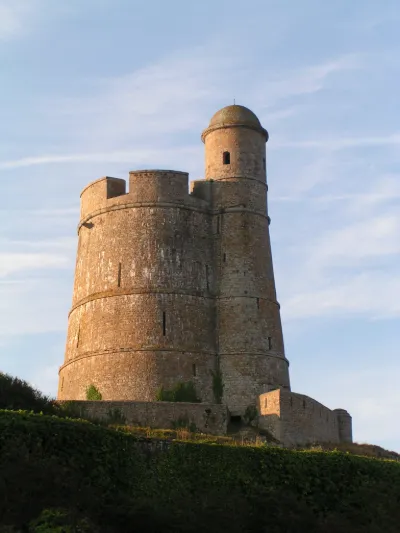
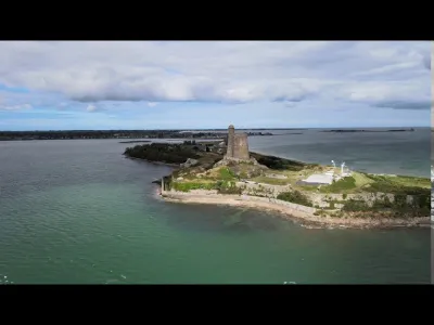
The small island of Tatihou, a true bird-watchers' paradise, becomes a peninsula at low tide, and is always accessible by amphibious boat. The island is dominated by the Vauban tower and its fortifications. The granite walls and slate roofs of the houses blend harmoniously into the colors of the coast, its dunes and its rocks lashed by sea spray. To reach the island, hop aboard the amphibious boat! At low tide, it threads its way between the oyster beds. At high tide, it links the jetties of Tatihou and Saint-Vaast in just a few minutes. Another option: walk to the island at low tide. Places and events not to miss on Tatihou Visit the maritime museum and discover the archaeological collections on the wrecks of the royal fleet, sunk during the Battle of La Hougue in 1692. The museum also has collections presenting the island, the secrets of its formation, and its fauna and flora. Stroll through the gardens of Tatihou: the wind from the open sea is a constant assault on the island's endemic flora. So the idea came to protect the gardens between dikes and low walls. Climb the Vauban Tower: 20m in diameter, it rises to 21m high and offers a magnificent view of the island and the coastline. Like its twin in Saint Vaast, it is UNESCO-listed. In summer, take part in the festival of music from the open sea, an off-the-beaten-path event: Les Traversées Tatihou
Map and restricted areas
Open in the main mapNearby aerodromes
Open aerodromes within 25 km of the spot, heliports included, with their distance and direction from the spot. Near an aerodrome, drone flying is prohibited or height-limited: check the UAS zones map.
| Aerodrome | Type | Distance | Elevation | Difference |
|---|---|---|---|---|
| Cherbourg-Maupertus Airport | Airport | 18 km NW | 140 m | spot 136 m lower |
Aviation weather (METAR and TAF)
LFRC – Cherbourg-Maupertus Airport MVFR
METAR
METAR LFRC 210630Z AUTO 18006KT 7000 NSC 05/05 Q1016 TEMPO 0300 FG VV///
- Wind
- 180°, 11 km/h
- Visibility
- 7 km
- Clouds
- –
- Temperature
- 5 °C, dew point 5 °C
- QNH
- 1016 hPa
- Flight category
- MVFR: ceiling 1,000–3,000 ft or visibility 3–5 mi
TAF
TAF LFRC 210500Z 2106/2115 VRB05KT 9999 SCT020 BECMG 2106/2108 15010KT 3000 BR BKN003 PROB40 TEMPO 2106/2110 0300 FG VV/// BECMG 2110/2112 9999 NSW BECMG 2113/2115 BKN006
| Period (local time) | Change | Wind | Visibility | Weather | Clouds |
|---|---|---|---|---|---|
| 21/11 07:00 → 21/11 16:00 | Initial conditions | Variable, 9 km/h | 10 km or more | Scattered (3-4/8) at 2,000 ft (610 m) | |
| 21/11 07:00 → 21/11 11:00 | Becoming | 150°, 19 km/h | 3.0 km | Mist | Broken (5-7/8) at 300 ft (90 m) |
| 21/11 07:00 → 21/11 11:00 | Temporarily, probability 40% | 300 m | Fog | ||
| 21/11 11:00 → 21/11 14:00 | Becoming | 150°, 19 km/h | 10 km or more | No significant weather | Broken (5-7/8) at 300 ft (90 m) |
| 21/11 14:00 → 21/11 16:00 | Becoming | 150°, 19 km/h | 10 km or more | No significant weather | Broken (5-7/8) at 600 ft (180 m) |
Weather and Kp index
Sunrise and sunset
| Day | Dawn | Sunrise | Golden hour | Sunset | Dusk | Day length |
|---|---|---|---|---|---|---|
| Sat 21 Nov | 07:50 | 08:26 | 08:26–09:18 · 16:24–17:16 | 17:16 | 17:52 | 8 h 50 |
| Sun 22 Nov | 07:51 | 08:27 | 08:27–09:20 · 16:23–17:15 | 17:15 | 17:51 | 8 h 47 |
| Mon 23 Nov | 07:53 | 08:29 | 08:29–09:21 · 16:21–17:14 | 17:14 | 17:50 | 8 h 45 |
| Tue 24 Nov | 07:54 | 08:30 | 08:30–09:23 · 16:20–17:13 | 17:13 | 17:49 | 8 h 42 |
| Wed 25 Nov | 07:55 | 08:32 | 08:32–09:25 · 16:19–17:12 | 17:12 | 17:48 | 8 h 40 |
| Thu 26 Nov | 07:57 | 08:33 | 08:33–09:27 · 16:18–17:11 | 17:11 | 17:48 | 8 h 38 |
| Fri 27 Nov | 07:58 | 08:35 | 08:35–09:28 · 16:17–17:11 | 17:11 | 17:47 | 8 h 36 |

Reviews
Log in to review this spot. Log in · Create a free account
No reviews yet. Share yours!