

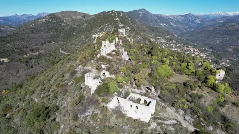
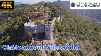
Ruins of Châteauneuf-Villevieille
No reviews yet
Have you flown here? Share your experience with other pilots.
+ Write the first reviewDescription
Ruins of Châteauneuf-Villevieille - Côte d'Azur - Drone 4K/UHD - February 2022
The protohistoric structures crowning the dominant high points attest to the antiquity of the occupation of the territory. Numerous Roman remains confirm the continuity of this settlement, particularly on the eastern buttress of the Férion range. The castrum Villa Vetula, Villevieille, prospered there until the 6th and 7th centuries.
Following the Lombard invasions, and to protect themselves from the Saracens, the population took refuge on the nearest rocky peak and built a fortified village there, Castel Nuovo, Châteauneuf. Between the 12th and 14th centuries, the fragmentation of the Châteauneuf fiefdom reached minimal portions.
Home of the troubadour Pierre de Châteauneuf in the 13th century, the village is also the home of Monsignor Louis Martini (1566-1621), bishop of Aosta in 1611. In 1769, 45 co-lords were counted. The title, by then honorary, was no longer tied to the exercise of feudal rights.
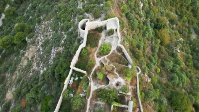
Thanks to the peace brought by the Treaty of Aix-la-Chapelle in 1748, the inhabitants expressed the desire to move closer to farmland with more abundant water. The original site of the village was resettled, and a new village, characterized by scattered housing, was established. The medieval town was from then on gradually abandoned. Devastated by soldiers of the revolutionary army in 1793, it emptied mostly from 1803 onward. Only two families still lived there in 1866. The commune of Villevieille-Châteauneuf was renamed Châteauneuf-de-Contes in 1877, in reference to the canton's main town. It was hit by the earthquake of 1887. The inhabitants lived mainly from agropastoral activities, and above all from growing beans, cherries and olives for curing, as well as producing olive oil. Until 1911, the commune included the lands of Bendejun and Cantaron. It was renamed Châteauneuf-Villevieille in 1992.
Map and restricted areas
Open in the main mapNearby aerodromes
Open aerodromes within 25 km of the spot, heliports included, with their distance and direction from the spot. Near an aerodrome, drone flying is prohibited or height-limited: check the UAS zones map.
| Aerodrome | Type | Distance | Elevation | Difference |
|---|---|---|---|---|
| Princess Grace Hospital Helipad | Heliport | 11 km SE | 103 m | spot 620 m higher |
| Hôpital L'Archet 2 Heliport | Heliport | 12 km SW | 185 m | spot 538 m higher |
| Monaco Heliport | Heliport | 12 km SE | 6 m | spot 717 m higher |
| Terre-Plein du Larvotto Heliport | Heliport | 12 km SE | 6 m | spot 717 m higher |
| Hôpital Lenval Heliport | Heliport | 13 km S | 35 m | spot 688 m higher |
Aviation weather (METAR and TAF)
LFMN – Nice-Côte d'Azur Airport VFR
METAR
METAR LFMN 211030Z 05005KT CAVOK 17/09 Q1016 NOSIG
- Wind
- 050°, 9 km/h
- Visibility
- 10 km or more
- Clouds
- –
- Temperature
- 17 °C, dew point 9 °C
- QNH
- 1016 hPa
- Flight category
- VFR: ceiling > 3,000 ft and visibility > 5 mi
TAF
TAF LFMN 210800Z 2109/2215 VRB02KT CAVOK PROB40 2113/2121 25010KT BECMG 2121/2123 34010KT TEMPO 2123/2210 4000 RA BKN014 SCT030TCU BECMG 2210/2214 25018G30KT
| Period (local time) | Change | Wind | Visibility | Weather | Clouds |
|---|---|---|---|---|---|
| 21/11 10:00 → 21/11 22:00 | Initial conditions | Variable, 4 km/h | 10 km or more | No significant weather | No significant cloud |
| 21/11 14:00 → 21/11 22:00 | probability 40% | 250°, 19 km/h | |||
| 21/11 22:00 → 22/11 11:00 | Becoming | 340°, 19 km/h | 10 km or more | No significant weather | No significant cloud |
| 22/11 00:00 → 22/11 11:00 | Temporarily | 4.0 km | Rain | Broken (5-7/8) at 1,400 ft (430 m) ; Scattered (3-4/8) at 3,000 ft (910 m) (towering cumulus) | |
| 22/11 11:00 → 22/11 16:00 | Becoming | 250°, 33 km/h, gusts 56 km/h | 10 km or more | No significant weather | No significant cloud |
Weather and Kp index
Sunrise and sunset
| Day | Dawn | Sunrise | Golden hour | Sunset | Dusk | Day length |
|---|---|---|---|---|---|---|
| Sat 21 Nov | 07:01 | 07:33 | 07:33–08:17 · 16:16–17:00 | 17:00 | 17:32 | 9 h 27 |
| Sun 22 Nov | 07:03 | 07:34 | 07:34–08:19 · 16:15–17:00 | 17:00 | 17:31 | 9 h 25 |
| Mon 23 Nov | 07:04 | 07:35 | 07:35–08:20 · 16:14–16:59 | 16:59 | 17:31 | 9 h 23 |
| Tue 24 Nov | 07:05 | 07:37 | 07:37–08:21 · 16:13–16:58 | 16:58 | 17:30 | 9 h 21 |
| Wed 25 Nov | 07:06 | 07:38 | 07:38–08:23 · 16:13–16:58 | 16:58 | 17:29 | 9 h 19 |
| Thu 26 Nov | 07:07 | 07:39 | 07:39–08:24 · 16:12–16:57 | 16:57 | 17:29 | 9 h 18 |
| Fri 27 Nov | 07:08 | 07:40 | 07:40–08:26 · 16:11–16:57 | 16:57 | 17:29 | 9 h 16 |


Reviews
Log in to review this spot. Log in · Create a free account
No reviews yet. Share yours!