

Tête du Garnier - Tête de Charnaye - Beuil - Côte d'Azur
No reviews yet
Have you flown here? Share your experience with other pilots.
+ Write the first reviewDescription
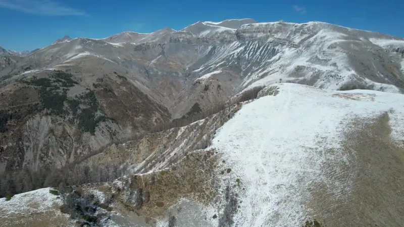
Tête du Garnier - 1906 meters and Tête de Charnaye - 1972 meters - Beuil - Côte d'Azur - Drone 4K/UHD - March 2022
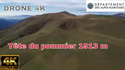
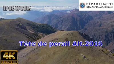
From the Tête du Garnier, which peaks at 1906 meters, the panorama is beautiful, especially over the impressive southwest ridge of Mont Mounier, the nearby mountains (Tête de Charnaye, Tête du Pommier and the Cluots, Cime du Raton, Tête de la Colombière, Cime du Pra, Dôme du Barrot) and, further away, the peaks of the Mercantour.
The Tête de Charnaye and the Chastellan: • Head onto the track leading to la Colle, passing the Mercantour National Park signs. You can see hedges, the boundaries of former hay meadows, as well as the shrike and the quail, the last witnesses of this bygone rural life. • Turn left at marker 8, then at the small pass behind it, turn left again across the fields on a fairly steep climb toward a water intake. The trail reaches the larch trees, following the Houesti ridge. • Across the fields again, a few yellow markings guide your steps to the Tête de Charnay ("Charnaye" on the signs). The view is open and drops down into the Péone valley, with Valberg behind you.
Crête de la Maure: • Continue along the ridge, going around an enormous hole, then once on the Crête de la Maure, the trail heads back down toward marker 6, at the col des Huerris. • Once on the flat area at marker 5, do not take the track to your left, but go straight ahead. The Chastellan is an imposing grassy hill dotted with larch trees. Follow for a while the track that runs diagonally along its west flank, toward the col des Huerris. You go around a wooded section, with a few rocks below the summit. • Further on, toward the pass, a gap in the larches on your left invites you to walk onto the grass. Follow this track, which leads to the summit without difficulty. • Head back down the same way and take the road back to the parking lot where your vehicle is parked, at the col de l'Espaul.
Map and restricted areas
Open in the main mapNearby aerodromes
Open aerodromes within 25 km of the spot, heliports included, with their distance and direction from the spot. Near an aerodrome, drone flying is prohibited or height-limited: check the UAS zones map.
| Aerodrome | Type | Distance | Elevation | Difference |
|---|---|---|---|---|
| Altisurface de Valberg | Aerodrome | 1.8 km W | 683 m | spot 1,219 m higher |
| Altisurface d'Isola 2000 | Aerodrome | 17 km NE | 2,500 m | spot 598 m lower |
Aviation weather (METAR and TAF)
No METAR station within 50 km.
Weather and Kp index
| Day | Weather | Temp. min. / max. | Wind | Rain | Max Kp |
|---|---|---|---|---|---|
| Sat 21 Nov | Fair | 1° / 8° | 6 km/h S | – | 2 |
| Sun 22 Nov | Showers | -1° / 4° | 26 km/h NW | 18 mm | 2 |
| Mon 23 Nov | Clear sky | -8° / 4° | 24 km/h NW | – | 4 |
| Tue 24 Nov | Cloudy | -6° / 2° | 6 km/h S | 1.1 mm | 2 |
| Wed 25 Nov | Snow | -5° / -2° | 12 km/h N | 20 mm | – |
| Thu 26 Nov | Fair | -8° / -0° | 9 km/h N | 7.1 mm | – |
| Fri 27 Nov | Clear sky | -19° / 1° | 7 km/h N | – | – |
Hour by hour: Saturday 21 November
| Time | Weather | Temp. | Wind | Rain | Clouds | Kp |
|---|---|---|---|---|---|---|
| 11:00 | Partly cloudy | 6° | 5 km/h N | – | 72 % | 2 |
| 12:00 | Partly cloudy | 7° | 5 km/h S | – | 64 % | 2 |
| 13:00 | Fair | 8° | 5 km/h S | – | 14 % | 1 |
| 14:00 | Clear sky | 8° | 6 km/h S | – | 4 % | 1 |
| 15:00 | Fair | 7° | 6 km/h S | – | 20 % | 1 |
| 16:00 | Fair | 6° | 4 km/h SE | – | 38 % | 2 |
| 17:00 | Partly cloudy | 3° | 3 km/h SE | – | 53 % | 2 |
| 18:00 | Partly cloudy | 2° | 4 km/h NE | – | 72 % | 2 |
| 19:00 | Partly cloudy | 2° | 1 km/h N | – | 88 % | 2 |
| 20:00 | Partly cloudy | 2° | 2 km/h N | – | 57 % | 2 |
| 21:00 | Cloudy | 1° | 3 km/h N | – | 88 % | 2 |
| 22:00 | Cloudy | 1° | 3 km/h N | – | 92 % | 2 |
Hour by hour: Sunday 22 November
| Time | Weather | Temp. | Wind | Rain | Clouds | Kp |
|---|---|---|---|---|---|---|
| 06:00 | Sleet | 0° | 8 km/h NE | 1.4 mm | 100 % | 2 |
| 07:00 | Sleet | 1° | 8 km/h NE | 2.1 mm | 100 % | 2 |
| 08:00 | Sleet | 1° | 8 km/h NE | 2.5 mm | 100 % | 2 |
| 09:00 | Sleet | 1° | 6 km/h NE | 3.6 mm | 100 % | 2 |
| 10:00 | Heavy rain | 2° | 6 km/h NE | 2.3 mm | 100 % | 2 |
| 11:00 | Rain | 2° | 5 km/h N | 0.8 mm | 100 % | 2 |
| 12:00 | Showers | 3° | 8 km/h N | 0.2 mm | 83 % | 2 |
| 13:00 | Showers | 4° | 14 km/h NW | 0.1 mm | 80 % | 2 |
| 14:00 | Showers | 4° | 19 km/h NW | 0.2 mm | 16 % | 2 |
| 15:00 | Partly cloudy | 3° | 17 km/h NW | – | 59 % | 2 |
| 16:00 | Partly cloudy | 2° | 17 km/h NW | – | 48 % | 2 |
| 17:00 | Partly cloudy | 1° | 15 km/h NW | – | 59 % | 2 |
| 18:00 | Partly cloudy | 0° | 17 km/h NW | – | 43 % | 2 |
| 19:00 | Partly cloudy | -1° | 16 km/h NW | – | 56 % | 2 |
| 20:00 | Partly cloudy | -1° | 17 km/h NW | – | 73 % | 2 |
| 21:00 | Cloudy | -1° | 19 km/h NW | – | 89 % | 2 |
| 22:00 | Partly cloudy | -0° | 23 km/h NW | – | 52 % | 2 |
Sunrise and sunset
| Day | Dawn | Sunrise | Golden hour | Sunset | Dusk | Day length |
|---|---|---|---|---|---|---|
| Sat 21 Nov | 07:04 | 07:35 | 07:35–08:20 · 16:16–17:01 | 17:01 | 17:32 | 9 h 25 |
| Sun 22 Nov | 07:05 | 07:36 | 07:36–08:21 · 16:15–17:00 | 17:00 | 17:32 | 9 h 23 |
| Mon 23 Nov | 07:06 | 07:38 | 07:38–08:23 · 16:14–16:59 | 16:59 | 17:31 | 9 h 21 |
| Tue 24 Nov | 07:07 | 07:39 | 07:39–08:24 · 16:14–16:59 | 16:59 | 17:31 | 9 h 19 |
| Wed 25 Nov | 07:08 | 07:40 | 07:40–08:25 · 16:13–16:58 | 16:58 | 17:30 | 9 h 18 |
| Thu 26 Nov | 07:09 | 07:41 | 07:41–08:27 · 16:12–16:58 | 16:58 | 17:30 | 9 h 16 |
| Fri 27 Nov | 07:10 | 07:42 | 07:42–08:28 · 16:11–16:57 | 16:57 | 17:29 | 9 h 14 |

Reviews
Log in to review this spot. Log in · Create a free account
No reviews yet. Share yours!