

The Roman baths of Gaujac
No reviews yet
Have you flown here? Share your experience with other pilots.
+ Write the first reviewDescription
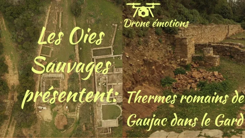
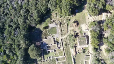
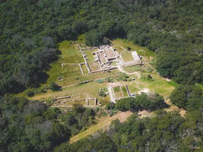
The Roman baths of Gaujac are a thermal complex from the Roman era, located in the commune of Gaujac, in the Gard department. The ancient site of Gaujac sits on an oppidum that was occupied before the Romans arrived, possibly by the Celtic people of the Samnagenses mentioned by Pliny the Elder.
The discovery and excavations The oppidum has been known for a long time: in 1911, in a overview of the pre- and protohistoric enclosures of the Gard department, Bourrilly and Mazauric noted the "considerable remains of an oppidum" at St Vincent. The baths were discovered in 1974 by Jean Charmasson, the first excavator of the oppidum, and Dominique Cannaud. They were fully excavated by the teams of the Société d'Étude des Civilisations Antiques de la Basse vallée du Rhône (SECABR) under the direction of Jean Charmasson, with the collaboration of Dominique Cannaud, from 1975 to 1984, from 1984 to 1988 and in 1998.
The two building phases The baths were built on the third terrace of the stepped southern slope of the oppidum. They went through two successive phases of construction.
Phase 1 The first building was under construction in 20 AD. Three adjoining rooms were built: the first, to the north, oriented east-west, was the paved changing room (apodyterium), surrounded by benches for leaving clothes; the other two, with mosaics, oriented north-south, adjoining and perpendicular to the south of the changing room, were heated. One, to the east, was the warm room (tepidarium); the other, to the west, was the hot room (caldarium), which had a semicircular apse housing an ablutions basin (labrum), the only water point of the establishment. Two furnaces to the south drove heat into the hypocausts of the two rooms. To the east of these buildings stretched the palaestra, to the southeast of which the monumental entrance opened.
Phase 2 The operating difficulty of the first phase of the baths came from the near-absence of water. The installation of an underground and overhead water network in the town, built during the second half of the first century, made it possible to supply water to the whole thermal complex. Around the years 90-100, an 80 m3 cistern was built against the outer face of the eastern enclosure wall, and the rooms were reorganized accordingly. The warm room received a monolithic limestone bathtub set in a rectangular apse built outside the main structure, which was heated by a furnace. The hot room gained two pools, one to the north and one to the south outside the main structure, which occupied the width of the room. The ablutions basin was kept. The palaestra of phase 1, too cluttered by the water installations and the bathtub apse, became a service courtyard, while a new palaestra, bordered by porticoes on three sides and an apse opening onto the landscape to the south, was set up to the west of the changing room.
The sanctuary of Fortuna Around 210-220, seismic tremors severely damaged the southern structures of the thermal establishment, ending its operation. The northern part, which remained intact, became a sanctuary dedicated to Fortuna, adding a place of worship to the priestly town. The cistern became the cella where the statue of the goddess, which has been found, was placed. On a low terrace, north of the service courtyard, the altar probably stood, the rest of the space being reserved for the deposit of offerings, which were found buried. The north portico of the palaestra and the changing room were perhaps arranged to house pilgrims. The oppidum was abandoned from the middle of the 3rd century.
Map and restricted areas
Open in the main mapNearby aerodromes
Open aerodromes within 25 km of the spot, heliports included, with their distance and direction from the spot. Near an aerodrome, drone flying is prohibited or height-limited: check the UAS zones map.
| Aerodrome | Type | Distance | Elevation | Difference |
|---|---|---|---|---|
| Uzès Airfield | Aerodrome | 13 km W | 270 m | same altitude as the spot |
| Aérodrome d'Avignon-Pujaut | Aerodrome | 18 km SE | 45 m | spot 222 m higher |
Aviation weather (METAR and TAF)
LFMO – Orange-Caritat (BA 115) Air Base VFR
METAR
METAR LFMO 210730Z AUTO VRB03KT CAVOK 05/05 Q1021 NOSIG
- Wind
- Variable, 6 km/h
- Visibility
- 10 km or more
- Clouds
- –
- Temperature
- 5 °C, dew point 5 °C
- QNH
- 1021 hPa
- Flight category
- VFR: ceiling > 3,000 ft and visibility > 5 mi
TAF
TAF LFMO 210200Z 2103/2203 32003KT CAVOK TX16/2115Z TN05/2105Z PROB30 TEMPO 2122/2203 4000 -RA BECMG 2201/2203 13015G25KT
| Period (local time) | Change | Wind | Visibility | Weather | Clouds |
|---|---|---|---|---|---|
| 21/11 04:00 → 22/11 02:00 | Initial conditions | 320°, 6 km/h | 10 km or more | No significant cloud | |
| 21/11 23:00 → 22/11 04:00 | Temporarily, probability 30% | 4.0 km | Rain light | ||
| 22/11 02:00 → 22/11 04:00 | Becoming | 130°, 28 km/h, gusts 46 km/h | 10 km or more | No significant cloud |
Weather and Kp index
Sunrise and sunset
| Day | Dawn | Sunrise | Golden hour | Sunset | Dusk | Day length |
|---|---|---|---|---|---|---|
| Sat 21 Nov | 07:13 | 07:45 | 07:45–08:29 · 16:26–17:11 | 17:11 | 17:42 | 9 h 25 |
| Sun 22 Nov | 07:14 | 07:46 | 07:46–08:31 · 16:25–17:10 | 17:10 | 17:41 | 9 h 23 |
| Mon 23 Nov | 07:15 | 07:47 | 07:47–08:32 · 16:24–17:09 | 17:09 | 17:41 | 9 h 21 |
| Tue 24 Nov | 07:17 | 07:48 | 07:48–08:34 · 16:23–17:08 | 17:08 | 17:40 | 9 h 20 |
| Wed 25 Nov | 07:18 | 07:50 | 07:50–08:35 · 16:22–17:08 | 17:08 | 17:40 | 9 h 18 |
| Thu 26 Nov | 07:19 | 07:51 | 07:51–08:36 · 16:22–17:07 | 17:07 | 17:39 | 9 h 16 |
| Fri 27 Nov | 07:20 | 07:52 | 07:52–08:38 · 16:21–17:07 | 17:07 | 17:39 | 9 h 14 |


Reviews
Log in to review this spot. Log in · Create a free account
No reviews yet. Share yours!